Old Maps of Ralls County, Missouri for Metal Detecting
Plan your next treasure hunt with 109 historic maps of Ralls County. Find old homesites, ghost towns, trails, and gathering spots that may be lost to time — perfect for identifying promising metal detecting locations.
- Locate forgotten sites: Uncover places like long-lost settlements, abandoned rail lines, or gathering spots.
- Plan better hunts: Use map overlays combined with LiDAR or satellite views to narrow in on historically rich areas.
- Made for detectorists: Thousands of hobbyists use these maps to discover relics, coins, and hidden history.
Use these historic maps to boost your research and find new opportunities beneath the surface of Ralls County.
Ralls County, MO maps
(109)- 1890 Map of Louisiana
 1890 Louisiana1890 Print · USGSUpper Missouri and Illinois river country in the 1890s is captured here at the height of the steam-rail era. Genealogists can trace family roots through old rural outposts like New Harmony, Prairieville, and the transit hub at Bowling Green.5 unique versions available
 - 1890 Map of Mexico
 1890 Mexico1890 Print · USGSMid-Missouri was a bustling junction of rail and river in the late 1880s, where iron rails began to reshape the old prairie. Genealogists can trace family roots in early settlements like Mexico, Laddonia, and the rural community at Shamrock P.O..5 unique versions available
 - 1903 Map of Palmyra
 1903 Palmyra1903 Print · USGSNortheast Missouri at the start of the twentieth century was a landscape of river-valley farming and critical rail junctions. Researchers can trace early rural life through features like Sharp Mills, St. Pauls Ch., and the crossing of the Hannibal and St. Joseph R. R.2 unique versions available
 - 1931 Map of Barry
 1931 Barry1931 Print · USGSPike County bottomlands along the Mississippi River are shown here in the late twenties and early thirties, just as drainage projects transformed the landscape. Genealogists and local historians can trace rural school locations like Guss Sch and Munger Sch, or find family burials at Money Cem and Blackjack Cem.
 - 1932 Map of Hannibal
 1932 Hannibal1932 Print · USGSAlong the Mississippi River in the early 1930s, this survey captures the riverfront from Hannibal across to the Illinois bottomlands. Researchers can trace the river rail crossings of the WABASH and locate rural landmarks like Bird Slough Sch and the CHENALE ECARTE CLUB.4 unique versions available
 - 1936 Map of Hannibal
 1936 Hannibal1936 Print · USGSMid-century Hannibal and New London are shown during a transitional era of river commerce and early aviation. Researchers can trace the paths of the Burlington railroad or find ancestral landmarks like Withers Mill and Mt Olivet Cem.2 unique versions available
 - 1936 Map of Barry
 1936 Barry1936 Print · USGSThe Mississippi River valley in the mid-1930s reveals a complex network of island chutes and railroad settlements. Genealogists and historians can trace old river crossings like Stouts Ford and find vanished local school districts such as Love Sch and Hawk Creek Sch.2 unique versions available
 - 1943 Map of Vandalia, 1972 Print
 1943 Vandalia1972 Print · USGSMissouri's rural heartland is captured here in the 1940s at the junction of Audrain, Pike, and Ralls Counties. Genealogists can trace dozens of rural schoolhouses and churches, including Round Grove Sch, Elm Grove Ch, and the settlement of Madisonville.
 - 1944 Map of Barry
 1944 Barry1944 Print · USGSPike County's river-bottoms and bluffs are captured here in the mid-1940s, showing the complex interaction between the river and the rail lines. Genealogists and local historians can trace rural school locations like Wilke Chapel Sch and Buckeye Sch, or explore old landings such as Cincinnati Landing.2 unique versions available
 - 1945 Map of Hannibal
 1945 Hannibal1945 Print · USGSMid-century Hannibal is captured here as a bustling Mississippi river port and railroad crossroads just after the war. Local historians can trace family roots through dozens of rural landmarks like Mt Zion Cem, Withers Mill, and Ocean Wave Sch.2 unique versions available
 - 1945 Map of Perry
 1945 Perry1945 Print · USGSNortheast Missouri’s agricultural heartland is documented here in the mid-1940s as the rail era began to fade. Researchers can trace dozens of vanished country schoolhouses like Oakdale Sch and early rural churches including Corinth Ch and Prairie View Ch.3 unique versions available
 - 1945 Map of Vandalia
 1945 Vandalia1945 Print · USGSMid-century Audrain and Pike Counties are shown here at a peak of rural settlement, centered on the rail hub of Vandalia. Genealogists can locate dozens of country schools and churches, from New Michigan Sch to Mt Air Ch and Spencerburg.3 unique versions available
 - 1948 Map of Quincy
 1948 Quincy1948 Print · USGSThe Mississippi and Illinois River valleys are captured at a post-war crossroads as rail and river travel met the expanding highway system. Genealogists can trace family settlements from Quincy to Hannibal and smaller towns like Vandalia and Jerseyville.2 unique versions available
 - 1956 Map of Quincy, 1967 Print
 1956 Quincy1967 Print · USGSThe river and rail corridors of the Illinois-Missouri border are documented here during the mid-1950s. Researchers can trace historic river landings and regional transit hubs from Quincy and Hannibal to smaller settlements like Meredosia and Roodhouse.3 unique versions available
 - 1958 Map of Rensselaer, 1960 Print
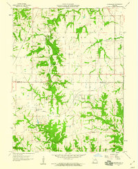 1958 Rensselaer1960 Print · USGSRensselaer and the surrounding Marion and Ralls county borderlands are shown here in the late fifties, just as the region’s agricultural and rail patterns were firmly established. Researchers can trace the dual rail lines of the Wabash and Chicago Burlington and Quincy, or locate family sites at Big Creek Cem and Finley Cem.2 unique versions available
 - 1959 Map of Monroe City, 1960 Print
 1959 Monroe City1960 Print · USGSMid-century Northeast Missouri comes into focus here at the tri-county junction of Marion, Ralls, and Monroe. Genealogists and rail historians can trace the paths of the Chicago Burlington and Quincy railroad, locate the St Judes Cem, or find rural schoolhouses like Stone Sch.2 unique versions available
 - 1959 Map of Joanna, 1960 Print
 1959 Joanna1960 Print · USGSThe rural borderlands of Monroe and Ralls Counties are captured here in the late fifties, just before significant hydrological changes. Genealogists can locate family landmarks like Utterback Cem, Shaver Ford, and the old Nolen Sch.2 unique versions available
 - 1959 Map of Center, 1960 Print
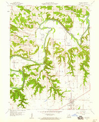 1959 Center1960 Print · USGSRalls County is defined by the winding course of the Salt River in the late fifties, where small farming communities are connected by narrow valley roads. Genealogists and historians can locate rural landmarks like Sidney Sch, the Olivet Cem, and the river crossing at Asher Bridge.2 unique versions available
 - 1971 Map of Hannibal West, 1973 Print
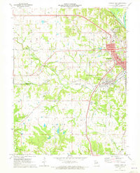 1971 Hannibal West1973 Print · USGSThe western edges of the Mississippi River bluffs in the early 1970s reveal a landscape of established seminaries and new shopping centers. Genealogists can trace family roots through Barkley Cem, Withers Mill, and Hydesburg Ch.2 unique versions available
 - 1971 Map of Hannibal East, 1973 Print
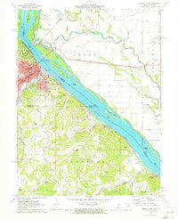 1971 Hannibal East1973 Print · USGSThe Missouri riverfront at Hannibal was a bustling hub of rail and river commerce in the early 1970s. Genealogists and historians can locate legacy sites like Mark Twain Cave, Antioch Ch, and the numerous quarries that defined the local economy.
 - 1971 Map of New London, 1973 Print
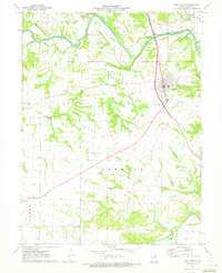 1971 New London1973 Print · USGSNew London and the surrounding Ralls County countryside are captured in the early seventies, showcasing a landscape of river-bend farms and rural parishes. Researchers can locate numerous family cemeteries such as Barkley Cem or trace the path of the Old Railroad Grade.
 - 1971 Map of Hannibal SE, 1973 Print
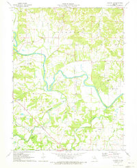 1971 Hannibal SE1973 Print · USGSRalls County's rural landscape is captured here in the early 1970s as the Salt River meanders through the Missouri countryside. Researchers can trace numerous family cemeteries and local landmarks like the Rocky Point Community Center and Fisher Cave.2 unique versions available
 - 1973 Map of Farber, 1975 Print
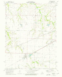 1973 Farber1975 Print · USGSThe rail towns of Farber and Vandalia are captured in the early 1970s along the Illinois Central Gulf tracks. Researchers can locate family landmarks including Farber Cem, the Drive-in Theater, and Van-Far High Sch.
 - 1973 Map of Perry, 1975 Print
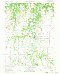 1973 Perry1975 Print · USGSPerry and the Ralls County countryside are captured here in the early seventies, just as the landscape was transforming. Genealogists and local historians can trace family locations near Scobee Cem, the old Mt Prairie Ch, and the winding Lick Creek.2 unique versions available
 - 1973 Map of Perry NE, 1975 Print
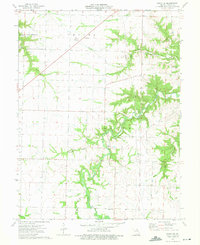 1973 Perry NE1975 Print · USGSRalls County in the early seventies shows a landscape transitioning with the waters of the Clarence Cannon Reservoir. Researchers can find legacy sites like Noonan, trace family roots at Madisonville Cem, or locate Fern Chapel and several rural quarries.
Showing maps 1-25 of 109
Top cities of Ralls County
Frequently asked questions
- What are the different types of historical maps available for Ralls County?
- What is the oldest map of Ralls County?
- Where can I purchase historical maps of Ralls County for my home or office?
- Where can I download high-res historical maps of Ralls County?
- Are there historical topographic maps available for Ralls County?
- Is there historical aerial imagery available for Ralls County?
- Where are historical maps of Ralls County sourced from?