1940s Maps of Saint Louis County, Missouri
Explore 14 historic maps of Saint Louis County from the 1940s. These maps offer a rare glimpse into what life looked like during the 1940s — showing old roads, neighborhoods, homes, and landmarks that have changed or disappeared over time.
Whether you're researching your family's past, planning a metal detecting trip, or studying how Saint Louis County's landscape evolved across the 1940s, these high-resolution maps are a powerful tool for exploring the history of this region.
- Focus on a specific era: All maps on this page are from the 1940s, giving you a focused view of this time period.
- See what’s changed: Compare century-old streets, trails, and buildings to today's modern landscape using overlays and satellite layers.
- Research with precision: Use these maps for genealogy, historical research, land use analysis, or educational projects.
- View, download, or print: Maps are fully viewable online in high resolution, and can be downloaded or printed for your own records.
Start exploring Saint Louis County's history through authentic maps from the 1940s. This is your window into the past.
Saint Louis County, MO maps
(14)- 1940 Map of Granite City
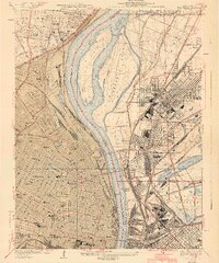 1940 Granite City1940 Print · USGSThe industrial heart of the bi-state region comes alive in this 1940s survey of the riverfront between Illinois and Missouri. Researchers can trace the massive rail yards and river docks supporting Granite City, alongside historic landmarks like Union Station, St Louis University, and the Bellefontaine Cemetery.4 unique versions available
 - 1940 Map of Eureka
 1940 Eureka1940 Print · USGSThe Missouri countryside west of St. Louis appears here just before the mid-century, defined by the twin river valleys of the Missouri and Meramec. You can trace the development of Eureka and Allenton along the St Louis San Francisco rail line, or find the CCC Camp and Wildhorse Creek Sch in the hills.
 - 1940 Map of Weldon Spring
 1940 Weldon Spring1940 Print · USGSThe Missouri River bottoms and St. Charles County uplands are captured here just before the Second World War. Researchers can trace family history through several rural landmarks, including Pitman Cem, Antioch Ch, and the lost river community of Hamburg.
 - 1940 Map of Creve Coeur
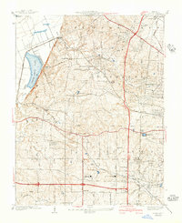 1940 Creve Coeur1940 Print · USGSWest of St. Louis in the late thirties, this area shows a transition from the Missouri River bottomlands to suburban townships and prestigious private clubs. Trace family roots at Fee Fee Cemetery or locate old school sites like Adams Sch and Spoede Sch.3 unique versions available
 - 1940 Map of Kirkwood
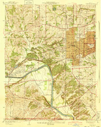 1940 Kirkwood1940 Print · USGSSt. Louis County shows its rapid suburban and institutional growth before the mid-century boom. Genealogists and historians can trace the rail-centered development of Kirkwood and find vanished landmarks like Windsor Springs and Hartman College.3 unique versions available
 - 1941 Map of Clayton
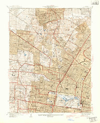 1941 Clayton1941 Print · USGSGreater St Louis is shown just before the mid-century expansion, detailing the dense street grids and rail lines connecting Clayton and University City. Genealogists and researchers can locate family sites near St Peters Cemetery, trace the early grounds of Washington University, or find local landmarks like the Daniel Boone Sch.2 unique versions available
 - 1941 Map of Jefferson Barracks
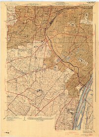 1941 Jefferson Barracks1941 Print · USGSThe suburbs south of St. Louis were maturing into a dense network of rail-side towns and institutions just before the mid-century. Genealogists and historians can trace family roots through numerous sites like Grants Farm, National Cemetery, and Webster College.3 unique versions available
 - 1944 Map of Eureka
 1944 Eureka1944 Print · USGSSouthwest St. Louis County remains a landscape of creek-bottom farms and wooded ridges during the early 1940s. Genealogists can trace family roots through sites like Bethany Ch, Melrose Sch, and the old rail stops at Glencoe and Allenton.3 unique versions available
 - 1945 Map of Manchester, 1955 Print
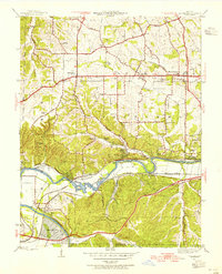 1945 Manchester1955 Print · USGSWestern St. Louis County is shown at a pivotal moment in the 1940s as suburban growth began to meet rural river life. Genealogists and historians can trace old homesteads and landmarks like Times Beach, Sherman P O, and the Sulphur Springs Sch.
 - 1947 Map of Manchester
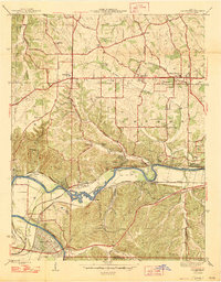 1947 Manchester1947 Print · USGSSt. Louis County is captured here just after the war, showing the distinct identities of communities along the historic Manchester Road. Genealogists and historians can locate family landmarks like the Ranken Cem, several local schoolhouses, and the original street grid of Times Beach.2 unique versions available
 - 1947 Map of Chesterfield
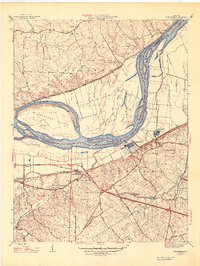 1947 Chesterfield1947 Print · USGSMid-century St. Louis County remains a landscape of river bottoms and rising bluffs as suburban expansion begins to reach westward. Genealogists can trace family footprints through rural sites like Gumbo, the Bellefontaine Sch, and Beeffee Ch.2 unique versions available
 - 1948 Map of Wood River, 1955 Print
 1948 Wood River1955 Print · USGSMadison County industrial hubs and river lowlands are captured here in the late 1940s as the regional energy sector expanded. Genealogists and historians can trace the foundations of Wood River refineries alongside local landmarks like St Paul Ch and the North Coal Mine.
 - 1948 Map of Kimmswick, 1955 Print
 1948 Kimmswick1955 Print · USGSThe Mississippi River corridor south of St. Louis appears here at a mid-century peak of rail and river industry. Researchers can trace historic river landings and rural schools like Harrisonville Landing, Blue Church, and the sprawling grounds of Jefferson Barracks.
 - 1949 Map of Saint Louis
 1949 Saint Louis1949 Print · USGSGreater St. Louis and its surrounding river valleys are captured here just after the war, showing the metropolitan core and the rural Ozark fringe. Researchers can trace the sprawling rail network of the Wabash RR or locate landmarks like Meramec Caverns Airport and Scott Air Force Base.2 unique versions available
End of results
Showing maps 1-14 of 14
Top cities of Saint Louis County
- Florissant historical maps
- Chesterfield historical maps
- Oakville historical maps
- Wildwood historical maps
- University City historical maps
- Ballwin historical maps
See more
Frequently asked questions
- What are the different types of historical maps available for Saint Louis County?
- What is the oldest map of Saint Louis County?
- Where can I purchase historical maps of Saint Louis County for my home or office?
- Where can I download high-res historical maps of Saint Louis County?
- Are there historical topographic maps available for Saint Louis County?
- Is there historical aerial imagery available for Saint Louis County?
- Where are historical maps of Saint Louis County sourced from?