1900s (20th Century) Maps of Clarence, Missouri
Explore 12 historic maps of Clarence from the 1900s (20th Century). These maps offer a rare glimpse into what life looked like during the 1900s — showing old roads, neighborhoods, homes, and landmarks that have changed or disappeared over time.
Whether you're researching your family's past, planning a metal detecting trip, or studying how Clarence's landscape evolved across the 1900s, these high-resolution maps are a powerful tool for exploring the history of this region.
- Focus on a specific era: All maps on this page are from the 1900s, giving you a focused view of this time period.
- See what’s changed: Compare century-old streets, trails, and buildings to today's modern landscape using overlays and satellite layers.
- Research with precision: Use these maps for genealogy, historical research, land use analysis, or educational projects.
- View, download, or print: Maps are fully viewable online in high resolution, and can be downloaded or printed for your own records.
Start exploring Clarence's history through authentic maps from the 1900s. This is your window into the past.
Clarence, MO maps
(12)- 1908 Map of Atlanta
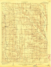 1908 Atlanta1908 Print · USGSMacon County is characterized by its early twentieth-century rail and river networks, anchored by the WABASH RR. Genealogists can trace family roots through numerous rural landmarks like Sue City, Mt Tabor Church, and La Porte School.2 unique versions available
 - 1908 Map of Macon, 1965 Print
 1908 Macon1965 Print · USGSMacon County and its neighbors are seen here in the early twentieth century, as rail lines and river forks defined the local economy. Genealogists can locate family landmarks among dozens of rural schoolhouses and churches like Bethlehem Church and Prairie Dale School.
 - 1910 Map of Macon
 1910 Macon1910 Print · USGSMacon County's rural landscape is captured here in the decade before the Great War, showing a territory defined by railroad towns and isolated river mills. Genealogists can trace family roots through numerous country landmarks like Blees Military Academy, Levick Mill, and the Bear Thicket School.
 - 1953 Map of Moberly
 1953 Moberly1953 Print · USGSMid-century north-central Missouri is documented here as a bustling intersection of river commerce and heavy rail. Researchers can trace historic family-named landmarks and transport hubs from the Missouri River corridor to the rail yards of Moberly, Chillicothe, and Macon.
 - 1954 Map of Moberly, 1969 Print
 1954 Moberly1969 Print · USGSMid-century Missouri is captured here during a period of transition for its river towns and rail hubs. Genealogists and historians can trace the paths of the Wabash railroad through Moberly or explore the riverside layout of Lexington and Brunswick.3 unique versions available
 - 1957 Map of Moberly
 1957 Moberly1957 Print · USGSNorth-central Missouri in the late nineteen-forties and fifties remains a landscape defined by its great rivers and a dense network of steam and diesel rail lines. Genealogists and historians can trace the paths of the Wabash RR and Santa Fe RR through historic junctions like Moberly, Brookfield, and Macon.
 - 1958 Map of Lentner, 1960 Print
 1958 Lentner1960 Print · USGSShelby and Monroe counties are captured here in the late fifties, centered on the railroad hub of Lentner. Genealogists and researchers can trace the locations of the Oak Ridge Sch, the Fairview Sch, and the rural community of Maud.2 unique versions available
 - 1960 Map of Moberly
 1960 Moberly1960 Print · USGSCentral Missouri comes alive in the mid-twentieth century as a bustling network of river towns and significant rail corridors. Genealogists and historians can trace the paths of the Wabash RR through Moberly or explore the riverfronts of Lexington and Brunswick.
 - 1964 Map of Hagers Grove, 1965 Print
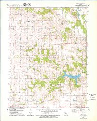
 1964 Hagers Grove1965 Print · USGSShelby County farmland and the river valleys of the North Fork Salt River are captured here in the mid-1960s. Genealogists can trace rural roots through landmarks like St Michael Ch Cem, Hagers Grove, and the Bacon Chapel.
 - 1971 Map of Clarence, 1972 Print
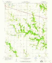
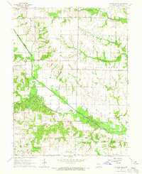
 1971 Clarence1972 Print · USGSShelby and Macon counties are shown in the early seventies as small farming communities thrived along the Burlington Northern rail line. Genealogists can locate family landmarks such as Bethlehem Cem, Graves Chapel, and the settlement of Enterprise.2 unique versions available
 - 1979 Map of Redman
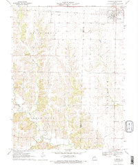
 1979 Redman1979 Print · USGSMacon and Shelby Counties appear here in the late seventies, showing a landscape defined by small farming communities and significant conservation lands. Researchers can trace rural lineages through numerous sites like Locust Grove Sch, the Amish Cem, and Ten Mile Ch.
 - 1981 Map of Macon
 1981 Macon1981 Print · USGSNorthern Missouri's rail-and-river landscape is captured here in the early eighties, centered on the crossroads of Macon. Researchers can trace old cemetery sites like St Marys Cem, local landmarks such as College Mound, and the routes of the Burlington Northern railroad.
End of results
Showing maps 1-12 of 12
Top cities near Clarence
- Macon historical maps
- Shelbina historical maps
- Shelbyville historical maps
- Jacksonville historical maps
- Leonard historical maps
Frequently asked questions
- What are the different types of historical maps available for Clarence?
- What is the oldest map of Clarence?
- Where can I purchase historical maps of Clarence for my home or office?
- Where can I download high-res historical maps of Clarence?
- Are there historical topographic maps available for Clarence?
- Is there historical aerial imagery available for Clarence?
- Where are historical maps of Clarence sourced from?