2020s Maps of Clarence, Missouri
Explore 4 historic maps of Clarence from the 2020s. These maps offer a rare glimpse into what life looked like during the 2020s — showing old roads, neighborhoods, homes, and landmarks that have changed or disappeared over time.
Whether you're researching your family's past, planning a metal detecting trip, or studying how Clarence's landscape evolved across the 2020s, these high-resolution maps are a powerful tool for exploring the history of this region.
- Focus on a specific era: All maps on this page are from the 2020s, giving you a focused view of this time period.
- See what’s changed: Compare century-old streets, trails, and buildings to today's modern landscape using overlays and satellite layers.
- Research with precision: Use these maps for genealogy, historical research, land use analysis, or educational projects.
- View, download, or print: Maps are fully viewable online in high resolution, and can be downloaded or printed for your own records.
Start exploring Clarence's history through authentic maps from the 2020s. This is your window into the past.
Clarence, MO maps
(4)- 2021 Map of Lentner, 2021 Print
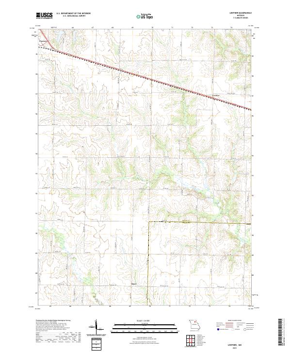 2021 Lentner2021 Print · USGSAgricultural life in Shelby County remains centered on the rail-and-road corridor during the early 2020s. Researchers can trace land tracts between the settlements of Lentner and Maud, or locate points of interest like Old Lake and Crooked Cr.
 - 2021 Map of Clarence, 2021 Print
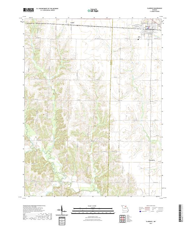 2021 Clarence2021 Print · USGSClarence and its surrounding agricultural reaches in the early twenty-first century are documented here at the intersection of Macon and Shelby counties. Trace local landmarks and rural history from Saint Patricks Cem to the banks of the Middle Fork Salt River and Otter Cr.
 - 2021 Map of Redman, 2021 Print
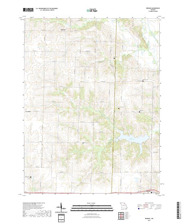 2021 Redman2021 Print · USGSMacon and Shelby counties meet in this detailed survey of the Missouri countryside during the early 2020s. Researchers can trace rural lineages through numerous local sites like Amish Cemetery, Ewing Cemetery, and the northern hamlet of Redman.
 - 2021 Map of Hagers Grove, 2021 Print
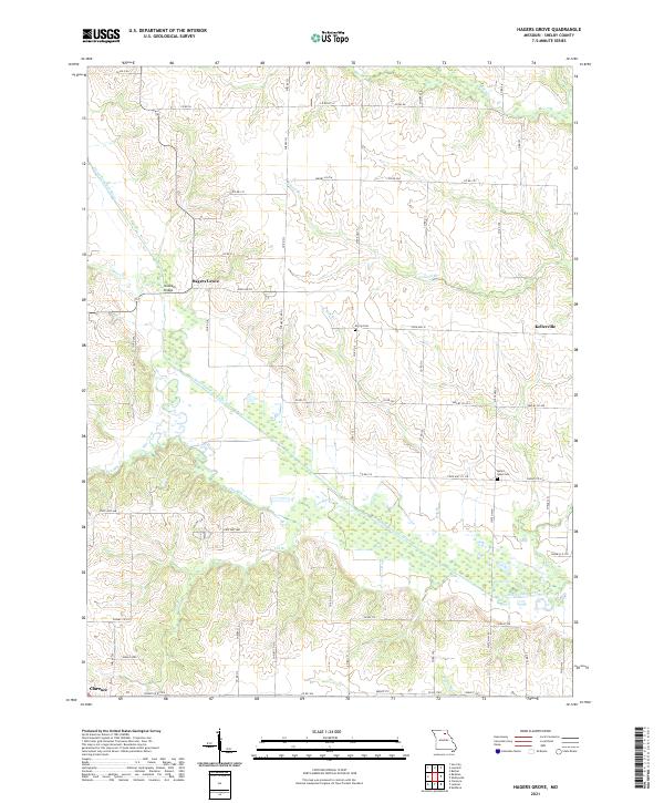 2021 Hagers Grove2021 Print · USGSShelby County, Missouri, is captured in this modern survey of the agricultural landscape along the North Fork Salt River. Researchers can trace old family sites and local landmarks like Morris Cem, Snowder Bridge, and the community of Hagers Grove.
End of results
Showing maps 1-4 of 4
Top cities near Clarence
- Macon historical maps
- Shelbina historical maps
- Shelbyville historical maps
- Jacksonville historical maps
- Leonard historical maps
Frequently asked questions
- What are the different types of historical maps available for Clarence?
- What is the oldest map of Clarence?
- Where can I purchase historical maps of Clarence for my home or office?
- Where can I download high-res historical maps of Clarence?
- Are there historical topographic maps available for Clarence?
- Is there historical aerial imagery available for Clarence?
- Where are historical maps of Clarence sourced from?