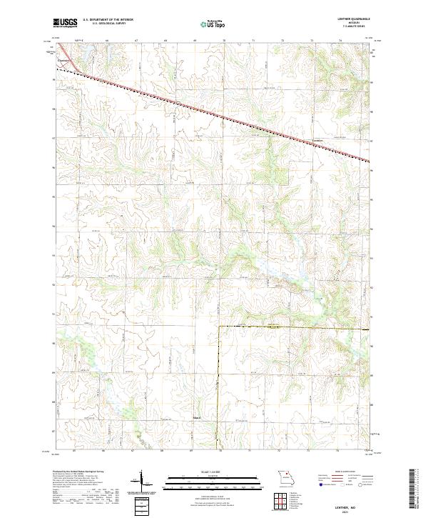
2021 Map of Lentner
USGS Topo · Published 2021About this map
Clarence and Lentner anchor the northern landscape of this Shelby County region, where the historical alignment of Old US Hwy 36 parallels the modern roadway through a grid of agricultural section lines. This rural environment is defined by the drainage patterns of Crooked Cr and Briggs Br, which carve gentle relief into the prairie. Near the southern edge, the settlement of Maud sits along State Hwy TT, serving as a landmark for local family historians. The presence of Old Lake north of the main highway provides a rare perennial water feature in an area otherwise characterized by intermittent streams like Otter Cr and Ram Br. The map records a transition across the Shelby Co Monroe Co boundary, illustrating how local roads and state highways have shaped the connectivity of these Missouri farming communities into the twenty-first century.
Find a feature on this map
64 named features on this map. Tap any name to fly to it.
Don’t see what you’re looking for? This feature index may not catch every label — zoom into the map to look around manually.
Map Details
Editions of this 2021 Lentner Map
This is the sole edition of this map. No revisions or reprints were ever made.
Other maps of this area

1908 · Atlanta
USGS Topo · 1:62,500

1908 · Macon
USGS Topo · 1:62,500

1910 · Macon
USGS Topo · 1:62,500

1953 · Moberly
USGS Topo · 1:250,000

1954 · Moberly
USGS Topo · 1:250,000

1957 · Moberly
USGS Topo · 1:250,000

1958 · Lentner
USGS Topo · 1:24,000

1959 · Shelbina
USGS Topo · 1:24,000
1959 · Woodlawn
USGS Topo · 1:24,000

1960 · Moberly
USGS Topo · 1:250,000