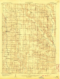
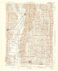
1908 Map of Macon
USGS Topo · Published 1965About this map
Macon serves as a significant regional hub where the Wabash RR intersects the Chicago Burlington and Quincy RR, illustrating the critical role of rail transport in early 20th-century Missouri. The landscape is defined by the winding course of the Middle Fork Salt River and its various tributaries like Otter Creek and Flat Creek, which shaped the placement of scattered rural communities.
Find a feature on this map
60 named features on this map. Tap any name to fly to it.
Don’t see what you’re looking for? This feature index may not catch every label — zoom into the map to look around manually.
Map Details
Editions of this 1908 Macon Map
This is the sole edition of this map. No revisions or reprints were ever made.
Other maps of this area

1890 · Moberly
USGS Topo · 1:125,000

1890 · Glasgow
USGS Topo · 1:125,000
1908 · Atlanta
USGS Topo · 1:62,500
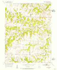
1910 · Macon
USGS Topo · 1:62,500
1937 · Elmer
USGS Topo · 1:48,000
1942 · Elmer
USGS Topo · 1:62,500
1952 · Middle Grove
USGS Topo · 1:24,000

1953 · Moberly
USGS Topo · 1:250,000
1953 · Huntsville
USGS Topo · 1:24,000
1953 · Bevier South
USGS Topo · 1:24,000