Old Maps of Oyer, Missouri for Metal Detecting
Plan your next treasure hunt with 12 historic maps of Oyer. Find old homesites, ghost towns, trails, and gathering spots that may be lost to time — perfect for identifying promising metal detecting locations.
- Locate forgotten sites: Uncover places like long-lost settlements, abandoned rail lines, or gathering spots.
- Plan better hunts: Use map overlays combined with LiDAR or satellite views to narrow in on historically rich areas.
- Made for detectorists: Thousands of hobbyists use these maps to discover relics, coins, and hidden history.
Use these historic maps to boost your research and find new opportunities beneath the surface of Oyer.
Oyer, MO maps
(12)- 1886 Map of Stockton
 1886 Stockton1886 Print · USGSSouthwest Missouri in the mid-1880s was a landscape of river-bottom farms and emerging rail towns along the Kansas City Clinton and Springfield R. R. Trace vanished post offices and local landmarks like Johnson's Mill, Dunnegan Springs, and the early streets of Stockton.3 unique versions available
 - 1938 Map of Roscoe, 1952 Print
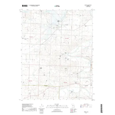
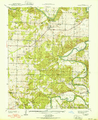 1938 Roscoe1952 Print · USGSThe confluence of the Osage River and Sac River dominates this Missouri landscape in the late 1930s. Genealogists can trace early family sites across dozens of local landmarks, from the Mt. Olive Ch to the Fraley Cem and Green Valley Sch.
 - 1940 Map of Roscoe
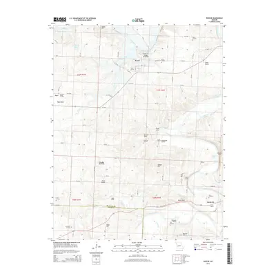
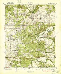 1940 Roscoe1940 Print · USGSThe Osage and Sac rivers meet in this late 1930s Missouri survey, capturing the rural riverfront settlements of St. Clair and Cedar counties. Genealogists can trace family footprints at Roscoe Cem, Hardyville, and country schools like Motley Sch.2 unique versions available
 - 1954 Map of Springfield
 1954 Springfield1954 Print · USGSThe Missouri Ozarks are captured here during the post-war era, showing the expansion of Springfield and the surrounding river valleys. Genealogists and historians can trace local landmarks like Mount Comfort Cemetery and the Fort Leonard Wood military grounds.6 unique versions available
 - 1958 Map of Springfield
 1958 Springfield1958 Print · USGSThe Missouri Ozarks are captured during the mid-century era of growth, centered on the bustling hub of Springfield. Genealogists and historians can trace family roots through numerous landmarks like Ebenezer Church, Stockton Cem, and the various county courthouses.
 - 1959 Map of Springfield
 1959 Springfield1959 Print · USGSThe Missouri Ozarks are captured here during a decade of postwar growth and increasing highway connectivity. Researchers can trace the legacy of the St Louis-San Francisco RR and locate early sites in Springfield, Lebanon, and Mountain Grove.
 - 1984 Map of Bolivar
 1984 Bolivar1984 Print · USGSWestern Missouri in the mid-eighties shows a landscape shaped by large-scale water management and rail commerce. Genealogists and historians can trace the development of towns like Bolivar and El Dorado Springs alongside the massive Stockton Lake.
 - 1991 Map of Roscoe
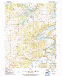 1991 Roscoe1991 Print · USGSThe river bottoms of St. Clair County are captured here in the early nineties as the Osage and Sac Rivers meet. Genealogists and local historians can trace family names and rural landmarks like Love Mound Cem, the Pasley Landing Strip, and the settlement of Crooks Springs.
 - 2011 Map of Roscoe, 2011 Print
 2011 Roscoe2011 Print · USGSCovers Oyer, including Roscoe, Cobb, and other nearby areas
 - 2015 Map of Roscoe, 2015 Print
 2015 Roscoe2015 Print · USGSCovers Oyer, including Roscoe, Cobb, and other nearby areas
 - 2017 Map of Roscoe, 2017 Print
 2017 Roscoe2017 Print · USGSCovers Oyer, including Roscoe, Cobb, and other nearby areas
 - 2021 Map of Roscoe, 2021 Print
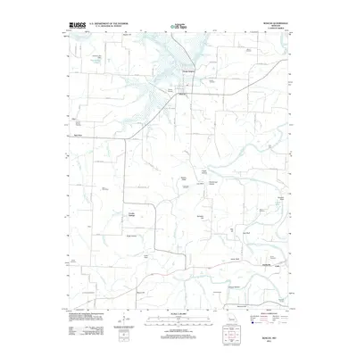
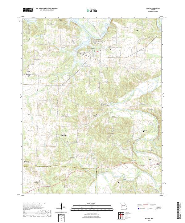 2021 Roscoe2021 Print · USGSThe confluence of the Osage and Sac Rivers in St. Clair and Cedar counties is documented here in the early twenty-first century. Genealogists and local researchers can locate numerous burial sites such as Love Mound Cem and Roscoe Cem, alongside landmarks like Pasley Airport.
End of results
Showing maps 1-12 of 12
Top cities near Oyer
- El Dorado Springs historical maps
- Appleton City historical maps
- Osceola historical maps
- Lowry City historical maps
- Rockville historical maps
- Roscoe historical maps
See more
Frequently asked questions
- What are the different types of historical maps available for Oyer?
- What is the oldest map of Oyer?
- Where can I purchase historical maps of Oyer for my home or office?
- Where can I download high-res historical maps of Oyer?
- Are there historical topographic maps available for Oyer?
- Is there historical aerial imagery available for Oyer?
- Where are historical maps of Oyer sourced from?