Old Maps of Asherville, Missouri for Metal Detecting
Plan your next treasure hunt with 11 historic maps of Asherville. Find old homesites, ghost towns, trails, and gathering spots that may be lost to time — perfect for identifying promising metal detecting locations.
- Locate forgotten sites: Uncover places like long-lost settlements, abandoned rail lines, or gathering spots.
- Plan better hunts: Use map overlays combined with LiDAR or satellite views to narrow in on historically rich areas.
- Made for detectorists: Thousands of hobbyists use these maps to discover relics, coins, and hidden history.
Use these historic maps to boost your research and find new opportunities beneath the surface of Asherville.
Asherville, MO maps
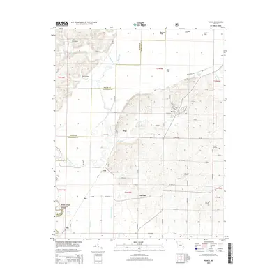
(11)- 1934 Map of Puxico
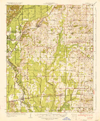 1934 Puxico1934 Print · USGSThe Missouri Bootheel comes into focus during the 1930s as drainage projects and rail lines reshape the swampy lowlands. Genealogists can locate dozens of country schools like Wilkerson Sch and Zoll Sch, or trace the tracks of the St Louis San Francisco through Puxico.2 unique versions available
 - 1939 Map of Puxico, 1942 Print
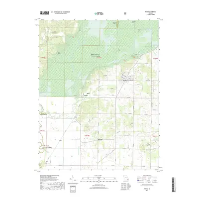
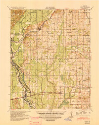 1939 Puxico1942 Print · USGSSoutheast Missouri's bootheel region comes to life in the late 1930s, showing a landscape defined by extensive drainage projects and burgeoning rail towns. Trace the locations of rural schoolhouses like Edmundson Sch and lost junctions along the St Louis - San Francisco Ry.
 - 1957 Map of Poplar Bluff, 1968 Print
 1957 Poplar Bluff1968 Print · USGSThe Missouri-Arkansas border region is captured here as the timber and rail industries shaped the Ozark foothills. Genealogists and historians can trace the Missouri Pacific Railroad through river towns like Pocahontas, Greenville, and Van Buren.3 unique versions available
 - 1959 Map of Poplar Bluff
 1959 Poplar Bluff1959 Print · USGSThe Missouri Ozarks and Arkansas borderlands meet in this late 1950s study of the region's diverse terrain and rail-fed towns. Researchers can trace the path of the Missouri Pacific Railroad through Poplar Bluff or locate smaller settlements like Birch Tree and Myrtle.
 - 1960 Map of Poplar Bluff
 1960 Poplar Bluff1960 Print · USGSSoutheast Missouri and Northeast Arkansas are captured here during the post-war era, showing the transition from the Ozark highlands to the Delta. Genealogists and historians can trace rail corridors like the St. Louis Southwestern RR and remote settlements such as Birch Tree and Warm Springs.
 - 1962 Map of Puxico, 1963 Print
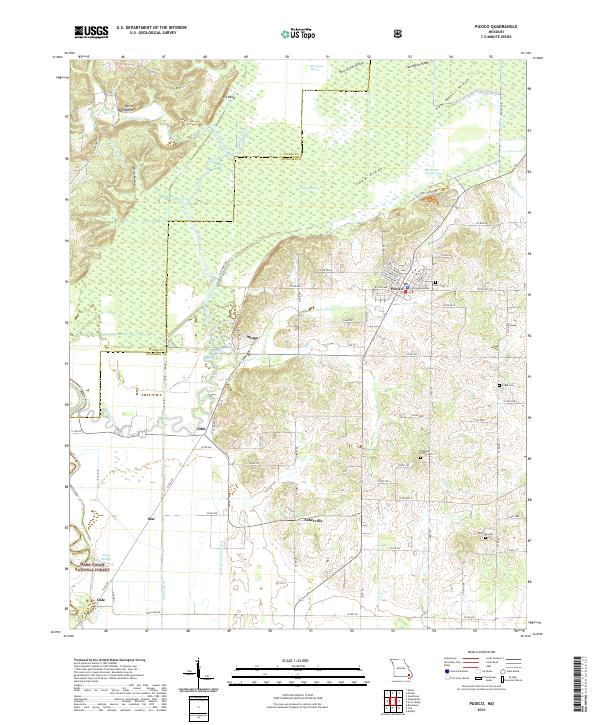
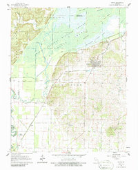 1962 Puxico1963 Print · USGSThe southeast Missouri lowlands and the edge of the Ozarks are captured here during the early sixties, showing a landscape defined by drainage engineering and wildlife conservation. Genealogists and historians can trace family locations near Puxico, Asherville, and rural gathering places like Egypt Church or Gravel Hill Cemetery.3 unique versions available
 - 1983 Map of Poplar Bluff
 1983 Poplar Bluff1983 Print · USGSSoutheast Missouri in the early 1980s reveals a landscape defined by the Ozark foothills and the complex drainage systems of the Bootheel. Researchers can trace the rail corridors of the Missouri Pacific RR through Poplar Bluff or locate rural sites like Wilhelmina Church and Lone Hill Lookout.
 - 2012 Map of Puxico, 2012 Print
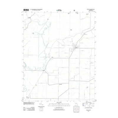 2012 Puxico2012 Print · USGSCovers Asherville, including Puxico, Dale, and other nearby areas
 - 2015 Map of Puxico, 2015 Print
 2015 Puxico2015 Print · USGSCovers Asherville, including Puxico, Dale, and other nearby areas
 - 2017 Map of Puxico, 2017 Print
 2017 Puxico2017 Print · USGSCovers Asherville, including Puxico, Dale, and other nearby areas
 - 2021 Map of Puxico, 2021 Print
 2021 Puxico2021 Print · USGSSoutheast Missouri at the edge of the Ozarks reveals a landscape of complex wetlands and timbered ridges. Researchers can trace rural lineages at Puxico Cem and Rock Hill Cem or explore the vast reaches of Mingo Swamp and the Mark Twain National Forest.
End of results
Showing maps 1-11 of 11
Top cities near Asherville
- Poplar Bluff historical maps
- Dexter historical maps
- Bernie historical maps
- Puxico historical maps
- Fisk historical maps
- Dudley historical maps
Frequently asked questions
- What are the different types of historical maps available for Asherville?
- What is the oldest map of Asherville?
- Where can I purchase historical maps of Asherville for my home or office?
- Where can I download high-res historical maps of Asherville?
- Are there historical topographic maps available for Asherville?
- Is there historical aerial imagery available for Asherville?
- Where are historical maps of Asherville sourced from?