Old Maps of Stone County, Missouri for Genealogy
Trace your family roots with 104 historic maps of Stone County. These high-res maps reveal old neighborhoods, homesites, landmarks, and streets — helping you uncover where your ancestors lived and how the area evolved over time.
- Explore historic neighborhoods: Identify where your relatives may have lived in the 1800s or 1900s.
- Compare maps over time: Trace the changes in streets, buildings, and landmarks for multi-generational research.
- Perfect for genealogy & ancestry research: Used by family historians and researchers to map out lineage and migration.
These maps are an incredible resource for exploring your personal connection to Stone County's past.
Stone County, MO maps
(104)- 1900 Map of Eureka Springs, 1954 Print
 1900 Eureka Springs1954 Print · USGSThe Ozark Mountains around the Arkansas and Missouri border are shown here during the turn of the century, when the river-and-rail economy was firmly established. Researchers can locate early family crossings and landmarks like Knox Ferry, Pivot Rock, and the St. Louis & San Francisco R. R.
 - 1901 Map of Eureka Springs
 1901 Eureka Springs1901 Print · USGSThe Arkansas Ozarks at the turn of the century are captured here in a time of river ferries and mountain townships. Genealogists and historians can locate early settlements like Eureka Springs and Berryville, or trace historic crossings such as Knox Ferry and Ellis Ford.3 unique versions available
 - 1904 Map of Harrison, 1954 Print
 1904 Harrison1954 Print · USGSThe Ozark Mountains of Northwest Arkansas are documented here at the turn of the century, showing a landscape of pioneer settlements and new rail lines. Genealogists can trace early homesteads and commerce at Blantons Mill, the village of Carrollton, and the regional hub of Harrison.
 - 1905 Map of Harrison
 1905 Harrison1905 Print · USGSThe Ozark Plateau at the start of the century was a land of winding mountain railroads and isolated creek-side settlements. Genealogists can trace family footprints across the highlands from Lead Hill to Green Forest, finding early industrial landmarks like Blantons Mill and the Rock Quarry.3 unique versions available
 - 1907 Map of Forsyth
 1907 Forsyth1907 Print · USGSThe White River country of southwest Missouri is seen here in the early nineteen-hundreds, prior to the region's major dam projects. Genealogists can trace family homesteads near landmarks like Marble Cave, numerous riverside crossings such as Mabry Ferry, and local landmarks like Loafers Glory School.3 unique versions available
 - 1927 Map of Shell Knob
 1927 Shell Knob1927 Print · USGSThe river valleys of the Missouri Ozarks are captured here in the mid-twenties, showing the intricate landscape of the White and James Rivers before they were dammed. Researchers can trace family homesteads near numerous country schools like Gaddis School or locate historic river crossings such as Schreiner Ferry and Big Creek Ford.3 unique versions available
 - 1942 Map of Aurora, 1961 Print
 1942 Aurora1961 Print · USGSThe northern Ozarks come to life in this mid-century survey of the rugged borderlands where three counties meet. Researchers can trace the path of the Missouri Pacific railroad through Aurora or locate family roots at rural landmarks like Charity Cem and Mountain Home Sch.2 unique versions available
 - 1945 Map of Harrison
 1945 Harrison1945 Print · USGSThe Ozark and Boston Mountains straddle the Missouri-Arkansas border during the mid-forties, showing a landscape of forest ridges and river valleys. Genealogists and historians can trace rail-connected towns like Monett and West Plains or early lake developments at Bull Shoals Res and Norfork Lake.
 - 1945 Map of Aurora
 1945 Aurora1945 Print · USGSThe Ozark plateau around Aurora and Crane is captured here during the mid-forties, showing a landscape defined by rail junctions and rural school districts. Researchers can trace ancestral locations like Stubblefield Cem, the Clay Hill Ch, and old springs including Bean Factory Spr.2 unique versions available
 - 1949 Map of Harrison
 1949 Harrison1949 Print · USGSThe Ozark highlands of northern Arkansas and southern Missouri are shown just after the war, when the White River still followed its original course. Genealogists and historians can trace rail lines like the Missouri & Arkansas RR and locate rural hubs like Harrison, Eureka Springs, and Mountain Home.
 - 1950 Map of Shell Knob, 1957 Print
 1950 Shell Knob1957 Print · USGSThe White River valley in the early 1950s retains its original character, defined by an intricate network of river fords and rural schoolhouses. Researchers can trace ancestral connections through named crossings like Cole Ford and community centers like Liberty Church or the Schreiner Ferry.3 unique versions available
 - 1950 Map of Garber, 1981 Print
 1950 Garber1981 Print · USGSThe Ozark hills transition into a recreation and heritage hub during the mid-twentieth century as the new lake levels rise. Researchers can trace the roots of local lore at Old Matt's Cabin, visit the Notch Ch, or locate the site of Marvel Cave.
 - 1954 Map of Harrison
 1954 Harrison1954 Print · USGSThe Ozarks and Boston Mountains meet during a period of massive river engineering in the mid-fifties. Researchers can trace the early shorelines of Bull Shoals Lake and Table Rock Reservoir or locate inland towns like Berryville and Harrison.
 - 1955 Map of Hurley, 1957 Print
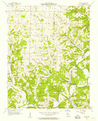 1955 Hurley1957 Print · USGSStone and Christian Counties were characterized by small farming hamlets and river-valley crossings in the mid-fifties. Genealogists can trace family names at Wright Chapel Cem or locate old community centers like Possum Trot, Lanetown, and Union City.2 unique versions available
 - 1955 Map of Highlandville, 1957 Print
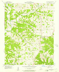 1955 Highlandville1957 Print · USGSThe Missouri Ozarks are captured here in the mid-1950s, showing a landscape of upland ridges and deep-cut creek valleys. Genealogists can locate family burial sites like Mayberry Cem and Tory Cem or rural centers like Ponce de Leon.2 unique versions available
 - 1956 Map of Lampe, 1957 Print
 1956 Lampe1957 Print · USGSThe Missouri Ozarks are seen here in the mid-1950s, shortly before the local river valleys were transformed by major reservoir projects. Researchers can trace ancestral locations through numerous family landmarks like Philibert Cem, Evans Cem, and the high point at Bread Tray Mountain.3 unique versions available
 - 1956 Map of Table Rock Dam, 1957 Print
 1956 Table Rock Dam1957 Print · USGSTaney County and the White River valley are shown in the mid-fifties, precisely when Table Rock Dam was reshaping the landscape. Researchers can trace land that would soon be underwater and locate local landmarks like Oasis, Bowman Ch, and the Hollister Lookout Tower.5 unique versions available
 - 1956 Map of Garber, 1957 Print
 1956 Garber1957 Print · USGSThe Ozark hills of Taney and Stone Counties are captured here in the mid-fifties, just as the region's literary fame was fueling early tourism. Researchers can locate the legendary Old Matts Cabin, the depths of Marvel Cave, and the abandoned Garber School along the rail line.3 unique versions available
 - 1956 Map of Spokane, 1957 Print
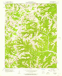 1956 Spokane1957 Print · USGSThe Ozark plateau in the mid-1950s reveals a network of ridge-top settlements and creek-bottom homesteads across Christian and Stone Counties. Local researchers can trace family landmarks like Schupbach Cem, the site of Old Spanish Cave, and the rural community of Abesville.2 unique versions available
 - 1956 Map of Reeds Spring, 1957 Print
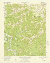 1956 Reeds Spring1957 Print · USGSStone County in the mid-fifties shows the Ozark river valleys before the major reservoir changes. Researchers can trace rural lineages through sites like Yocum Pond Cem, Stallion Sch, and local congregations at Rock Ch.2 unique versions available
 - 1956 Map of Galena, 1957 Print
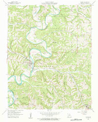 1956 Galena1957 Print · USGSThe Ozark highlands of Stone County come alive in the mid-1950s as the James River loops past the town of Galena. Genealogists and historians can trace family-named landmarks like Parsons Cem and follow the route of the Missouri Pacific railroad.2 unique versions available
 - 1958 Map of Harrison, 1973 Print
 1958 Harrison1973 Print · USGSThe Ozark and Boston Mountains appear in this mid-century survey as the great White River impoundments were reshaping the region. Researchers can trace the rail lines of the St Louis-San Francisco Ry and locate early settlements like Berryville and Gainesville.
 - 1964 Map of Harrison
 1964 Harrison1964 Print · USGSThe Ozark and Boston Mountains of Arkansas and Missouri are captured here in the mid-sixties, showing the rugged highlands before extensive modern development. Genealogists and historians can trace family-named peaks like Gaither Mountain and follow the St Louis-San Francisco RR through Monett and Purdy.
 - 1972 Map of Denver, 1973 Print
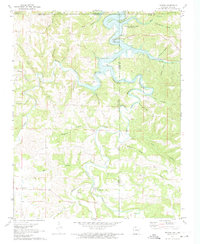 1972 Denver1973 Print · USGSThe Missouri-Arkansas border region is captured here in the early seventies as the reservoir waters of Table Rock Lake submerged the lower creek valleys. Genealogists and local historians can trace family roots through Denver Cem, the settlement of Farewell, and the steep terrain of Backbone Bluff.
 - 1972 Map of Grandview, 1973 Print
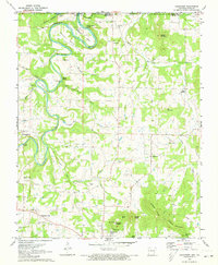 1972 Grandview1973 Print · USGSThe rural Ozarks near the Missouri border come to life in this early 1970s portrait of Berryville and the Kings River valley. Genealogists and hikers can trace the Old Railroad Grade or locate family sites like Williams Cem and Blackjack Ch.
Showing maps 1-25 of 104
Top cities of Stone County
- Kimberling City historical maps
- Crane historical maps
- Reeds Spring historical maps
- Galena historical maps
- Branson West historical maps
- McCord Bend historical maps
See more
Frequently asked questions
- What are the different types of historical maps available for Stone County?
- What is the oldest map of Stone County?
- Where can I purchase historical maps of Stone County for my home or office?
- Where can I download high-res historical maps of Stone County?
- Are there historical topographic maps available for Stone County?
- Is there historical aerial imagery available for Stone County?
- Where are historical maps of Stone County sourced from?