1960s Maps of Taney County, Missouri
Explore 7 historic maps of Taney County from the 1960s. These maps offer a rare glimpse into what life looked like during the 1960s — showing old roads, neighborhoods, homes, and landmarks that have changed or disappeared over time.
Whether you're researching your family's past, planning a metal detecting trip, or studying how Taney County's landscape evolved across the 1960s, these high-resolution maps are a powerful tool for exploring the history of this region.
- Focus on a specific era: All maps on this page are from the 1960s, giving you a focused view of this time period.
- See what’s changed: Compare century-old streets, trails, and buildings to today's modern landscape using overlays and satellite layers.
- Research with precision: Use these maps for genealogy, historical research, land use analysis, or educational projects.
- View, download, or print: Maps are fully viewable online in high resolution, and can be downloaded or printed for your own records.
Start exploring Taney County's history through authentic maps from the 1960s. This is your window into the past.
Taney County, MO maps
(7)- 1964 Map of Harrison
 1964 Harrison1964 Print · USGSThe Ozark and Boston Mountains of Arkansas and Missouri are captured here in the mid-sixties, showing the rugged highlands before extensive modern development. Genealogists and historians can trace family-named peaks like Gaither Mountain and follow the St Louis-San Francisco RR through Monett and Purdy.
 - 1966 Map of Omaha NE, 1968 Print
 1966 Omaha NE1968 Print · USGSThe Missouri-Arkansas border region in the mid-1960s is defined by the rising waters of Bull Shoals Lake and the rugged hollows of Boone County. Genealogists and local historians can trace rural family sites like Cottonwood Cem, the settlement of Self, and old congregational hubs at Chaney Ch.2 unique versions available
 - 1967 Map of Omaha, 1968 Print
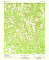 1967 Omaha1968 Print · USGSOmaha and the Boone County hills are shown here during the late sixties as the railroad era continued to shape this Ozark borderland. Genealogists and local historians can locate the Burlington Lookout Tower, the cemetery at New Hope, and the path of the Missouri Pacific railroad.
 - 1967 Map of Hilda, 1969 Print
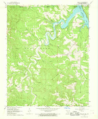
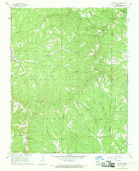
 1967 Hilda1969 Print · USGSTaney County’s hill country and the Mark Twain National Forest are shown here in the late sixties as the region’s landscape was shaped by the rising waters of Bull Shoals Lake. Researchers can locate numerous family-named landmarks and rural burial grounds like Bray Cem, Roberts Cem, and the Hilda Lookout Tower.4 unique versions available
 - 1968 Map of Protem, 1969 Print
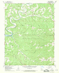
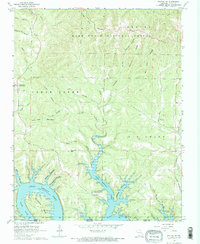
 1968 Protem1969 Print · USGSThe northern Taney County hills meet the rising waters of the White River in the late sixties. Genealogists can locate family burial sites at Rueter Cemetery and Merritt Cemetery or trace landmarks like Blackjack Knob and the Mark Twain School.2 unique versions available
 - 1968 Map of Protem NE, 1969 Print
 1968 Protem NE1969 Print · USGSThe wooded border of Taney and Ozark Counties comes into sharp focus during the late 1960s, showing the intersection of forest management and rural life. Researchers can locate remote landmarks like the Caney Lookout Tower, the Hercules settlement, and springs such as Rock Spring.2 unique versions available
 - 1968 Map of Protem SW, 1970 Print
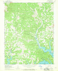
 1968 Protem SW1970 Print · USGSTaney County and the Missouri-Arkansas border appear here during the transition to a reservoir-based economy following the damming of the White River. Researchers can locate several remote burial sites and early landmarks, including Wyman Ch, Cedar Creek Cem, and the Bright Elbow Ranch Landing Field.2 unique versions available
End of results
Showing maps 1-7 of 7
Top cities of Taney County
- Branson historical maps
- Hollister historical maps
- Forsyth historical maps
- Merriam Woods historical maps
- Rockaway Beach historical maps
- Taneyville historical maps
See more
Frequently asked questions
- What are the different types of historical maps available for Taney County?
- What is the oldest map of Taney County?
- Where can I purchase historical maps of Taney County for my home or office?
- Where can I download high-res historical maps of Taney County?
- Are there historical topographic maps available for Taney County?
- Is there historical aerial imagery available for Taney County?
- Where are historical maps of Taney County sourced from?