Old Maps of Taney County, Missouri for Metal Detecting
Plan your next treasure hunt with 139 historic maps of Taney County. Find old homesites, ghost towns, trails, and gathering spots that may be lost to time — perfect for identifying promising metal detecting locations.
- Locate forgotten sites: Uncover places like long-lost settlements, abandoned rail lines, or gathering spots.
- Plan better hunts: Use map overlays combined with LiDAR or satellite views to narrow in on historically rich areas.
- Made for detectorists: Thousands of hobbyists use these maps to discover relics, coins, and hidden history.
Use these historic maps to boost your research and find new opportunities beneath the surface of Taney County.
Taney County, MO maps
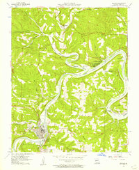
(139)- 1893 Map of Yellville
 1893 Yellville1893 Print · USGSNorthern Arkansas in the late nineteenth century was a world defined by its rivers and local crossings. You can trace the ancestral ferry routes along the White River and locate settlements with unique local nicknames like Peel (Needmore) and St Joe (Monkey Run).2 unique versions available
 - 1903 Map of Yellville
 1903 Yellville1903 Print · USGSNorth Central Arkansas in the late nineteenth century is a land of winding river valleys and ridge-top settlements. Genealogists can trace early homesteads and river crossings like Denton Ferry, Yellville, and the remote outposts of Dodd City or St. Joe.
 - 1904 Map of Harrison, 1954 Print
 1904 Harrison1954 Print · USGSThe Ozark Mountains of Northwest Arkansas are documented here at the turn of the century, showing a landscape of pioneer settlements and new rail lines. Genealogists can trace early homesteads and commerce at Blantons Mill, the village of Carrollton, and the regional hub of Harrison.
 - 1905 Map of Harrison
 1905 Harrison1905 Print · USGSThe Ozark Plateau at the start of the century was a land of winding mountain railroads and isolated creek-side settlements. Genealogists can trace family footprints across the highlands from Lead Hill to Green Forest, finding early industrial landmarks like Blantons Mill and the Rock Quarry.3 unique versions available
 - 1905 Map of Yellville
 1905 Yellville1905 Print · USGSThe Ozark Mountains and the winding White River define this area at the start of the twentieth century. Genealogists can trace family names through dozens of river crossings and small settlements like Denton Ferry, Rush, and Elixir Springs.3 unique versions available
 - 1907 Map of Forsyth
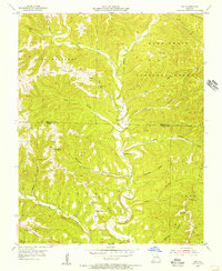
 1907 Forsyth1907 Print · USGSThe White River country of southwest Missouri is seen here in the early nineteen-hundreds, prior to the region's major dam projects. Genealogists can trace family homesteads near landmarks like Marble Cave, numerous riverside crossings such as Mabry Ferry, and local landmarks like Loafers Glory School.3 unique versions available
 - 1929 Map of Yellville, 1954 Print
 1929 Yellville1954 Print · USGSThe Ozark river valleys and early rail corridors of north-central Arkansas are shown here during the late 1920s. Researchers can trace historic river crossings like Whites Ferry and Moony Ford or locate regional hubs such as Yellville and Cotter.
 - 1937 Map of Bradleyville
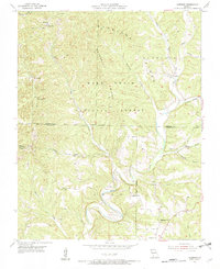
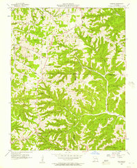
 1937 Bradleyville1937 Print · USGSDouglas County in the late 1930s was a landscape of remote hollows and high ridges connected by a network of one-room schools and small post offices. Trace family roots at Huffman Cem or locate forgotten community hubs like Old Merritt and Lone Star Sch.
 - 1943 Map of Protem
 1943 Protem1943 Print · USGSThe Ozark backcountry of Taney and Ozark Counties is shown here in the 1940s, before modern developments changed the landscape. Researchers can find numerous rural schoolhouses like Liberty Sch and family landmarks such as Merritt Cem and Dean Ranch.
 - 1943 Map of Bradleyville, 1968 Print
 1943 Bradleyville1968 Print · USGSThe Missouri Ozarks during the 1940s are documented here, showing the rural communities of Taney and Douglas counties. Genealogists can trace family homesteads near Bradleyville or locate remote landmarks like Huffman Cem and Whiteside Sch.2 unique versions available
 - 1945 Map of Harrison
 1945 Harrison1945 Print · USGSThe Ozark and Boston Mountains straddle the Missouri-Arkansas border during the mid-forties, showing a landscape of forest ridges and river valleys. Genealogists and historians can trace rail-connected towns like Monett and West Plains or early lake developments at Bull Shoals Res and Norfork Lake.
 - 1945 Map of Bradleyville
 1945 Bradleyville1945 Print · USGSThe Missouri Ozarks are revealed in the mid-1940s, showing a landscape of small settlements and township life. Trace family roots through many rural schoolhouses like High Lonesome Sch and remote cemeteries like Old Merritt Cem.
 - 1949 Map of Harrison
 1949 Harrison1949 Print · USGSThe Ozark highlands of northern Arkansas and southern Missouri are shown just after the war, when the White River still followed its original course. Genealogists and historians can trace rail lines like the Missouri & Arkansas RR and locate rural hubs like Harrison, Eureka Springs, and Mountain Home.
 - 1950 Map of Garber, 1981 Print
 1950 Garber1981 Print · USGSThe Ozark hills transition into a recreation and heritage hub during the mid-twentieth century as the new lake levels rise. Researchers can trace the roots of local lore at Old Matt's Cabin, visit the Notch Ch, or locate the site of Marvel Cave.
 - 1954 Map of Harrison
 1954 Harrison1954 Print · USGSThe Ozarks and Boston Mountains meet during a period of massive river engineering in the mid-fifties. Researchers can trace the early shorelines of Bull Shoals Lake and Table Rock Reservoir or locate inland towns like Berryville and Harrison.
 - 1955 Map of Garrison, 1956 Print
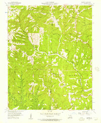
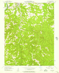
 1955 Garrison1956 Print · USGSThe border of Christian and Taney Counties is shown here in the mid-1950s, when remote ridges and deep hollows still defined local life. Researchers can find ancestral landmarks like Lone Star Ch, the Middleton Sch, and the winding banks of Swan Creek.3 unique versions available
 - 1955 Map of Day, 1956 Print
 1955 Day1956 Print · USGSThe Ozark hills along the Christian and Taney County line are shown here in the mid-fifties, dominated by the timbered ridges of the Mark Twain National Forest. Genealogists can trace rural family sites like Nash Cem and remote congregations including Oak Ridge Ch and Meadows Ch.4 unique versions available
 - 1956 Map of Table Rock Dam, 1957 Print
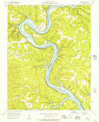
 1956 Table Rock Dam1957 Print · USGSTaney County and the White River valley are shown in the mid-fifties, precisely when Table Rock Dam was reshaping the landscape. Researchers can trace land that would soon be underwater and locate local landmarks like Oasis, Bowman Ch, and the Hollister Lookout Tower.5 unique versions available
 - 1956 Map of Garber, 1957 Print
 1956 Garber1957 Print · USGSThe Ozark hills of Taney and Stone Counties are captured here in the mid-fifties, just as the region's literary fame was fueling early tourism. Researchers can locate the legendary Old Matts Cabin, the depths of Marvel Cave, and the abandoned Garber School along the rail line.3 unique versions available
 - 1956 Map of Mincy, 1957 Print
 1956 Mincy1957 Print · USGSThe Taney County borderlands in the mid-fifties show a landscape reshaped by the rising Bull Shoals Lake. Researchers can trace the river's path through Mays Bend and find family landmarks like Mincy Cem, McCarty Ch, and Bald Knob.2 unique versions available
 - 1956 Map of Spokane, 1957 Print
 1956 Spokane1957 Print · USGSThe Ozark plateau in the mid-1950s reveals a network of ridge-top settlements and creek-bottom homesteads across Christian and Stone Counties. Local researchers can trace family landmarks like Schupbach Cem, the site of Old Spanish Cave, and the rural community of Abesville.2 unique versions available
 - 1956 Map of Forsyth, 1957 Print
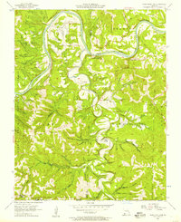
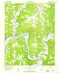 1956 Forsyth1957 Print · USGSTaney County's landscape was being reshaped by new reservoirs in the mid-fifties as the White River valley filled. Researchers can trace family history through local landmarks like Cedar Grove School, Kissee Mills, and the Forsyth Cemetery.3 unique versions available
 - 1956 Map of Hollister, 1957 Print
 1956 Hollister1957 Print · USGSThe Missouri Ozarks meet the Arkansas border in the mid-1950s, showing a landscape of deep hollows and high knobs. You can trace family roots through Vandzant Cem and Horton Cem, or locate the historic School of the Ozarks and the Missouri Pacific rail line.3 unique versions available
 - 1956 Map of Branson, 1957 Print
 1956 Branson1957 Print · USGSThe White River valley in the mid-fifties shows the established resort culture around Lake Taneycomo just before the regional landscape was further altered by major dams. Researchers can trace the development of Branson, find local landmarks like the Drive-in Theater, or locate the Mountain Grove Sch.3 unique versions available
 - 1958 Map of Harrison, 1973 Print
 1958 Harrison1973 Print · USGSThe Ozark and Boston Mountains appear in this mid-century survey as the great White River impoundments were reshaping the region. Researchers can trace the rail lines of the St Louis-San Francisco Ry and locate early settlements like Berryville and Gainesville.
Showing maps 1-25 of 139
Top cities of Taney County
- Branson historical maps
- Hollister historical maps
- Forsyth historical maps
- Merriam Woods historical maps
- Rockaway Beach historical maps
- Taneyville historical maps
See more
Frequently asked questions
- What are the different types of historical maps available for Taney County?
- What is the oldest map of Taney County?
- Where can I purchase historical maps of Taney County for my home or office?
- Where can I download high-res historical maps of Taney County?
- Are there historical topographic maps available for Taney County?
- Is there historical aerial imagery available for Taney County?
- Where are historical maps of Taney County sourced from?