2000s (21st Century) Maps of Cedarcreek, Missouri
Explore 5 historic maps of Cedarcreek from the 2000s (21st Century). These maps offer a rare glimpse into what life looked like during the 2000s — showing old roads, neighborhoods, homes, and landmarks that have changed or disappeared over time.
Whether you're researching your family's past, planning a metal detecting trip, or studying how Cedarcreek's landscape evolved across the 2000s, these high-resolution maps are a powerful tool for exploring the history of this region.
- Focus on a specific era: All maps on this page are from the 2000s, giving you a focused view of this time period.
- See what’s changed: Compare century-old streets, trails, and buildings to today's modern landscape using overlays and satellite layers.
- Research with precision: Use these maps for genealogy, historical research, land use analysis, or educational projects.
- View, download, or print: Maps are fully viewable online in high resolution, and can be downloaded or printed for your own records.
Start exploring Cedarcreek's history through authentic maps from the 2000s. This is your window into the past.
Cedarcreek, MO maps
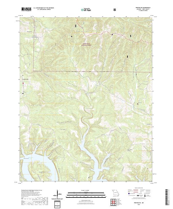
(5)- 2004 Map of Protem SW, 2006 Print
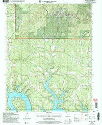 2004 Protem SW2006 Print · USGSTaney County and the Missouri-Arkansas border appear here as the White River valley transitions into the flooded inlets of Bull Shoals Lake. Genealogists and historians can trace local family landmarks and burial sites like Hankins Cem, Ray Cem, and the small settlement of Cedarcreek.
 - 2012 Map of Protem SW, 2012 Print
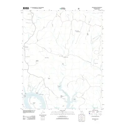 2012 Protem SW2012 Print · USGSCovers Cedarcreek, including Taney County, United States, and other nearby areas
 - 2015 Map of Protem SW, 2015 Print
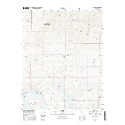 2015 Protem SW2015 Print · USGSCovers Cedarcreek, including Taney County, United States, and other nearby areas
 - 2017 Map of Protem SW, 2017 Print
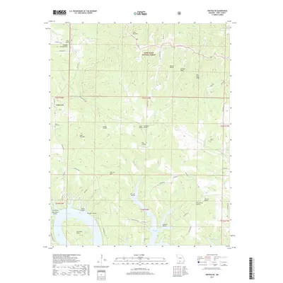 2017 Protem SW2017 Print · USGSCovers Cedarcreek, including Taney County, United States, and other nearby areas
 - 2021 Map of Protem SW, 2021 Print
 2021 Protem SW2021 Print · USGSThe Missouri Ozarks meet the northern reaches of the White River system in the early 2020s. Genealogists and local historians can trace legacy sites like Cedar Greek Cem and Wyman Cem near the shores of Bull Shoals Lake.
End of results
Showing maps 1-5 of 5
Top cities near Cedarcreek
- Branson historical maps
- Hollister historical maps
- Forsyth historical maps
- Merriam Woods historical maps
- Diamond City historical maps
- Rockaway Beach historical maps
See more
Frequently asked questions
- What are the different types of historical maps available for Cedarcreek?
- What is the oldest map of Cedarcreek?
- Where can I purchase historical maps of Cedarcreek for my home or office?
- Where can I download high-res historical maps of Cedarcreek?
- Are there historical topographic maps available for Cedarcreek?
- Is there historical aerial imagery available for Cedarcreek?
- Where are historical maps of Cedarcreek sourced from?