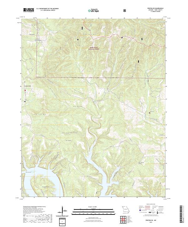
2021 Map of Protem SW
USGS Topo · Published 2021About this map
Bull Shoals Lake dominates the southern landscape of this Ozark borderland, where the fingers of the reservoir reach deep into the Missouri hills. The settlement of Cedarcreek serves as a central point in a terrain defined by steep ridges and narrow hollows, such as Cardwell Ridge and Gilten Hollow. This area, largely managed within the Mark Twain National Forest, maintains a rural character with a distribution of small family cemeteries including Cedar Greek Cem and Ray Cem. The presence of landmarks like Poor Joe Bald and Lime Kiln Mtn reflects a topography that dictated early settlement patterns and road placements, such as Hive Ferry Rd and Barton Rd, which still follow the contours of the land around the lake's many inlets.
Find a feature on this map
52 named features on this map. Tap any name to fly to it.
Don’t see what you’re looking for? This feature index may not catch every label — zoom into the map to look around manually.
Map Details
Editions of this 2021 Protem SW Map
This is the sole edition of this map. No revisions or reprints were ever made.
Other maps of this area

1893 · Yellville
USGS Topo · 1:125,000

1903 · Yellville
USGS Topo · 1:125,000

1904 · Harrison
USGS Topo · 1:125,000

1905 · Harrison
USGS Topo · 1:125,000

1905 · Yellville
USGS Topo · 1:125,000

1907 · Forsyth
USGS Topo · 1:125,000

1929 · Yellville
USGS Topo · 1:125,000

1943 · Protem
USGS Topo · 1:62,500

1945 · Harrison
USGS Topo · 1:250,000

1949 · Harrison
USGS Topo · 1:250,000