Old Maps of Hogeland, Montana for Genealogy
Trace your family roots with 10 historic maps of Hogeland. These high-res maps reveal old neighborhoods, homesites, landmarks, and streets — helping you uncover where your ancestors lived and how the area evolved over time.
- Explore historic neighborhoods: Identify where your relatives may have lived in the 1800s or 1900s.
- Compare maps over time: Trace the changes in streets, buildings, and landmarks for multi-generational research.
- Perfect for genealogy & ancestry research: Used by family historians and researchers to map out lineage and migration.
These maps are an incredible resource for exploring your personal connection to Hogeland's past.
Hogeland, MT maps
(10)- 1913 Map of Cherry Ridge
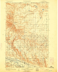 1913 Cherry Ridge1913 Print · USGSNorthern Montana ranching and the Fort Belknap Indian Reservation are captured here during the early twentieth century. Genealogists and historians can locate early homesteads like Arbagasts Ranch and trace the path of the Great Northern railroad.3 unique versions available
 - 1953 Map of Havre, 1967 Print
 1953 Havre1967 Print · USGSNorthern Montana’s Hi-Line comes into focus in the mid-fifties, centered on the Milk River and the critical Great Northern rail link. Genealogists can trace small sidings and settlements like Assinniboine, Laredo, and Box Elder alongside the Fort Belknap Agency.3 unique versions available
 - 1957 Map of Havre
 1957 Havre1957 Print · USGSNorth-central Montana at the mid-century is defined by the vital Great Northern rail corridor and the winding Milk River. Researchers can trace old settlements like Laredo and Savoy, or locate historic sites such as the Hays (old) Sub Agency and the Chinook No 1 mine.
 - 1958 Map of Havre
 1958 Havre1958 Print · USGSUpper Montana in the late fifties was a landscape of remote rail towns and vast high-plain ranges. Genealogists and historians can trace the Great Northern railroad through Havre, Chinook, and the Fort Belknap Indian Reservation.
 - 1984 Map of Hogeland
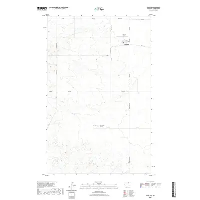
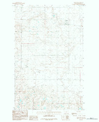 1984 Hogeland1984 Print · USGSBlaine County plains come into focus in the late seventies, showing the rural layout of the Big Flat region near the Canadian border. Genealogists and researchers can trace the local road network surrounding the settlement of Hogeland and the course of Murphy Coulee.
 - 2011 Map of Hogeland, 2011 Print
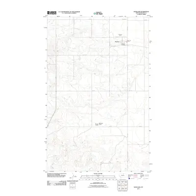 2011 Hogeland2011 Print · USGSCovers Hogeland, including Blaine County, United States, and other nearby areas
 - 2014 Map of Hogeland, 2014 Print
 2014 Hogeland2014 Print · USGSCovers Hogeland, including Blaine County, United States, and other nearby areas
 - 2017 Map of Hogeland, 2017 Print
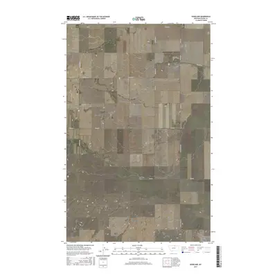 2017 Hogeland2017 Print · USGSCovers Hogeland, including Blaine County, United States, and other nearby areas
 - 2020 Map of Hogeland, 2020 Print
 2020 Hogeland2020 Print · USGSCovers Hogeland, including Blaine County, United States, and other nearby areas
 - 2024 Map of Hogeland, 2024 Print
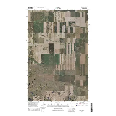
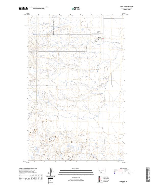 2024 Hogeland2024 Print · USGSThe northern plains of Blaine County are captured in this modern survey of the High Line country. Researchers can trace the local infrastructure around Hogeland, from the Hogeland Airport to the deep drainage of East Butte Coulee.
End of results
Showing maps 1-10 of 10
Frequently asked questions
- What are the different types of historical maps available for Hogeland?
- What is the oldest map of Hogeland?
- Where can I purchase historical maps of Hogeland for my home or office?
- Where can I download high-res historical maps of Hogeland?
- Are there historical topographic maps available for Hogeland?
- Is there historical aerial imagery available for Hogeland?
- Where are historical maps of Hogeland sourced from?