2020s Maps of Great Falls, Montana
Explore 10 historic maps of Great Falls from the 2020s. These maps offer a rare glimpse into what life looked like during the 2020s — showing old roads, neighborhoods, homes, and landmarks that have changed or disappeared over time.
Whether you're researching your family's past, planning a metal detecting trip, or studying how Great Falls's landscape evolved across the 2020s, these high-resolution maps are a powerful tool for exploring the history of this region.
- Focus on a specific era: All maps on this page are from the 2020s, giving you a focused view of this time period.
- See what’s changed: Compare century-old streets, trails, and buildings to today's modern landscape using overlays and satellite layers.
- Research with precision: Use these maps for genealogy, historical research, land use analysis, or educational projects.
- View, download, or print: Maps are fully viewable online in high resolution, and can be downloaded or printed for your own records.
Start exploring Great Falls's history through authentic maps from the 2020s. This is your window into the past.
Great Falls, MT maps
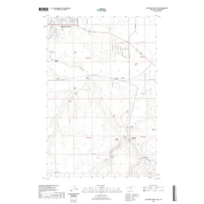
(10)- 2020 Map of Northwest Great Falls, 2020 Print
 2020 Northwest Great Falls2020 Print · USGSCovers Great Falls, including Cascade County, United States, and other nearby areas
 - 2020 Map of Northeast Great Falls, 2020 Print
 2020 Northeast Great Falls2020 Print · USGSCovers Great Falls, including Sheffels, Cooper, and other nearby areas
 - 2020 Map of Antelope Butte, 2020 Print
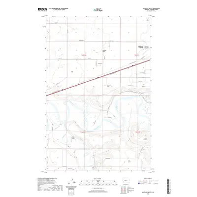 2020 Antelope Butte2020 Print · USGSCovers Great Falls, including Cascade County, United States, and other nearby areas
 - 2020 Map of Southeast Great Falls, 2020 Print
 2020 Southeast Great Falls2020 Print · USGSCovers Great Falls, including Centerville, Sand Coulee, and other nearby areas
 - 2020 Map of Southwest Great Falls, 2020 Print
 2020 Southwest Great Falls2020 Print · USGSCovers Great Falls, including Cascade County, United States, and other nearby areas
 - 2024 Map of Southeast Great Falls, 2024 Print
 2024 Southeast Great Falls2024 Print · USGSCascade County's coal mining and military heritage are on full display in this modern survey of the benchlands south of the Missouri River. Researchers can trace historical settlement patterns from Malmstrom Air Force Base down to old mining camps like Number Seven and Tracy.
 - 2024 Map of Northeast Great Falls, 2024 Print
 2024 Northeast Great Falls2024 Print · USGSNortheast of the city in the 2020s, the river valley remains a centerpiece of the landscape alongside the strategic military presence. Local historians can trace the river's path through Rainbow Falls and Giant Springs or locate rural landmarks like Sheffels.
 - 2024 Map of Southwest Great Falls, 2024 Print
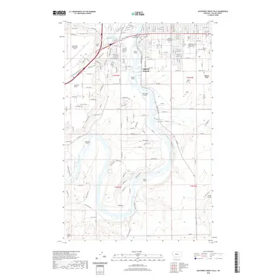
 2024 Southwest Great Falls2024 Print · USGSThe outskirts of Great Falls are documented here during a period of modern expansion along the Missouri and Sun Rivers. Researchers can trace the development of Gibson Flats and Gore Hill, or locate local landmarks like the University of Providence and Highland Cem.
 - 2024 Map of Northwest Great Falls, 2024 Print
 2024 Northwest Great Falls2024 Print · USGSGreat Falls and the surrounding Cascade County plains come into sharp focus in this recent survey. Researchers can trace the modern development of Great Falls alongside legacy landmarks like Smelter Hill, Emerson Junction, and Black Eagle Falls.
 - 2024 Map of Antelope Butte, 2024 Print
 2024 Antelope Butte2024 Print · USGSThe river-carved benches southwest of Great Falls are documented in this recent survey. Local researchers can trace the reach of Great Falls International Airport or locate rural landmarks like Ulm, Wilson Butte, and Bair Airport.
End of results
Showing maps 1-10 of 10
Top cities near Great Falls
Top neighborhoods of Great Falls
- Eastside historical maps
- Southeast historical maps
- Westside historical maps
- Southside historical maps
- Northside historical maps
- Southwest historical maps
See more
Frequently asked questions
- What are the different types of historical maps available for Great Falls?
- What is the oldest map of Great Falls?
- Where can I purchase historical maps of Great Falls for my home or office?
- Where can I download high-res historical maps of Great Falls?
- Are there historical topographic maps available for Great Falls?
- Is there historical aerial imagery available for Great Falls?
- Where are historical maps of Great Falls sourced from?