Old Maps of Saint Peter, Montana for Hiking & Exploration
Hike through history with 11 historic maps of Saint Peter. Explore old trails, ghost towns, and forgotten backroads — perfect for outdoor adventurers and local explorers.
- Rediscover forgotten places: Map out old mining camps, roads, and footpaths that no longer exist on modern maps.
- Layer with modern tools: Combine with LiDAR or satellite views to plan hikes through historical terrain.
- Made for exploration: Popular among hikers, overlanders, and local history lovers.
Use these maps to find adventure and explore the hidden past of Saint Peter.
Saint Peter, MT maps
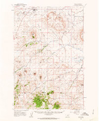
(11)- 1886 Map of Great Falls
 1886 Great Falls1886 Print · USGSCentral Montana in the mid-1880s is defined by its great river systems and the early footprints of frontier outposts. Researchers can trace the early development of Great Falls, find the site of St. Peter's Mission, and locate river settlements like Truly and Fort Shaw.4 unique versions available
 - 1954 Map of Great Falls
 1954 Great Falls1954 Print · USGSThe Missouri River valley in the mid-1950s is shown at a time of significant industrial and military growth. Genealogists and historians can locate early schools and rail stops like Tiger Butte Community Center, Fort Benton, and the Anaconda Wire Plant.4 unique versions available
 - 1957 Map of Great Falls
 1957 Great Falls1957 Print · USGSMontana's central plains and mountain foothills are captured here in the mid-fifties, showing the hub of Great Falls and the surrounding grain-shipping towns. Genealogists can trace family roots through the rail sidings of the Great Northern and small rural communities like Sand Coulee or Fort Benton.
 - 1960 Map of Simms, 1962 Print
 1960 Simms1962 Print · USGSWestern Montana's ranching and transit corridors are captured here during the mid-century, featuring the rugged volcanic mesas of the Sun River valley. Researchers can trace the legacy of the Mullan Road, the St Peter Mission, and the Eagle Rock Stage Station (Site).2 unique versions available
 - 1976 Map of Great Falls South, 1994 Print
 1976 Great Falls South1994 Print · USGSCascade County in the mid-seventies reveals a landscape defined by the winding Missouri River and the high peaks of the Little Belt Mountains. Researchers can trace the heritage of mining settlements like Centerville, Stockett, and Number Seven or explore the boundaries of the Lewis and Clark National Forest.
 - 1983 Map of Telegraph Mountain
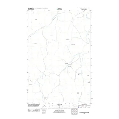
 1983 Telegraph Mountain1983 Print · USGSCascade County ranching and mission life are captured here during the early 1980s. Genealogists and local historians can trace the foundations of the area at St Peter, Sullivan School, and the Cem along the St Peter Mission Road.
 - 2011 Map of Telegraph Mountain, 2011 Print
 2011 Telegraph Mountain2011 Print · USGSCovers Saint Peter, including Cascade County, United States, and other nearby areas
 - 2014 Map of Telegraph Mountain, 2014 Print
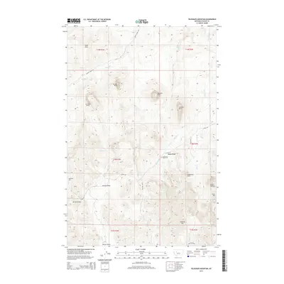 2014 Telegraph Mountain2014 Print · USGSCovers Saint Peter, including Cascade County, United States, and other nearby areas
 - 2017 Map of Telegraph Mountain, 2017 Print
 2017 Telegraph Mountain2017 Print · USGSCovers Saint Peter, including Cascade County, United States, and other nearby areas
 - 2020 Map of Telegraph Mountain, 2020 Print
 2020 Telegraph Mountain2020 Print · USGSCovers Saint Peter, including Cascade County, United States, and other nearby areas
 - 2024 Map of Telegraph Mountain, 2024 Print
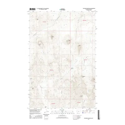
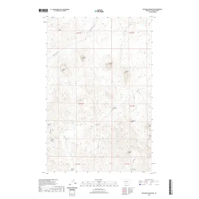
 2024 Telegraph Mountain2024 Print · USGSCascade County ranchlands and dramatic volcanic buttes are documented here in the 2020s. Researchers can locate Saint Peters Mission Cem and trace the paths of Birdtail Creek and Mission Creek through the high country.
End of results
Showing maps 1-11 of 11
Top cities near Saint Peter
Frequently asked questions
- What are the different types of historical maps available for Saint Peter?
- What is the oldest map of Saint Peter?
- Where can I purchase historical maps of Saint Peter for my home or office?
- Where can I download high-res historical maps of Saint Peter?
- Are there historical topographic maps available for Saint Peter?
- Is there historical aerial imagery available for Saint Peter?
- Where are historical maps of Saint Peter sourced from?