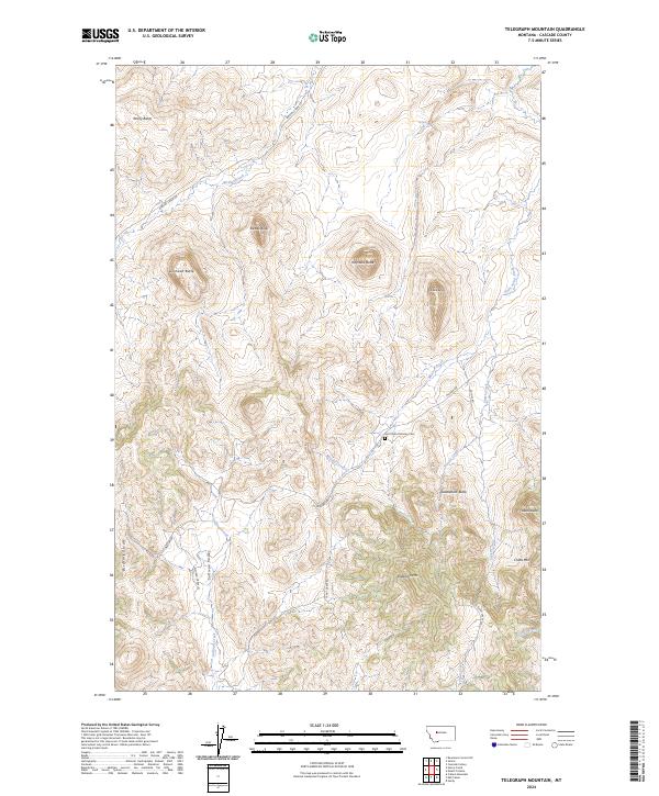
2024 Map of Telegraph Mountain
USGS Topo · Published 2024About this map
Saint Peters Mission Cem serves as a significant historical anchor in this portion of Cascade County, situated along Mission RD just north of Saddleback Butte. This landscape is defined by its dramatic volcanic and tectonic topography, where isolated peaks like Birdtail Butte, Lionhead Butte, and Haystack Butte rise sharply above the drainages. The rugged character of the Birdtail Divide separates the Sullivan Valley from the western basins, while a network of waterways including Mission Creek, Smith Creek, and Birdtail Creek carve through the foothills. The terrain climbs toward the high points of Telegraph Mtn and China Mtn in the southeast, illustrating the transition from open range to the higher elevations of the Montana front.
Find a feature on this map
33 named features on this map. Tap any name to fly to it.
Don’t see what you’re looking for? This feature index may not catch every label — zoom into the map to look around manually.
Map Details
Editions of this 2024 Telegraph Mountain Map
This is the sole edition of this map. No revisions or reprints were ever made.
Other maps of this area

1886 · Great Falls
USGS Topo · 1:250,000

1943 · Hogan
USGS Topo · 1:125,000

1954 · Great Falls
USGS Topo · 1:250,000

1955 · Choteau
USGS Topo · 1:250,000

1957 · Choteau
USGS Topo · 1:250,000

1957 · Great Falls
USGS Topo · 1:250,000

1958 · Choteau
USGS Topo · 1:250,000

1960 · Simms
USGS Topo · 1:62,500

1961 · Hardy
USGS Topo · 1:24,000
1961 · Coburn Mountain
USGS Topo · 1:24,000