
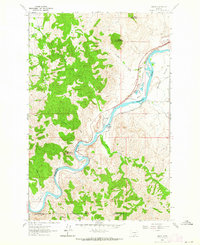
1961 Map of Hardy
USGS Topo · Published 1964About this map
The Missouri River carves a deep, winding path through this portion of central Montana, defining the boundary between Cascade and Lewis and Clark counties. The small settlement of Hardy sits at a critical bend in the river, serving as a focal point for local transportation and water management. The infrastructure of the Great Northern railroad is prominent here, following the river's contours and utilizing sidings such as Tintinger Siding and Gilmore Siding to support the area's movement of goods.
Find a feature on this map
27 named features on this map. Tap any name to fly to it.
Don’t see what you’re looking for? This feature index may not catch every label — zoom into the map to look around manually.
Map Details
Editions of this 1961 Hardy Map
2 editions found
Other maps of this area

1886 · Great Falls
USGS Topo · 1:250,000

1949 · Cascade
USGS Topo · 1:62,500

1951 · Cascade
USGS Topo · 1:62,500

1954 · Great Falls
USGS Topo · 1:250,000

1957 · Great Falls
USGS Topo · 1:250,000

1960 · Simms
USGS Topo · 1:62,500

1961 · Craig
USGS Topo · 1:24,000

1961 · Hound Creek Reservoir
USGS Topo · 1:24,000

1961 · Rocky Reef
USGS Topo · 1:24,000
1961 · The Sawteeth
USGS Topo · 1:24,000