1980s Maps of Deer Lodge County, Montana
Explore 8 historic maps of Deer Lodge County from the 1980s. These maps offer a rare glimpse into what life looked like during the 1980s — showing old roads, neighborhoods, homes, and landmarks that have changed or disappeared over time.
Whether you're researching your family's past, planning a metal detecting trip, or studying how Deer Lodge County's landscape evolved across the 1980s, these high-resolution maps are a powerful tool for exploring the history of this region.
- Focus on a specific era: All maps on this page are from the 1980s, giving you a focused view of this time period.
- See what’s changed: Compare century-old streets, trails, and buildings to today's modern landscape using overlays and satellite layers.
- Research with precision: Use these maps for genealogy, historical research, land use analysis, or educational projects.
- View, download, or print: Maps are fully viewable online in high resolution, and can be downloaded or printed for your own records.
Start exploring Deer Lodge County's history through authentic maps from the 1980s. This is your window into the past.
Deer Lodge County, MT maps
(8)- 1989 Map of Sugarloaf Mountain
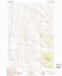
 1989 Sugarloaf Mountain1989 Print · USGSWestern Montana's high ridges are captured in the late eighties, showing the convergence of three counties along the Continental Divide. Researchers can trace old mining footprints at Schurchs Tunnel or explore the drainage basins of Orofino Creek and the Boulder River.
 - 1989 Map of Warm Springs
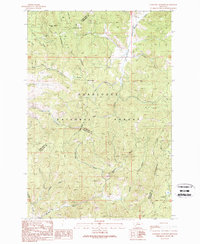
 1989 Warm Springs1989 Print · USGSDeer Lodge County in the late eighties is defined by the heavy footprint of the mining industry and state institutions along the Clark Fork. Researchers can trace the layout of the Montana State Hospital and the extensive tailings management systems that reshaped the valley floor.
 - 1989 Map of Orofino Mountain
 1989 Orofino Mountain1989 Print · USGSDeer Lodge and Silver Bow counties meet at this high-altitude mining district during the late twentieth century. Researchers can trace the extensive network of 4WD trails and resource sites like the Butte Pacific Mine, Lockhart Meadows, and Whitcraft.
 - 1989 Map of Anaconda North
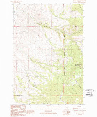
 1989 Anaconda North1989 Print · USGSAnaconda was a hub of Montana industry and community in the late eighties, balanced between heavy mining operations and the vast Deer Lodge National Forest. Genealogists and historians can trace local landmarks like Washington School, the city Cem, and the industrial Tailings fields.
 - 1989 Map of Orofino Creek
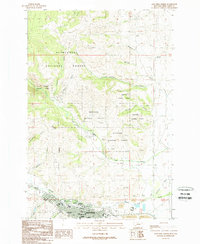
 1989 Orofino Creek1989 Print · USGSThe Clark Fork river valley and the northern edge of the Deerlodge National Forest are shown here in the late 1980s. Researchers can trace historic water rights and family-named landmarks like Reese Anderson Creek, O'Donnell Mountain, and the settlement at Racetrack.
 - 1989 Map of Lockhart Meadows
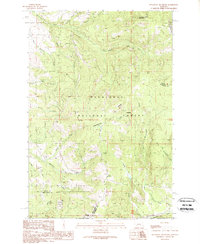
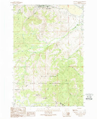
 1989 Lockhart Meadows1989 Print · USGSMontana's high country is captured here in the late eighties as it straddles the continental crest within the national forest. Researchers can trace historic mining operations at the Champion Mine or locate early family-named landmarks like Strozzi and Olson Gulch.
 - 1989 Map of Opportunity
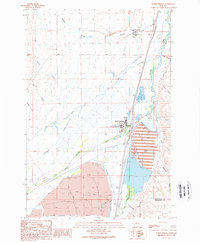
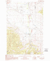 1989 Opportunity1989 Print · USGSThe Deer Lodge valley in the late eighties shows a landscape of industrial bypasses and small rail-side settlements. Trace the history of Opportunity or find sites like Crackerville, Gregson, and the Sunset Memorial Gardens Cem.
 - 1989 Map of Anaconda South
 1989 Anaconda South1989 Print · USGSThe mining and smelting hub of Anaconda is captured in the late eighties, showing the transition from industrial city to the high peaks of the Continental Divide. Researchers can locate the Lincoln School, Cem, and remnants of the Anaconda Ralston Railroad Grade.
End of results
Showing maps 1-8 of 8
Top cities of Deer Lodge County
Frequently asked questions
- What are the different types of historical maps available for Deer Lodge County?
- What is the oldest map of Deer Lodge County?
- Where can I purchase historical maps of Deer Lodge County for my home or office?
- Where can I download high-res historical maps of Deer Lodge County?
- Are there historical topographic maps available for Deer Lodge County?
- Is there historical aerial imagery available for Deer Lodge County?
- Where are historical maps of Deer Lodge County sourced from?