Old Maps of Deer Lodge County, Montana for Hiking & Exploration
Hike through history with 217 historic maps of Deer Lodge County. Explore old trails, ghost towns, and forgotten backroads — perfect for outdoor adventurers and local explorers.
- Rediscover forgotten places: Map out old mining camps, roads, and footpaths that no longer exist on modern maps.
- Layer with modern tools: Combine with LiDAR or satellite views to plan hikes through historical terrain.
- Made for exploration: Popular among hikers, overlanders, and local history lovers.
Use these maps to find adventure and explore the hidden past of Deer Lodge County.
Deer Lodge County, MT maps
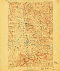
(217)- 1889 Map of Helena
 1889 Helena1889 Print · USGSThe Montana territory is caught in a moment of feverish railroad and mining expansion just before the close of the century. Genealogists and historians can trace early mountain routes and rail stations through settlements like Marysville, Wickes, and the bustling territorial hub of Helena.
 - 1893 Map of Helena
 1893 Helena1893 Print · USGSMontana's gold and silver boom is captured here in the late nineteenth century, showing the rail lines and mining camps radiating from the territorial capital. Genealogists and historians can trace the early layout of Helena or locate vanished sites like Blackfoot City and Gloster.2 unique versions available
 - 1893 Map of Dillon
 1893 Dillon1893 Print · USGSSouthwestern Montana’s mountain ranges and river basins were being reshaped by the mining and rail boom in the late nineteenth century. Genealogists and historians can trace the early layout of Dillon and vanished camps like Hecla, Rochester, and Argenta.5 unique versions available
 - 1899 Map of Helena, 1956 Print
 1899 Helena1956 Print · USGSThe Montana gold country and the Continental Divide appear here at the close of the nineteenth century. Genealogists and historians can trace the mining and rail networks connecting Helena and Butte, including Pikes Peak Mill, Marysville, and Ft. Harrison.
 - 1903 Map of Helena
 1903 Helena1903 Print · USGSMontana's mining heartland comes alive at the dawn of the new century, from the state capital to the copper-rich summits above the Silver Bow. Trace the early rail lines serving Marysville, locate the historic barracks of Ft. Harrison, and follow the mountain trails through Mullan Pass.4 unique versions available
 - 1908 Map of Philipsburg
 1908 Philipsburg1908 Print · USGSGranite County at the height of its mining era features a landscape shaped by mineral wealth and the high peaks of the Divide. Genealogists and historians can trace industrial roots at Philipsburg, Southern Cross, and the Stamp Mill near Combination.3 unique versions available
 - 1947 Map of Butte, 1949 Print
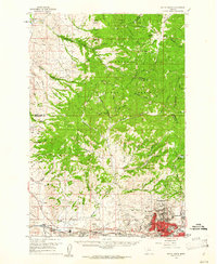
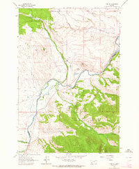
 1947 Butte1949 Print · USGSWestern Montana at the peak of its rail-and-river era shows the vital connections between the mining and industrial centers of Butte and Helena. Researchers can trace the three major railroad lines serving mountain settlements like Garrison, Philipsburg, and Warm Springs.2 unique versions available
 - 1955 Map of Dillon, 1978 Print
 1955 Dillon1978 Print · USGSSouthwest Montana at the dawn of the interstate era reveals a landscape of high-mountain ranching and historic mining camps. Trace the routes of the Union Pacific through Dillon and Armstead, or locate early settlements like Bannack and Wisdom.2 unique versions available
 - 1957 Map of Dillon
 1957 Dillon1957 Print · USGSSouthwest Montana and Idaho in the mid-fifties reveal a high-country landscape of mountain ranges and ranching valleys. Genealogists can trace family holdings and rail stops along the Union Pacific Railroad, from Dillon to historic Virginia City and Twin Bridges.
 - 1958 Map of Butte
 1958 Butte1958 Print · USGSWestern Montana's mining and rail corridors are captured in the late fifties, from the urban bustle of the Copper King cities to high mountain passes. Researchers can trace the path of the Milwaukee St Paul and Pacific through Deer Lodge and locate remote outposts like Potomac Post Office.5 unique versions available
 - 1958 Map of Dillon
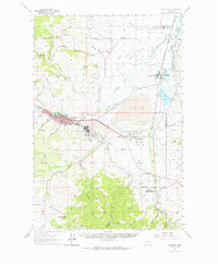
 1958 Dillon1958 Print · USGSSouthwestern Montana during the late fifties reveals a high-country landscape defined by the Continental Divide and a legacy of mountain mining. Genealogists and historians can trace rail lines like the Union Pacific or locate early industrial sites including the Hecla Mine and Ermont Mine.
 - 1959 Map of Butte North, 1961 Print
 1959 Butte North1961 Print · USGSSilver Bow County in the late fifties was the heart of the American copper industry, dominated by the massive mining operations around Butte. Researchers can trace the rail lines of the Northern Pacific and locate historic mining sites like the Butte Pacific Mine or the emerging Berkeley Pit.3 unique versions available
 - 1959 Map of Deer Lodge, 1961 Print
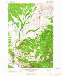
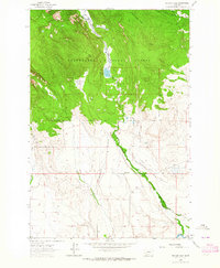
 1959 Deer Lodge1961 Print · USGSDeer Lodge and the Clark Fork valley are captured here in the late fifties, showcasing a landscape defined by parallel transcontinental railroads and mountain mining. Genealogists and historians can trace the foundations of Deer Lodge, the State Prison, and isolated settlements like Leadville.2 unique versions available
 - 1960 Map of Butte
 1960 Butte1960 Print · USGSWestern Montana at the dawn of the sixties is defined by its industrial mining hubs and the railroads that connect them. Genealogists and historians can trace the routes of the Milwaukee Road through Butte or locate smaller settlements like Southern Cross and Bearmouth.
 - 1961 Map of Dickie Peak, 1964 Print
 1961 Dickie Peak1964 Print · USGSSilver Bow County high country is shown here in the early sixties, split by the Continental Divide and county boundaries. Genealogists and historians can trace remote activity at French Town, the Hungry Hill Mine, and Johnson Park.2 unique versions available
 - 1961 Map of Anaconda, 1964 Print
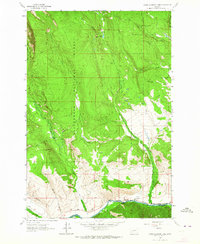
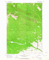
 1961 Anaconda1964 Print · USGSThe Deer Lodge Valley in the early 1960s was a hub of smelting industry and state institutions. Trace the industrial footprint of the Anaconda Smelter and find local landmarks like Gregson Hot Springs and the State Hospital at Warm Springs.
 - 1962 Map of Butte
 1962 Butte1962 Print · USGSWestern Montana in the early sixties remains a landscape of industrial muscle and high-mountain passes. Trace the rail lines of the Northern Pacific through Deer Lodge and the mining history around Anaconda and Philipsburg.
 - 1962 Map of Dillon
 1962 Dillon1962 Print · USGSSouthwest Montana in the early sixties is defined by its high mountain ranges and the winding rivers that carved its settlement patterns. Trace the rail routes of the Union Pacific through Dillon or locate mining activity near Butte and Argenta.
 - 1962 Map of Lincoln Gulch, 1964 Print
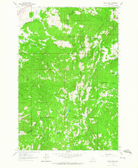
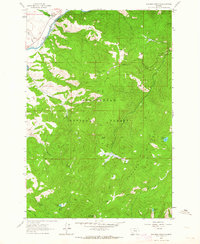
 1962 Lincoln Gulch1964 Print · USGSThe Montana high country in the early sixties was a landscape of remote mountain ranching and early winter recreation. Family-named landmarks such as Rousch Ranch and the Deep Creek Ski Area offer rich details for genealogists and local historians.3 unique versions available
 - 1962 Map of Lower Seymour Lake, 1964 Print
 1962 Lower Seymour Lake1964 Print · USGSDeer Lodge and Beaverhead counties meet in these Montana mountains during the early 1960s. Genealogists and local historians can trace the remote La Marche Creek Ranch or follow the paths of Bacon Ditch and the Big Hole River.3 unique versions available
 - 1962 Map of Pine Hill, 1964 Print
 1962 Pine Hill1964 Print · USGSDeer Lodge and Beaverhead counties meet along the Big Hole River in this early 1960s survey of Montana ranching country. Genealogists and local historians can trace the irrigation networks and homesteads of Bacon Ranch, Nichols Ranch, and the settlement at Goris.2 unique versions available
 - 1962 Map of Dickie Hills, 1964 Print
 1962 Dickie Hills1964 Print · USGSBeaverhead County ranching and forestry are captured here in the early 1960s, where the river meets the high forest boundary. Researchers can trace historic property sites like Davis Ranch, find the crossing at Dickie Bridge, and locate high-altitude features like Foolhen Lake.4 unique versions available
 - 1962 Map of Foolhen Mountain, 1964 Print
 1962 Foolhen Mountain1964 Print · USGSThe high country of the Big Hole River valley comes alive in the early sixties, showing the intersection of industry and national forest management. Researchers can locate the Calvert Mine, the Fishtrap Sch, and the remote Foolhen Ranger Cabin.3 unique versions available
 - 1962 Map of Pintlar Lake, 1964 Print
 1962 Pintlar Lake1964 Print · USGSBeaverhead and Deer Lodge counties are captured here in the early sixties as high-mountain wilderness meets valley ranching. Researchers can trace historic water rights and rural education via the Nyhart Ditch, Bushong Ditch, and the remote Bowen Sch.2 unique versions available
 - 1962 Map of Long Peak, 1964 Print
 1962 Long Peak1964 Print · USGSThe Beaverhead National Forest in the early sixties was a land of high peaks and pack trails. Researchers can trace historic water management systems like Paddock Ditch and navigate the drainages of Fishtrap Creek and Middle Fork La Marche Creek.2 unique versions available
Showing maps 1-25 of 217
Top cities of Deer Lodge County
Frequently asked questions
- What are the different types of historical maps available for Deer Lodge County?
- What is the oldest map of Deer Lodge County?
- Where can I purchase historical maps of Deer Lodge County for my home or office?
- Where can I download high-res historical maps of Deer Lodge County?
- Are there historical topographic maps available for Deer Lodge County?
- Is there historical aerial imagery available for Deer Lodge County?
- Where are historical maps of Deer Lodge County sourced from?