Old Maps of Karst Loop, Montana for Academic Research
Study the evolution of Karst Loop with 17 high-resolution historic maps. Whether you're teaching, researching, or modeling changes in land use, these maps provide essential visual documentation of urban, environmental, and geographic change.
- Analyze long-term change: Track patterns in development, transportation, and natural features.
- Ideal for environmental or urban studies: Support academic projects with primary historical map data.
- Use in the classroom or lab: Educators and researchers rely on these maps to bring historical context to life.
These maps are a powerful tool for teaching, research, and visualizing how Karst Loop has changed over the decades.
Karst Loop, MT maps
(17)- 1888 Map of Three Forks
 1888 Three Forks1888 Print · USGSSouthwestern Montana was a land of mining camps and river junctions in the late nineteenth century, as the railroad began to connect established valleys. Genealogists can trace family roots through pioneer settlements like Virginia City, Salesville, and Spring Hill, or locate early crossings at Barton's Bridge.
 - 1894 Map of Three Forks
 1894 Three Forks1894 Print · USGSSouthwestern Montana thrives along the river forks and rail lines during the mid-1880s. Genealogists and historians can trace early town sites like Pony, Logan, and Salesville while locating river crossings such as Fly's Bridge and Shedds Bridge.
 - 1895 Map of Three Forks
 1895 Three Forks1895 Print · USGSSouthern Montana was a landscape of emerging rail towns and gold-country gulches during the mid-1890s. Genealogists and historians can trace the early footprints of Bozeman, locate Guns Ranch, and follow the Northern Pacific Railroad through Three Forks.5 unique versions available
 - 1947 Map of Bozeman, 1948 Print
 1947 Bozeman1948 Print · USGSBozeman and the surrounding mountain ranges are captured here just after the war, showing the vital rail and river networks of southwestern Montana. Genealogists and historians can trace routes to early settlements like Virginia City, Gallatin Gateway, and the mountain community of Jardine.
 - 1948 Map of Bozeman, 1951 Print
 1948 Bozeman1951 Print · USGSSouthern Montana in the late 1940s is shown as a high-country crossroads of rail lines and river headwaters. Genealogists and historians can trace old town sites like Virginia City and McLeod alongside the Northern Pacific and Milwaukee Road railroads.
 - 1955 Map of Bozeman
 1955 Bozeman1955 Print · USGSBozeman and the upper Missouri River headwaters are captured here during the mid-fifties, showing the vital rail and river networks of southwestern Montana. Local historians can trace the routes of the Northern Pacific railroad through Livingston and locate smaller settlements like Trident, Anceney, and Jardine.
 - 1955 Map of Garnet Mountain, 1957 Print
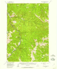 1955 Garnet Mountain1957 Print · USGSThe Gallatin Canyon corridor is captured here in the mid-fifties as mountain industry and recreation began to shape the forest. Researchers can trace the development of the Karst Ranch, find the Blanchard Sawmill, and locate the Mica Mine.4 unique versions available
 - 1958 Map of Bozeman, 1968 Print
 1958 Bozeman1968 Print · USGSThe Gallatin and Madison River valleys are captured here in the late fifties, showing the region's transition into a modern mountain hub. Genealogists and historians can trace the paths of the Northern Pacific RR, locate the Anceney School, and see the early layout of Bozeman.3 unique versions available
 - 1965 Map of Bozeman
 1965 Bozeman1965 Print · USGSSouthwestern Montana's river valleys and mountain ranges appear in detail during the early 1960s. Genealogists and historians can trace rail-era settlements like Trident, locate the Anceney School, and see the early footprint of Montana State College.
 - 1988 Map of Hidden Lake
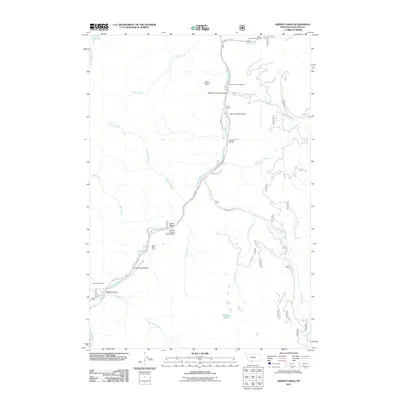
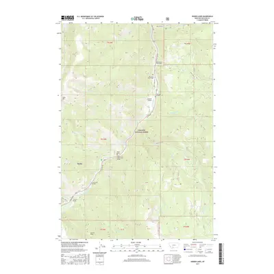
 1988 Hidden Lake1988 Print · USGSGallatin County was a center for wilderness preservation and river-corridor travel in the late eighties. Trace backcountry routes like the Pack Trail to alpine waters at Lava Lake or visit the riverside Karat Ranch.2 unique versions available
 - 1989 Map of Ennis, 1990 Print
 1989 Ennis1990 Print · USGSMadison County ranching and the rise of mountain tourism define this region during the 1980s. Genealogists and historians can trace the development of Ennis, find historic mining sites like the Missouri Mine, or locate the settlements at Virginia City and McAllister.
 - 2000 Map of Hidden Lakes, 2005 Print
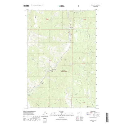
 2000 Hidden Lakes2005 Print · USGSGallatin County at the turn of the millennium shows a landscape defined by the winding Gallatin River and protected wilderness. Researchers can trace the routes through Gallatin Canyon to find local landmarks like Karat Ranch and Jack Smith Bridge.
 - 2011 Map of Hidden Lakes, 2011 Print
 2011 Hidden Lakes2011 Print · USGSCovers Karst Loop, including Gallatin County, United States, and other nearby areas
 - 2014 Map of Hidden Lakes, 2014 Print
 2014 Hidden Lakes2014 Print · USGSCovers Karst Loop, including Gallatin County, United States, and other nearby areas
 - 2017 Map of Hidden Lakes, 2017 Print
 2017 Hidden Lakes2017 Print · USGSCovers Karst Loop, including Gallatin County, United States, and other nearby areas
 - 2020 Map of Hidden Lakes, 2020 Print
 2020 Hidden Lakes2020 Print · USGSCovers Karst Loop, including Gallatin County, United States, and other nearby areas
 - 2024 Map of Hidden Lakes, 2024 Print
 2024 Hidden Lakes2024 Print · USGSThe Gallatin County high country is captured here during the 2020s, showing the intersection of the Big Sky community and the protected Lee Metcalf Wilderness. You can trace the complex network of mountain paths including the Hidden Lakes Trl and Karst Trl along the Gallatin River.
End of results
Showing maps 1-17 of 17
Top cities near Karst Loop
Frequently asked questions
- What are the different types of historical maps available for Karst Loop?
- What is the oldest map of Karst Loop?
- Where can I purchase historical maps of Karst Loop for my home or office?
- Where can I download high-res historical maps of Karst Loop?
- Are there historical topographic maps available for Karst Loop?
- Is there historical aerial imagery available for Karst Loop?
- Where are historical maps of Karst Loop sourced from?