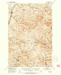
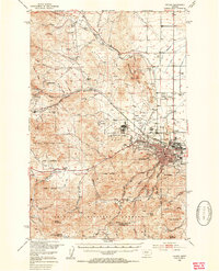
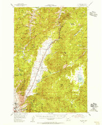
1900s (20th Century) Maps of Jefferson County, Montana
Explore 115 historic maps of Jefferson County from the 1900s (20th Century). These maps offer a rare glimpse into what life looked like during the 1900s — showing old roads, neighborhoods, homes, and landmarks that have changed or disappeared over time.
Whether you're researching your family's past, planning a metal detecting trip, or studying how Jefferson County's landscape evolved across the 1900s, these high-resolution maps are a powerful tool for exploring the history of this region.
- Focus on a specific era: All maps on this page are from the 1900s, giving you a focused view of this time period.
- See what’s changed: Compare century-old streets, trails, and buildings to today's modern landscape using overlays and satellite layers.
- Research with precision: Use these maps for genealogy, historical research, land use analysis, or educational projects.
- View, download, or print: Maps are fully viewable online in high resolution, and can be downloaded or printed for your own records.
Start exploring Jefferson County's history through authentic maps from the 1900s. This is your window into the past.
Jefferson County, MT maps
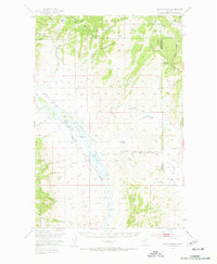
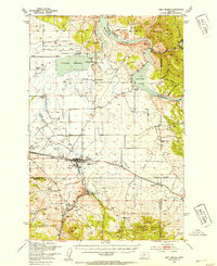
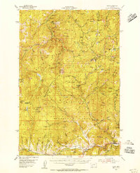
(115)- 1903 Map of Helena
 1903 Helena1903 Print · USGSMontana's mining heartland comes alive at the dawn of the new century, from the state capital to the copper-rich summits above the Silver Bow. Trace the early rail lines serving Marysville, locate the historic barracks of Ft. Harrison, and follow the mountain trails through Mullan Pass.4 unique versions available
 - 1947 Map of Bozeman, 1948 Print
 1947 Bozeman1948 Print · USGSBozeman and the surrounding mountain ranges are captured here just after the war, showing the vital rail and river networks of southwestern Montana. Genealogists and historians can trace routes to early settlements like Virginia City, Gallatin Gateway, and the mountain community of Jardine.
 - 1947 Map of Butte, 1949 Print
 1947 Butte1949 Print · USGSWestern Montana at the peak of its rail-and-river era shows the vital connections between the mining and industrial centers of Butte and Helena. Researchers can trace the three major railroad lines serving mountain settlements like Garrison, Philipsburg, and Warm Springs.2 unique versions available
 - 1948 Map of Bozeman, 1951 Print
 1948 Bozeman1951 Print · USGSSouthern Montana in the late 1940s is shown as a high-country crossroads of rail lines and river headwaters. Genealogists and historians can trace old town sites like Virginia City and McLeod alongside the Northern Pacific and Milwaukee Road railroads.
 - 1948 Map of White Sulphur Springs, 1951 Print
 1948 White Sulphur Springs1951 Print · USGSMontana's capital and the high country of the Big Belt Mountains come alive in this mid-century survey. Trace the early hydroelectric developments at Canyon Ferry Dam or follow the historic rail lines through Ringling and Townsend.
 - 1949 Map of Radersburg, 1953 Print
 1949 Radersburg1953 Print · USGSRadersburg and the surrounding mountain gulches are captured here in the late 1940s during a period of transition for Montana's mining and ranching communities. Researchers can trace deep-rooted mining claims like the Black Friday Mines or locate rural landmarks such as the Crow Creek School and Riverside Ranch.5 unique versions available
 - 1950 Map of Devils Fence
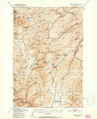
 1950 Devils Fence1950 Print · USGSJefferson County ranchlands and mining districts are meticulously detailed in this mid-century survey of the Boulder Valley region. Researchers can locate remote family landmarks such as the Quaintance Ranch, Boulder Valley Church, and the active Ida Mine.5 unique versions available
 - 1950 Map of Jefferson City, 1952 Print
 1950 Jefferson City1952 Print · USGSMining districts in Jefferson and Lewis and Clark Counties are shown in high detail during the early fifties. Trace the history of the Northern Pacific rail line and dozens of old workings like the Grey Eagle Mine and Rimini.5 unique versions available
 - 1950 Map of Three Forks, 1953 Print
 1950 Three Forks1953 Print · USGSThree Forks and the surrounding Gallatin Valley are captured here just after the war, showing the historic meeting of the rivers that form the Missouri. Genealogists and historians can trace the foundations of this ranching community through the Jefferson Sch, Fairview Cem, and the Climbing Arrow Ranch.4 unique versions available
 - 1950 Map of Jefferson Island, 1954 Print
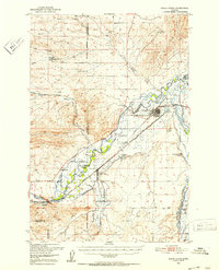
 1950 Jefferson Island1954 Print · USGSThe Jefferson River valley in the early 1950s reveals a landscape of industrial rail lines and established family ranchlands. Genealogists and local historians can locate early homesteads like Tribble Ranch, the Eureka School, and the South Boulder Cemetery.4 unique versions available
 - 1950 Map of East Helena, 1954 Print
 1950 East Helena1954 Print · USGSThe Missouri River valley near East Helena comes to life in the early fifties as a hub of rail transport and industrial mining. Genealogists and local historians can locate rural landmarks like Harmony School, St Anns Cem, and the Economy Mine.4 unique versions available
 - 1950 Map of Clancy, 1954 Print
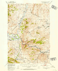
 1950 Clancy1954 Print · USGSIn the mid-century Montana mountains, the mining district around Clancy and Elkhorn remains a network of high-altitude claims and forest outposts. Genealogists and historians can trace old operations like the Golden Age Mine and Elkhorn Skyline Mine or locate the Clancy Post Office.5 unique versions available
 - 1950 Map of Helena, 1954 Print
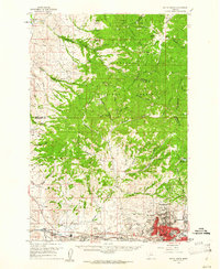
 1950 Helena1954 Print · USGSThe Montana state capital and its mining-era outskirts are captured here just after the war, showing the city's growth alongside established military and medical sites. Researchers can trace the legacy of Unionville, locate the St Joseph Orphan Home, or explore the many gulches and mines that defined the early local economy.6 unique versions available
 - 1954 Map of Elk Park, 1956 Print
 1954 Elk Park1956 Print · USGSThe high country of the Continental Divide near Butte comes into focus during the mid-fifties, showing the transition from industrial mining to the Deerlodge National Forest. Researchers can trace the Northern Pacific rail line past the Ruby Mine and old settlements at Woodville and McQueen.3 unique versions available
 - 1954 Map of Basin, 1956 Print
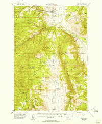
 1954 Basin1956 Print · USGSJefferson and Powell Counties were centers of intense mountain industry in the mid-fifties, linked by the GREAT NORTHERN rail line. Researchers can trace dozens of individual lode and placer operations, including the Monarch Mine, Bullion Mine, and the local rail hub at Basin.3 unique versions available
 - 1954 Map of Boulder, 1956 Print
 1954 Boulder1956 Print · USGSThe Boulder valley in the mid-fifties shows a landscape of mountain ranching and railway life. Genealogists and researchers can trace family holdings at the Keogh Ranch and Mc Cauley Ranch, or locate historic sites like the May Day Mine and Boulder Cem.4 unique versions available
 - 1955 Map of Bozeman
 1955 Bozeman1955 Print · USGSBozeman and the upper Missouri River headwaters are captured here during the mid-fifties, showing the vital rail and river networks of southwestern Montana. Local historians can trace the routes of the Northern Pacific railroad through Livingston and locate smaller settlements like Trident, Anceney, and Jardine.
 - 1955 Map of Dillon, 1978 Print
 1955 Dillon1978 Print · USGSSouthwest Montana at the dawn of the interstate era reveals a landscape of high-mountain ranching and historic mining camps. Trace the routes of the Union Pacific through Dillon and Armstead, or locate early settlements like Bannack and Wisdom.2 unique versions available
 - 1957 Map of Dillon
 1957 Dillon1957 Print · USGSSouthwest Montana and Idaho in the mid-fifties reveal a high-country landscape of mountain ranges and ranching valleys. Genealogists can trace family holdings and rail stops along the Union Pacific Railroad, from Dillon to historic Virginia City and Twin Bridges.
 - 1958 Map of Butte
 1958 Butte1958 Print · USGSWestern Montana's mining and rail corridors are captured in the late fifties, from the urban bustle of the Copper King cities to high mountain passes. Researchers can trace the path of the Milwaukee St Paul and Pacific through Deer Lodge and locate remote outposts like Potomac Post Office.5 unique versions available
 - 1958 Map of Dillon
 1958 Dillon1958 Print · USGSSouthwestern Montana during the late fifties reveals a high-country landscape defined by the Continental Divide and a legacy of mountain mining. Genealogists and historians can trace rail lines like the Union Pacific or locate early industrial sites including the Hecla Mine and Ermont Mine.
 - 1958 Map of Bozeman, 1968 Print
 1958 Bozeman1968 Print · USGSThe Gallatin and Madison River valleys are captured here in the late fifties, showing the region's transition into a modern mountain hub. Genealogists and historians can trace the paths of the Northern Pacific RR, locate the Anceney School, and see the early layout of Bozeman.3 unique versions available
 - 1958 Map of White Sulphur Springs, 1968 Print
 1958 White Sulphur Springs1968 Print · USGSCentral Montana in the late fifties was a landscape of high-country mining and newly formed reservoirs. You can trace the rail-and-river economy of the era through sites like Canyon Ferry Lake, the East Pacific Mine, and the historic Fort Logan.3 unique versions available
 - 1959 Map of Butte North, 1961 Print
 1959 Butte North1961 Print · USGSSilver Bow County in the late fifties was the heart of the American copper industry, dominated by the massive mining operations around Butte. Researchers can trace the rail lines of the Northern Pacific and locate historic mining sites like the Butte Pacific Mine or the emerging Berkeley Pit.3 unique versions available
 - 1959 Map of Deer Lodge, 1961 Print
 1959 Deer Lodge1961 Print · USGSDeer Lodge and the Clark Fork valley are captured here in the late fifties, showcasing a landscape defined by parallel transcontinental railroads and mountain mining. Genealogists and historians can trace the foundations of Deer Lodge, the State Prison, and isolated settlements like Leadville.2 unique versions available
Showing maps 1-25 of 115
Top cities of Jefferson County
- Montana City historical maps
- Clancy historical maps
- Boulder historical maps
- Whitehall historical maps
- Cardwell historical maps
Frequently asked questions
- What are the different types of historical maps available for Jefferson County?
- What is the oldest map of Jefferson County?
- Where can I purchase historical maps of Jefferson County for my home or office?
- Where can I download high-res historical maps of Jefferson County?
- Are there historical topographic maps available for Jefferson County?
- Is there historical aerial imagery available for Jefferson County?
- Where are historical maps of Jefferson County sourced from?