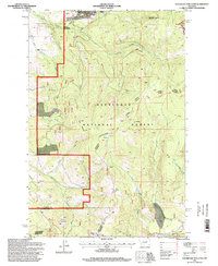
1990s Maps of Jefferson County, Montana
Explore 30 historic maps of Jefferson County from the 1990s. These maps offer a rare glimpse into what life looked like during the 1990s — showing old roads, neighborhoods, homes, and landmarks that have changed or disappeared over time.
Whether you're researching your family's past, planning a metal detecting trip, or studying how Jefferson County's landscape evolved across the 1990s, these high-resolution maps are a powerful tool for exploring the history of this region.
- Focus on a specific era: All maps on this page are from the 1990s, giving you a focused view of this time period.
- See what’s changed: Compare century-old streets, trails, and buildings to today's modern landscape using overlays and satellite layers.
- Research with precision: Use these maps for genealogy, historical research, land use analysis, or educational projects.
- View, download, or print: Maps are fully viewable online in high resolution, and can be downloaded or printed for your own records.
Start exploring Jefferson County's history through authentic maps from the 1990s. This is your window into the past.
Jefferson County, MT maps
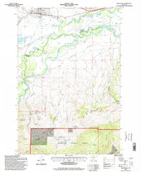
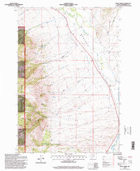
(30)- 1992 Map of Bozeman
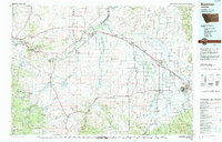 1992 Bozeman1992 Print · USGSThe Gallatin and Madison valleys are captured here in the early nineties, centered on the growth of the Montana State University area. Researchers can trace the legacy of mining in the Tobacco Root Mountains or locate landmarks like the Madison Buffalo Jump State Monument and Church Hill Church.
 - 1994 Map of Butte North
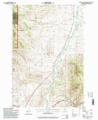
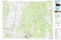 1994 Butte North1994 Print · USGSWestern Montana in the nineties was a landscape defined by ranching legacy and high-altitude mining. Genealogists and historians can trace institutional history at the Deer Lodge Prison Farm or locate old claims like the Saratoga Mine and Morning Glory Mine.
 - 1996 Map of Grace, 1998 Print
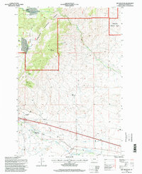
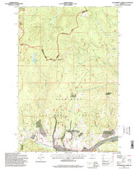
 1996 Grace1998 Print · USGSJefferson and Silver Bow Counties come together in the late nineties amidst the high peaks of the Deerlodge National Forest. Researchers can trace the small settlements at Grace and Cedric or locate several Quarry and Prospect sites near Little Pipestone Creek.
 - 1996 Map of Basin, 1998 Print
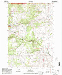
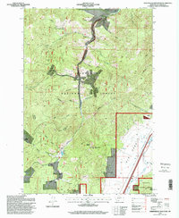
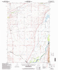
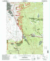
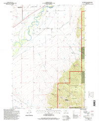
 1996 Basin1998 Print · USGSThe mining-district landscape of Jefferson County is documented here in the mid-1990s, centered on the settlement of Basin. Researchers can trace old claims and workings including the Bullion Mine, Crystal Mine, and Helper Mine along the mountain drainages.
 - 1996 Map of Sheepshead Mountain, 1998 Print
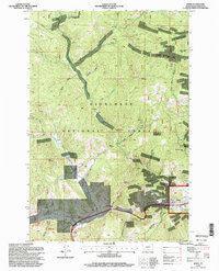
 1996 Sheepshead Mountain1998 Print · USGSJefferson County mining and ranching land is captured in the late 1990s, showcasing a terrain shaped by mineral extraction and high-altitude life. Researchers can trace the layout of the Ruby Mine, find the location of the Irvine Ranch, and see the extent of the Lowland Tailings.
 - 1996 Map of Boulder West, 1998 Print
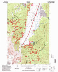
 1996 Boulder West1998 Print · USGSJefferson County mining and forest lands are captured here in the mid-1990s, centered on the rugged terrain west of Boulder. Local historians can trace early mineral claims at the May Day Mine or Springtime Mine and locate the Elder Creek Picnic Area.
 - 1996 Map of Black Butte, 1998 Print
 1996 Black Butte1998 Print · USGSJefferson County ranchlands meet the forest edge in the mid-1990s as the town of Whitehall expands into the valley. Genealogists and local historians can trace legacy properties like Forcella Ranch or locate the historic Old Whitehall Cemetery amid a landscape dotted with mines and prospects.
 - 1996 Map of Mount Thompson, 1998 Print
 1996 Mount Thompson1998 Print · USGSMining activity in the high country of Jefferson County is meticulously detailed during the mid-nineties. Trace the location of historic claims and operations like the Eva May Mine, the settlement of Comet, and landmarks such as Sugarloaf Mountain.
 - 1996 Map of Whitehall, 1998 Print
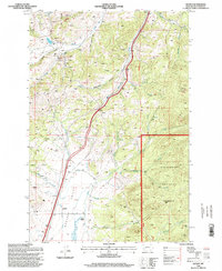
 1996 Whitehall1998 Print · USGSWhitehall and the Jefferson River valley are captured here in the mid-1990s, showcasing a landscape shaped by mining and irrigation. Genealogists and historians can locate family plots at Whitehall Cemetery or trace mining claims at the Mayflower Mine and Gold Hill.
 - 1996 Map of Doherty Mountain, 1998 Print
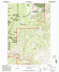
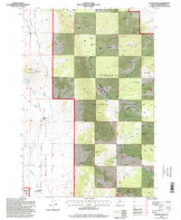
 1996 Doherty Mountain1998 Print · USGSJefferson County in the mid-1990s showcases a transition from the Deerlodge National Forest to the industrial valleys of the Boulder River. Researchers can trace the placement of a Tailings Pond, explore family landmarks like Negro Hollow, or locate old Prospects near Doherty Mountain.
 - 1996 Map of Dry Mountain, 1998 Print
 1996 Dry Mountain1998 Print · USGSJefferson County’s high country is captured here during the late nineties, documenting the intersections of mining and ranching. Genealogists and historians can locate family landmarks like Caldwell Ranch, the Easter Lily Mine, and the locally famous Pipestone Hot Springs.
 - 1996 Map of Vendome, 1998 Print
 1996 Vendome1998 Print · USGSThe Jefferson River valley in the mid-1990s reveals a landscape of ranching and complex irrigation. Genealogists and local historians can trace the irrigation networks of Parrot Ditch or locate the Fish Creek Cem and settlements like Piedmont and Vendome.
 - 1996 Map of Homestake, 1998 Print
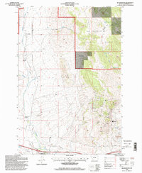
 1996 Homestake1998 Print · USGSThe high mountain passes above Butte come into focus in the mid-nineties as urban neighborhoods met the wilderness of the Deerlodge National Forest. Genealogists and local historians can locate the Holy Cross Cemetery, the remote Mc Allister Ranch, and the mountain settlement of Homestake.
 - 1996 Map of Whitetail Peak, 1998 Print
 1996 Whitetail Peak1998 Print · USGSJefferson County in the mid-1990s was a landscape of high-altitude water management and mineral prospecting. Researchers can locate the Stockmens Association Cabin and trace the drainage of the Upper Whitetail Reservoir through Whitetail Creek.
 - 1996 Map of Wickes, 1998 Print
 1996 Wickes1998 Print · USGSThe mining corridors of Jefferson County are captured here in the late twentieth century, showing a landscape shaped by deep-earth extraction and high-altitude ranching. Researchers can locate numerous historical Prospects, the old Stagecoach route, and family landmarks like Sloan Ranch.
 - 1996 Map of Wilson Park, 1998 Print
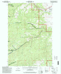
 1996 Wilson Park1998 Print · USGSJefferson County ranching and timberlands come into focus in the mid-1990s, where the high parks of the Deerlodge National Forest meet the valley floor. Genealogists and historians can trace family operations like Keogh Ranch and Simonsen Ranch alongside remote landmarks such as Murray Cabin.
 - 1996 Map of Dunn Creek, 1998 Print
 1996 Dunn Creek1998 Print · USGSJefferson County in the late nineties shows the vital intersection of the forest and the valley irrigation economy. Trace the essential water routes of the Murphy Ditch and Carey DITCH or locate landmarks like Wilson Park and the high-country Cemetery.
 - 1996 Map of Jefferson Island, 1998 Print
 1996 Jefferson Island1998 Print · USGSThe Jefferson River valley in the late nineties is captured here as it winds through the London Hills. Researchers can trace the legacy of mining at the Mayflower Mine or locate early settlement markers at Dogtown and the South Boulder Cemetery.
 - 1996 Map of Tacoma Park, 1998 Print
 1996 Tacoma Park1998 Print · USGSJefferson County saw a mix of mining interests and forest management in the mid-1990s as the high country transitioned into the Boulder Valley. Genealogists and historians can trace the legacy of mineral exploration through numerous prospect sites, tailings, and the winding course of Elkhorn Creek.
 - 1996 Map of Bison Canyon, 1998 Print
 1996 Bison Canyon1998 Print · USGSBison Canyon and the high ridges of the Deer Lodge National Forest are captured here in the late twentieth century. Researchers can trace historical land use through the Stock Driveway and locate old mining sites like the Eureka Mine and Ice Pond.
 - 1996 Map of Waterloo, 1998 Print
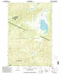
 1996 Waterloo1998 Print · USGSThe Waterloo area of Madison County appears here in the 1990s, where the river valley meets the forest edge. Researchers can trace irrigation networks like Parrot Ditch and mining sites such as Strawn Mine or Silver Bow Ranch.
 - 1996 Map of Elk Park Pass, 1998 Print
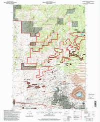
 1996 Elk Park Pass1998 Print · USGSThe Continental Divide and the high slopes of Rampart Mountain overlook the mining and forest lands of Jefferson County in the late nineties. Researchers can trace the industrial footprint of numerous Mine Dumps and Prospects near the Our Lady of the Rockies monument.
 - 1996 Map of Butte North, 1998 Print
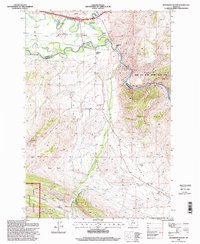
 1996 Butte North1998 Print · USGSThe mining landscape of Butte is shown in the late twentieth century as the massive Berkeley Pit and Strip Mine reshape the area. Genealogists and historians can locate heritage sites like Walkerville, Centerville, and the tragic Granite Mountain Mine.
 - 1996 Map of Thunderbolt Creek, 1998 Print
 1996 Thunderbolt Creek1998 Print · USGSThe Continental Divide in the mid-1990s remained a remote landscape of mining claims and forest boundaries. You can trace early mineral exploration at the Saratoga Mine and numerous Prospect sites near Iron Mountain and Thunderbolt Mountain.
 - 1996 Map of Sugarloaf Mountain, 1998 Print
 1996 Sugarloaf Mountain1998 Print · USGSHigh in the Montana backcountry during the 1990s, this area shows the rugged intersection of mining history and wilderness recreation. Researchers can trace old resource extraction sites like Schurchs Tunnel and Leadville alongside the Continental Divide National Scenic Trail.
Showing maps 1-25 of 30
Top cities of Jefferson County
- Montana City historical maps
- Clancy historical maps
- Boulder historical maps
- Whitehall historical maps
- Cardwell historical maps
Frequently asked questions
- What are the different types of historical maps available for Jefferson County?
- What is the oldest map of Jefferson County?
- Where can I purchase historical maps of Jefferson County for my home or office?
- Where can I download high-res historical maps of Jefferson County?
- Are there historical topographic maps available for Jefferson County?
- Is there historical aerial imagery available for Jefferson County?
- Where are historical maps of Jefferson County sourced from?