1990s Maps of Judith Basin County, Montana
Explore 33 historic maps of Judith Basin County from the 1990s. These maps offer a rare glimpse into what life looked like during the 1990s — showing old roads, neighborhoods, homes, and landmarks that have changed or disappeared over time.
Whether you're researching your family's past, planning a metal detecting trip, or studying how Judith Basin County's landscape evolved across the 1990s, these high-resolution maps are a powerful tool for exploring the history of this region.
- Focus on a specific era: All maps on this page are from the 1990s, giving you a focused view of this time period.
- See what’s changed: Compare century-old streets, trails, and buildings to today's modern landscape using overlays and satellite layers.
- Research with precision: Use these maps for genealogy, historical research, land use analysis, or educational projects.
- View, download, or print: Maps are fully viewable online in high resolution, and can be downloaded or printed for your own records.
Start exploring Judith Basin County's history through authentic maps from the 1990s. This is your window into the past.
Judith Basin County, MT maps
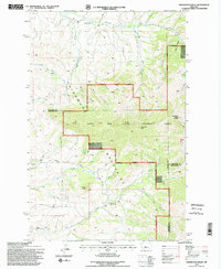
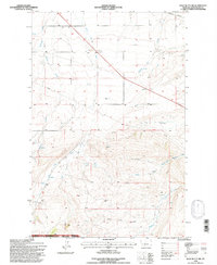
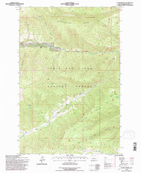
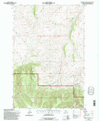
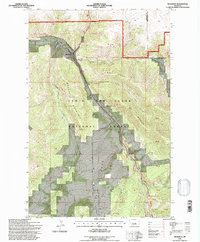
(33)- 1993 Map of Big Snowy Mountains
 1993 Big Snowy Mountains1993 Print · USGSCentral Montana ranching and mountain landscapes come into focus in the early 1990s as small settlements like Judith Gap and Straw dot the plains. Genealogists and historians can trace the Burlington Northern rail line and identify remote sites like Living Springs or the Elephant Rocks.
 - 1995 Map of Highwood Baldy
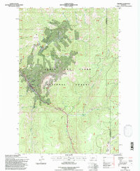
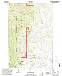
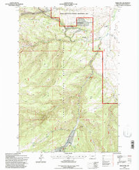
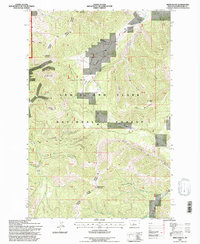
 1995 Highwood Baldy1995 Print · USGSThe Highwood Mountains in the mid-1990s offer a detailed view of the rugged terrain where Cascade, Chouteau, and Judith Basin counties meet. Researchers can trace the legacy of rural communities through sites like the Big Willow Cemetery, Mountain View Sch, and the Highwood Creek Community Hall.2 unique versions available
 - 1995 Map of Raynesford, 1997 Print
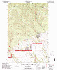
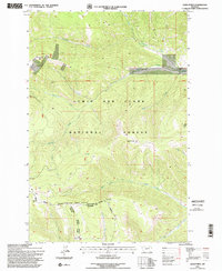
 1995 Raynesford1997 Print · USGSRaynesford sits at a critical junction of rail and river in the mid-1990s, nestled between the coulees and the Highwood peaks. Researchers can trace the Burlington Northern line through the valley or locate local landmarks like the Golladay site and Kibbey Canyon.
 - 1995 Map of Judith Gap, 1997 Print
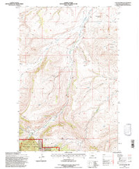
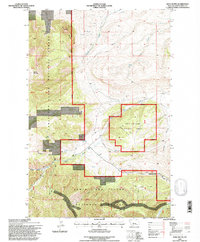
 1995 Judith Gap1997 Print · USGSThe mountain pass at Judith Gap remained a vital corridor for Montana ranching and transport in the mid-nineties. Researchers can trace the legacy of the high plains through the Old Railroad Grade, the local Cem, and natural landmarks like Oka Butte.
 - 1995 Map of Kings Hill, 1997 Print
 1995 Kings Hill1997 Print · USGSKings Hill Pass and the surrounding National Forest are captured here in the mid-nineties as a winter recreation destination. Researchers can trace the high-altitude trails around Porphyry Peak Lookout or locate the settlement of Forest Green near Sheep Creek.2 unique versions available
 - 1995 Map of Russian Flat, 1997 Print
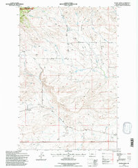
 1995 Russian Flat1997 Print · USGSThe Little Belt Mountains in the mid-nineties reveal a landscape of forestry management and legacy mining operations across Meagher and Judith Basin counties. Local researchers can trace the locations of the New Deal Mine, the Hunter Spring Guard Station, and the distinct Elephant Rock.2 unique versions available
 - 1995 Map of Wolf Butte NW, 1997 Print
 1995 Wolf Butte NW1997 Print · USGSJudith Basin County's high plains and the edge of the national forest are mapped here during the mid-nineties. Researchers can locate infrastructure and natural landmarks like the Burlington Northern line, Wolf Butte, and the Dipping Spring.
 - 1995 Map of Neihart, 1997 Print
 1995 Neihart1997 Print · USGSNeihart and the Little Belt Mountains are captured here in the mid-1990s, showcasing a landscape shaped by high-altitude mining. Genealogists and historians can locate numerous claims like the Silver Dyke Mine and Broadwater Mines near Neihart.
 - 1995 Map of Jellison Place, 1997 Print
 1995 Jellison Place1997 Print · USGSWheatland and Judith Basin counties are captured in the mid-1990s at the edge of the Little Belt Mountains. Genealogists and historians can trace high-country ranching life and water rights through landmarks like Jellison Place, Capser Ranch, and Jellison Reservoir.
 - 1995 Map of Limestone Butte, 1997 Print
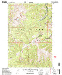
 1995 Limestone Butte1997 Print · USGSThe Lewis and Clark National Forest landscape appears here in the mid-1990s, revealing a maze of high-country canyons and coulees. Researchers can trace historic family-named locations such as Colarchik Cabin Coulee and notable landmarks like Whiskey Spring.
 - 1995 Map of Cayuse Basin, 1997 Print
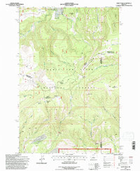
 1995 Cayuse Basin1997 Print · USGSMontana's Judith Basin was a landscape of deep canyons and timbered high country in the mid-nineties. Trace the rugged terrain of the Judith Ranger District through landmarks like Coal Mine Coulee, Steamboat Butte, and Running Wolf Creek.
 - 1995 Map of Ettien Spring, 1997 Print
 1995 Ettien Spring1997 Print · USGSThe Little Belt Mountains of Judith Basin County come into focus in the mid-nineties, showing the rugged headwaters of the Judith River system. Researchers can trace old mountain outposts like Korell Cabin and family-named landmarks including Ettien Spring and Burris Cabin.
 - 1995 Map of Woodhurst Mountain, 1997 Print
 1995 Woodhurst Mountain1997 Print · USGSIn the mid-nineties, the Little Belt Mountains met the high plains at the edge of the Lewis and Clark National Forest. Trace family roots in Sapphire Village, find old mines near Willow Creek, and locate the Wildlife Management Area Headquarters.
 - 1995 Map of Byrne Creek, 1997 Print
 1995 Byrne Creek1997 Print · USGSThe Highwood Mountains and Judith Basin plains come together in this mid-nineties survey of Montana ranching country. Researchers can trace the Burlington Northern rail line near Geyser or locate family-named sites like Knutson and Meyers.
 - 1995 Map of Bandbox Mountain, 1997 Print
 1995 Bandbox Mountain1997 Print · USGSThe Judith Basin region was undergoing revised forest management and mineral evaluation during the mid-1990s. Researchers can pinpoint the historical location of Old Yogo Town (Site) or trace mining operations at the strip mine and Tollgate Mtn.
 - 1995 Map of Browns Canyon, 1997 Print
 1995 Browns Canyon1997 Print · USGSJudith Basin County's forested high country is captured here during the mid-nineties, documenting the transition between public and private lands. Researchers can trace the steep drainages of Browns Canyon and Antelope Gorge or locate seasonal water sources like Alice Coulee.
 - 1995 Map of Daisy Peak, 1997 Print
 1995 Daisy Peak1997 Print · USGSThe high headwaters of the Judith River are captured in the mid-1990s as they flow through the Little Belt Mountains. Researchers can trace old forest management sites like the Daisy Guard Station (Site) and remote landmarks including Mount High and Johnson Park.
 - 1995 Map of Yogo Peak, 1997 Print
 1995 Yogo Peak1997 Print · USGSThe Little Belt Mountains of central Montana appear here in the mid-1990s as a landscape of high peaks and mineral history. Genealogists and researchers can trace local landmarks like Dry Wolf, Big Baldy Mountain, and the waters of Lake Elva or Yogo Creek.2 unique versions available
 - 1995 Map of Barker, 1997 Print
 1995 Barker1997 Print · USGSThe Little Belt Mountains during the mid-1990s reveal a landscape defined by mining history and forest management. Researchers can locate the mountain settlements of Hughesville and Barker, alongside the Barker Cem and various Mine sites.
 - 1995 Map of Hoover Spring, 1997 Print
 1995 Hoover Spring1997 Print · USGSMeagher County's high-country drainages are captured in the mid-1990s as the wilderness of the Lewis and Clark National Forest remains largely untouched. Trace the headwaters of the South Fork Judith River and identify local landmarks like Brock Ranch and Hoover Spring.2 unique versions available
 - 1995 Map of Indian Hill, 1997 Print
 1995 Indian Hill1997 Print · USGSJudith Basin County was defined by its forest management and ranching outposts during the mid-nineties. Researchers can locate remote sites like Korells Dude Ranch, the Judith Guard Station, and the historic Yogo Crossing along the Judith River.
 - 1995 Map of Monarch, 1997 Print
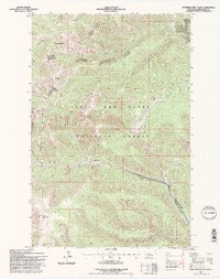
 1995 Monarch1997 Print · USGSMonarch and the surrounding Little Belt Mountains are shown during the mid-1990s as the area balanced its industrial past with forest recreation. Trace the path of the Old Railroad Grade along Belt Creek and locate local landmarks like Saint Thomas Camp or Keegan Peak.2 unique versions available
 - 1995 Map of Mixes Baldy, 1997 Print
 1995 Mixes Baldy1997 Print · USGSThe Little Belt Mountains of central Montana appear in high detail during the 1990s, showing a rugged landscape of national forest land and private claims. Researchers can trace the drainage of Dry Fork Belt Creek and locate landmarks like Mixes Baldy and Taylor Peak.
 - 1995 Map of Sand Point, 1997 Print
 1995 Sand Point1997 Print · USGSThe high Divide country of central Montana is captured here during the mid-1990s as it transitions between industrial use and forest management. Researchers can trace the drainage patterns of Harrison Creek, locate numerous old Mines, or identify the remote Middle Fork Ranch site.2 unique versions available
 - 1995 Map of Wolf Butte, 1997 Print
 1995 Wolf Butte1997 Print · USGSThe high country of Judith Basin County comes into sharp focus during the mid-nineties as forest management and topography intersect. Trace the drainages of Wolf Creek and Dry Wolf Creek, or locate old mining Prospects and the distinctively named Democrat Gulch.
Showing maps 1-25 of 33
Top cities of Judith Basin County
Frequently asked questions
- What are the different types of historical maps available for Judith Basin County?
- What is the oldest map of Judith Basin County?
- Where can I purchase historical maps of Judith Basin County for my home or office?
- Where can I download high-res historical maps of Judith Basin County?
- Are there historical topographic maps available for Judith Basin County?
- Is there historical aerial imagery available for Judith Basin County?
- Where are historical maps of Judith Basin County sourced from?