1900s (20th Century) Maps of Judith Basin County, Montana
Explore 102 historic maps of Judith Basin County from the 1900s (20th Century). These maps offer a rare glimpse into what life looked like during the 1900s — showing old roads, neighborhoods, homes, and landmarks that have changed or disappeared over time.
Whether you're researching your family's past, planning a metal detecting trip, or studying how Judith Basin County's landscape evolved across the 1900s, these high-resolution maps are a powerful tool for exploring the history of this region.
- Focus on a specific era: All maps on this page are from the 1900s, giving you a focused view of this time period.
- See what’s changed: Compare century-old streets, trails, and buildings to today's modern landscape using overlays and satellite layers.
- Research with precision: Use these maps for genealogy, historical research, land use analysis, or educational projects.
- View, download, or print: Maps are fully viewable online in high resolution, and can be downloaded or printed for your own records.
Start exploring Judith Basin County's history through authentic maps from the 1900s. This is your window into the past.
Judith Basin County, MT maps
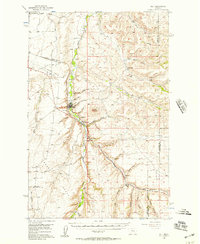
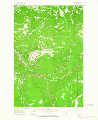
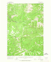
(102)- 1902 Map of Little Belt Mts.
 1902 Little Belt Mts.1902 Print · USGSMeagher County at the close of the nineteenth century is a landscape of mountain mining camps and riverside settlements. Researchers can trace early industry and family roots near the Sapphire Mine, the town of White Sulphur Springs, and the camp at Neihart.3 unique versions available
 - 1948 Map of White Sulphur Springs, 1951 Print
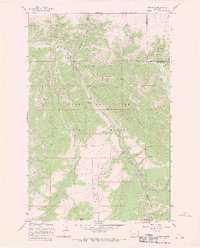
 1948 White Sulphur Springs1951 Print · USGSMontana's capital and the high country of the Big Belt Mountains come alive in this mid-century survey. Trace the early hydroelectric developments at Canyon Ferry Dam or follow the historic rail lines through Ringling and Townsend.
 - 1954 Map of Great Falls
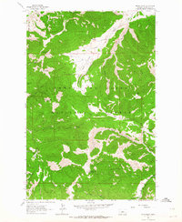
 1954 Great Falls1954 Print · USGSThe Missouri River valley in the mid-1950s is shown at a time of significant industrial and military growth. Genealogists and historians can locate early schools and rail stops like Tiger Butte Community Center, Fort Benton, and the Anaconda Wire Plant.4 unique versions available
 - 1954 Map of Roundup, 1966 Print
 1954 Roundup1966 Print · USGSCentral Montana in the mid-1960s showcases a landscape of high-plains agriculture and vital rail connections. Researchers can trace historic routes through Harlowton and Roundup while locating landmarks like Judith Cemetery and Deadmans Basin Reservoir.2 unique versions available
 - 1954 Map of Lewistown, 1967 Print
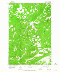
 1954 Lewistown1967 Print · USGSCentral Montana at the height of the mid-century rail era reveals a landscape shaped by the Judith River and high mountain ranges. Trace the old lines of the Great Northern through Lewistown and Denton, or locate sites like Giltedge and Landusky.3 unique versions available
 - 1956 Map of Belt, 1957 Print
 1956 Belt1957 Print · USGSCentral Montana in the mid-fifties reveals a landscape defined by the Great Northern railroad and rural school districts. Researchers can trace the legacy of mining and homesteading through sites like the Orr East Belt Mine, Pleasant View Cemetery, and Belt Butte.
 - 1957 Map of Great Falls
 1957 Great Falls1957 Print · USGSMontana's central plains and mountain foothills are captured here in the mid-fifties, showing the hub of Great Falls and the surrounding grain-shipping towns. Genealogists can trace family roots through the rail sidings of the Great Northern and small rural communities like Sand Coulee or Fort Benton.
 - 1958 Map of Roundup
 1958 Roundup1958 Print · USGSCentral Montana ranching and rail infrastructure are captured here in the late fifties as the Musselshell River valley thrived. Researchers can trace the Great Northern line through Harlowton or locate the Judith Cemetery and Gage Community.2 unique versions available
 - 1958 Map of White Sulphur Springs, 1968 Print
 1958 White Sulphur Springs1968 Print · USGSCentral Montana in the late fifties was a landscape of high-country mining and newly formed reservoirs. You can trace the rail-and-river economy of the era through sites like Canyon Ferry Lake, the East Pacific Mine, and the historic Fort Logan.3 unique versions available
 - 1959 Map of Lewistown
 1959 Lewistown1959 Print · USGSCentral Montana in the mid-1950s shows a landscape defined by the winding Missouri River and the rise of the South Moccasin Mtns. Researchers can trace the rail lines of the Great Northern through towns like Winifred and locate the Cat Creek Oil Field.3 unique versions available
 - 1961 Map of White Sulphur Springs
 1961 White Sulphur Springs1961 Print · USGSThe Missouri River valley and central Montana highlands are captured here during a period of significant hydroelectric and rail expansion. Genealogists and rail historians can trace the paths of the Northern Pacific and Chicago Milwaukee St Paul and Pacific through settlements like White Sulphur Springs and Townsend.
 - 1961 Map of Mixes Baldy, 1964 Print
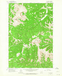
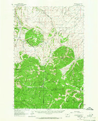
 1961 Mixes Baldy1964 Print · USGSThe Little Belt Mountains in the early sixties reveal a landscape of timbered peaks and hidden gulches within the Lewis and Clark National Forest. Researchers can trace old mountain routes like the Jeep Trail or locate remote sites like the Mine near Lone Tree Park.2 unique versions available
 - 1961 Map of The Arch, 1964 Print
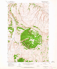
 1961 The Arch1964 Print · USGSJudith Basin County at the start of the sixties reveals a landscape of high timbered ridges and deep coulees within the Lewis and Clark National Forest. Researchers can locate early mining activity at the Nailer Mine or trace seasonal drainages like Chambers Coulee.2 unique versions available
 - 1961 Map of Kings Hill, 1964 Print
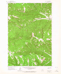
 1961 Kings Hill1964 Print · USGSThe high passes of Meagher and Cascade counties are captured here in the early 1960s, showing the intersection of three county lines. Trace mountain trails and recreation spots like Kings Hill Campground or landmarks such as Porphyry Peak and Kings Hill Pass.2 unique versions available
 - 1961 Map of Neihart, 1964 Print
 1961 Neihart1964 Print · USGSNeihart and the surrounding Little Belt Mountains are captured here in the early sixties, as the region's mining legacy remained etched into the landscape. Trace old workings at the Silver Dyke Mine or follow the waters of Belt Creek past Memorial Falls.2 unique versions available
 - 1961 Map of Yogo Peak, 1964 Print
 1961 Yogo Peak1964 Print · USGSThe Little Belt Mountains of central Montana are documented here in the early sixties, showing a wilderness defined by high peaks and mining claims. Trace historic routes along Pack Trails to Yogo Peak or the Neihart No 2 mine site.3 unique versions available
 - 1961 Map of Limestone Butte, 1964 Print
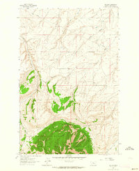
 1961 Limestone Butte1964 Print · USGSJudith Basin was a land of high plateaus and deep drainage coulees in the early sixties, as seen in this detailed topographical study. Researchers can trace land use patterns near Peterson Mountain and find family-named landmarks like Colarchik Cabin Coulee or Whiskey Spring.
 - 1961 Map of Barker, 1964 Print
 1961 Barker1964 Print · USGSDeep in the Little Belt Mountains during the early sixties, this map captures the mining legacy of Barker and Hughesville. Researchers can trace old prospecting routes like the Sawmill Trail and locate early Mines near Barker Mountain.
 - 1961 Map of Sand Point, 1964 Print
 1961 Sand Point1964 Print · USGSThe headwaters of the Judith and Musselshell rivers are captured here in the early sixties, showing a wilderness of ridges and trails. Researchers can trace remote mountain ranching at Middle Fork Ranch or locate early mineral extraction at Mines along Prospect Ridge.3 unique versions available
 - 1961 Map of Neihart, 1965 Print
 1961 Neihart1965 Print · USGSThe mining district around Neihart and the Lewis and Clark National Forest come alive in this early 1960s survey. Researchers can trace deep-mountain legacy sites like the Silver Dyke Mine, Kings Hill Pass, and the Yogo Lookout Tower.2 unique versions available
 - 1961 Map of Barker, 1966 Print
 1961 Barker1966 Print · USGSThe mining camps of Judith Basin are documented here in the early sixties, showing the remote peaks of the Little Belt Mountains. Genealogists and historians can trace the foundations of Barker and Hughesville, or find the Barker Cem and Chambers Mine.2 unique versions available
 - 1965 Map of White Sulphur Springs
 1965 White Sulphur Springs1965 Print · USGSCentral Montana in the late 1950s and early 60s reveals a rugged mountain landscape shaped by the Missouri River and the emergence of the Canyon Ferry Reservoir. Genealogists and local historians can trace legacy ranching sites, the Northern Pacific rail line, and remote schoolhouses like Cottonwood School and Spokane Creek School.
 - 1967 Map of Monarch NE, 1969 Print
 1967 Monarch NE1969 Print · USGSMontana's high country at the edge of the Little Belt Mountains is captured here in the late sixties. Trace the drainage systems of Sweet Never Coulee and Dutchman Coulee or find landmarks like Rattlesnake Butte and GLO Post 26.
 - 1967 Map of Monarch, 1970 Print
 1967 Monarch1970 Print · USGSIn the late 1960s, the mountain settlement of Monarch remained a key outpost in the Lewis and Clark National Forest. Researchers can trace the path of the Old Railroad Grade and locate historical sites like the Prospect or Saint Thomas Camp.2 unique versions available
 - 1970 Map of Buffalo, 1973 Print
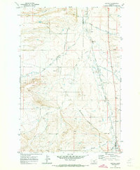 1970 Buffalo1973 Print · USGSJudith Basin and Fergus counties are captured at the start of the 1970s as a high-plains crossroads of rail and water. Researchers can trace the dual routes of the Burlington Northern and the Milwaukee Road through settlements like Buffalo and Garnell.
Showing maps 1-25 of 102
Top cities of Judith Basin County
Frequently asked questions
- What are the different types of historical maps available for Judith Basin County?
- What is the oldest map of Judith Basin County?
- Where can I purchase historical maps of Judith Basin County for my home or office?
- Where can I download high-res historical maps of Judith Basin County?
- Are there historical topographic maps available for Judith Basin County?
- Is there historical aerial imagery available for Judith Basin County?
- Where are historical maps of Judith Basin County sourced from?