2000s (21st Century) Maps of Old Weiss and French Place, Montana
Explore 6 historic maps of Old Weiss and French Place from the 2000s (21st Century). These maps offer a rare glimpse into what life looked like during the 2000s — showing old roads, neighborhoods, homes, and landmarks that have changed or disappeared over time.
Whether you're researching your family's past, planning a metal detecting trip, or studying how Old Weiss and French Place's landscape evolved across the 2000s, these high-resolution maps are a powerful tool for exploring the history of this region.
- Focus on a specific era: All maps on this page are from the 2000s, giving you a focused view of this time period.
- See what’s changed: Compare century-old streets, trails, and buildings to today's modern landscape using overlays and satellite layers.
- Research with precision: Use these maps for genealogy, historical research, land use analysis, or educational projects.
- View, download, or print: Maps are fully viewable online in high resolution, and can be downloaded or printed for your own records.
Start exploring Old Weiss and French Place's history through authentic maps from the 2000s. This is your window into the past.
Old Weiss and French Place, MT maps
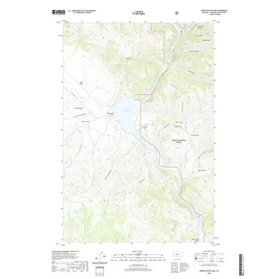
(6)- 2001 Map of Upper Holter Lake, 2004 Print
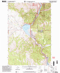 2001 Upper Holter Lake2004 Print · USGSIn the central Montana wilderness at the start of the twenty-first century, the Missouri River flows through a landscape rich with expedition history. Researchers can locate family landmarks like Hilger Ranch and trace the canyon terrain from Meriwether Canyon to the Hauser Dam.
 - 2011 Map of Upper Holter Lake, 2011 Print
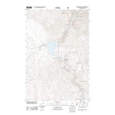 2011 Upper Holter Lake2011 Print · USGSCovers Old Weiss and French Place, including Lewis and Clark County, United States, and other nearby areas
 - 2014 Map of Upper Holter Lake, 2014 Print
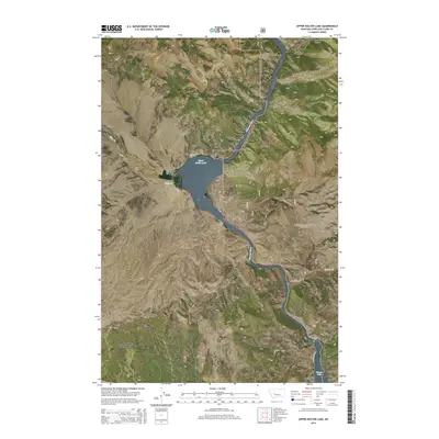 2014 Upper Holter Lake2014 Print · USGSCovers Old Weiss and French Place, including Lewis and Clark County, United States, and other nearby areas
 - 2017 Map of Upper Holter Lake, 2017 Print
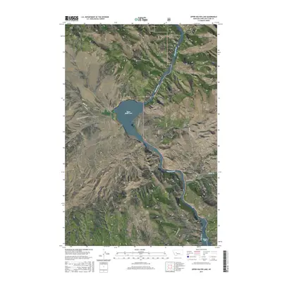 2017 Upper Holter Lake2017 Print · USGSCovers Old Weiss and French Place, including Lewis and Clark County, United States, and other nearby areas
 - 2020 Map of Upper Holter Lake, 2020 Print
 2020 Upper Holter Lake2020 Print · USGSCovers Old Weiss and French Place, including Lewis and Clark County, United States, and other nearby areas
 - 2024 Map of Upper Holter Lake, 2024 Print
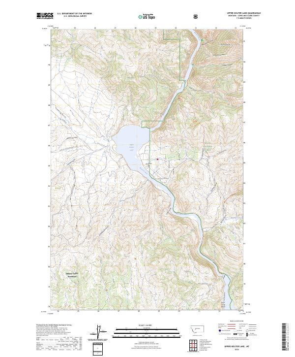 2024 Upper Holter Lake2024 Print · USGSThe Montana backcountry near the Gates of the Mountains comes alive in this current survey of the Missouri River corridor. Researchers can trace the winding canyons and remote access points like American Bar, Sacajawea Mtn, and the Missouri River Canyon Trl.
End of results
Showing maps 1-6 of 6
Top cities near Old Weiss and French Place
Frequently asked questions
- What are the different types of historical maps available for Old Weiss and French Place?
- What is the oldest map of Old Weiss and French Place?
- Where can I purchase historical maps of Old Weiss and French Place for my home or office?
- Where can I download high-res historical maps of Old Weiss and French Place?
- Are there historical topographic maps available for Old Weiss and French Place?
- Is there historical aerial imagery available for Old Weiss and French Place?
- Where are historical maps of Old Weiss and French Place sourced from?