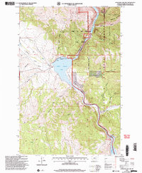
2001 Map of Upper Holter Lake
USGS Topo · Published 2004About this map
Upper Holter Lake and the Missouri River corridor dominate this landscape within the Helena National Forest. The geography is defined by the narrow passage of the Gates of the Mountains, where the river carves through limestone cliffs. Local settlement history is represented by the Hilger Ranch and Hilger Well within the broad Hilger Valley, while the southern reaches of the map show the industrial infrastructure of the Hauser Dam and its associated Powerplant. Numerous named gulches and canyons, such as Meriwether Canyon and Sacajawea Mountain, reflect the historical Lewis and Clark expedition's journey through this terrain. The map also detail boat access points like the Gates of the Mountains Boat Club and several designated picnic areas along the water's edge.
Find a feature on this map
35 named features on this map. Tap any name to fly to it.
Don’t see what you’re looking for? This feature index may not catch every label — zoom into the map to look around manually.
Map Details
Editions of this 2001 Upper Holter Lake Map
This is the sole edition of this map. No revisions or reprints were ever made.
Other maps of this area

1886 · Fort Logan
USGS Topo · 1:250,000

1889 · Helena
USGS Topo · 1:250,000

1893 · Helena
USGS Topo · 1:250,000

1899 · Helena
USGS Topo · 1:62,500

1899 · Helena
USGS Topo · 1:250,000

1903 · Helena
USGS Topo · 1:250,000

1947 · Butte
USGS Topo · 1:250,000

1948 · White Sulphur Springs
USGS Topo · 1:250,000

1950 · East Helena
USGS Topo · 1:62,500

1950 · Helena
USGS Topo · 1:62,500