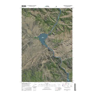
2017 Map of Upper Holter Lake
USGS Topo · Published 2017About this map
Upper Holter Lake and the winding Missouri River dominate this section of Lewis and Clark County, where the water cuts through dramatic vertical relief. The landscape is defined by a dense network of gulches and canyons, including Meriwether Canyon and Picnic Canyon in the north, which descend from the high ground of Sacajawea Mtn. Settlement is sparse and concentrated along the water and valley floors, with American Bar situated on a prominent bend of the river and Black Sandy Beach located near the southern boundary along Hauser Lake.
Find a feature on this map
34 named features on this map. Tap any name to fly to it.
Don’t see what you’re looking for? This feature index may not catch every label — zoom into the map to look around manually.
Map Details
Editions of this 2017 Upper Holter Lake Map
This is the sole edition of this map. No revisions or reprints were ever made.
Other maps of this area

1886 · Fort Logan
USGS Topo · 1:250,000

1889 · Helena
USGS Topo · 1:250,000

1893 · Helena
USGS Topo · 1:250,000

1899 · Helena
USGS Topo · 1:62,500

1899 · Helena
USGS Topo · 1:250,000

1903 · Helena
USGS Topo · 1:250,000

1947 · Butte
USGS Topo · 1:250,000

1948 · White Sulphur Springs
USGS Topo · 1:250,000

1950 · East Helena
USGS Topo · 1:62,500

1950 · Helena
USGS Topo · 1:62,500