Old Maps of Stark, Montana for Metal Detecting
Plan your next treasure hunt with 10 historic maps of Stark. Find old homesites, ghost towns, trails, and gathering spots that may be lost to time — perfect for identifying promising metal detecting locations.
- Locate forgotten sites: Uncover places like long-lost settlements, abandoned rail lines, or gathering spots.
- Plan better hunts: Use map overlays combined with LiDAR or satellite views to narrow in on historically rich areas.
- Made for detectorists: Thousands of hobbyists use these maps to discover relics, coins, and hidden history.
Use these historic maps to boost your research and find new opportunities beneath the surface of Stark.
Stark, MT maps
(10)- 1956 Map of Wallace, 1966 Print
 1956 Wallace1966 Print · USGSWestern Montana and the Idaho panhandle meet in this mid-century survey of the Bitterroot and Cabinet Mountains. Genealogists and historians can trace the rail-and-river economy through the Northern Pacific line and settlements like Thompson Falls or St. Ignatius.3 unique versions available
 - 1959 Map of Tarkio, 1961 Print
 1959 Tarkio1961 Print · USGSMineral County's river-and-rail corridor is captured here in the late fifties, during the peak era of the transcontinental railroads. Researchers can trace the heritage of small trackside communities like Tarkio and Rivulet or locate specific historical sites such as the local cemetery and mines.3 unique versions available
 - 1960 Map of Wallace
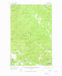
 1960 Wallace1960 Print · USGSNorthwestern Montana and the Idaho panhandle are captured in the late fifties, showing the vast Flathead Indian Reservation and the mining districts of the Bitterroot Range. Researchers can trace the rail lines of the Northern Pacific or locate early sites like the Morning Mine and the National Bison Range.
 - 1984 Map of Stark North
 1984 Stark North1984 Print · USGSThe northern reaches of Missoula County in the early eighties show a landscape where the Lolo National Forest meets the Flathead Indian Reservation. Researchers can trace the settlement at Stark and follow high-country routes like the Pack Trail near Lost Lake.
 - 1999 Map of Stark North, 2003 Print
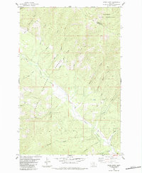
 1999 Stark North2003 Print · USGSWestern Montana forests and the Flathead Indian Reservation border appear here at the close of the twentieth century. Researchers can trace the drainage of Ninemile Creek through the Lolo National Forest, locating specific sites like Stark and Lost Lake.
 - 2011 Map of Stark North, 2011 Print
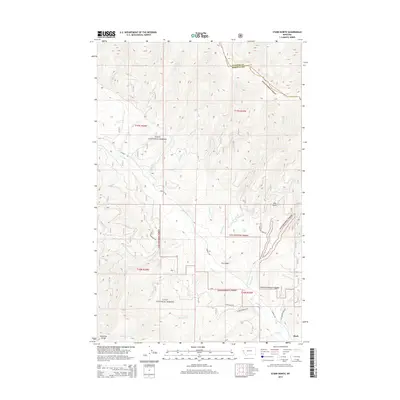
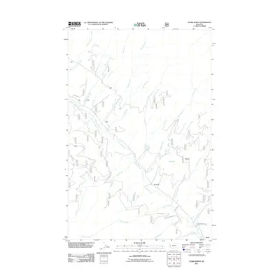 2011 Stark North2011 Print · USGSCovers Stark, including Missoula County, Sanders County, and other nearby areas
 - 2014 Map of Stark North, 2014 Print
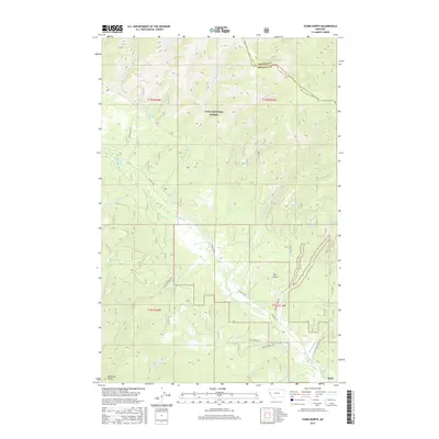
 2014 Stark North2014 Print · USGSCovers Stark, including Missoula County, Sanders County, and other nearby areas
 - 2017 Map of Stark North, 2017 Print
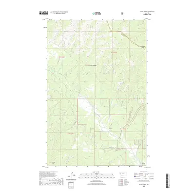
 2017 Stark North2017 Print · USGSCovers Stark, including Missoula County, Sanders County, and other nearby areas
 - 2020 Map of Stark North, 2020 Print
 2020 Stark North2020 Print · USGSCovers Stark, including Missoula County, Sanders County, and other nearby areas
 - 2024 Map of Stark North, 2024 Print
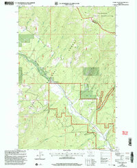
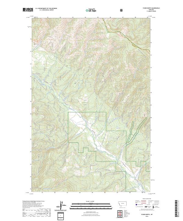 2024 Stark North2024 Print · USGSThe Lolo National Forest interior comes into focus in this contemporary survey of the Missoula and Sanders county line. Tracing the steep terrain of the Reservation Divide, you can follow the winding path of Ninemile Creek and locate landmarks like Lost Lake.
End of results
Showing maps 1-10 of 10
Top cities near Stark
Frequently asked questions
- What are the different types of historical maps available for Stark?
- What is the oldest map of Stark?
- Where can I purchase historical maps of Stark for my home or office?
- Where can I download high-res historical maps of Stark?
- Are there historical topographic maps available for Stark?
- Is there historical aerial imagery available for Stark?
- Where are historical maps of Stark sourced from?