Old Maps of Petroleum County, Montana
Explore 294 old maps of Petroleum County, spanning from 1954 to today. These high-resolution historic maps reveal how streets, neighborhoods, landmarks, and natural features evolved over time — perfect for genealogy, metal detecting, research, and local history exploration.
What you can do with these maps:
- See how Petroleum County changed over time: Compare historical maps to modern-day views to trace roads, homesites, rail lines & more.
- View detailed metadata: Each map includes creators, publishers, year, scale, and archive source.
- Overlay maps with satellite & LiDAR: Visualize the past alongside modern tools to explore terrain & human change.
- Trusted historical sources: Maps sourced from the USGS, Library of Congress, and other archives.
- Access maps your way: View online, download high-res files, or order prints for personal or research use.
Start exploring old maps of Petroleum County to uncover forgotten places, hidden landmarks, and the deep history beneath your feet.
Petroleum County, MT maps
(294)- 1954 Map of Jordan, 1965 Print
 1954 Jordan1965 Print · USGSGarfield County in the mid-fifties is a land of expansive ranches and isolated prairie schoolhouses. Researchers can trace rural genealogy and land use through landmarks like Regina School, Robertson Brothers Ranch, and the Charles M Russell National Wildlife Range.2 unique versions available
 - 1954 Map of Forsyth, 1966 Print
 1954 Forsyth1966 Print · USGSThe Yellowstone River valley and the northern high plains are captured here in the mid-1950s during a period of expanding energy and rail infrastructure. Genealogists and historians can trace rail sidings and cattle-country outposts like Ingomar, Vananda, and Angela.3 unique versions available
 - 1954 Map of Roundup, 1966 Print
 1954 Roundup1966 Print · USGSCentral Montana in the mid-1960s showcases a landscape of high-plains agriculture and vital rail connections. Researchers can trace historic routes through Harlowton and Roundup while locating landmarks like Judith Cemetery and Deadmans Basin Reservoir.2 unique versions available
 - 1954 Map of Lewistown, 1967 Print
 1954 Lewistown1967 Print · USGSCentral Montana at the height of the mid-century rail era reveals a landscape shaped by the Judith River and high mountain ranges. Trace the old lines of the Great Northern through Lewistown and Denton, or locate sites like Giltedge and Landusky.3 unique versions available
 - 1956 Map of Jordan
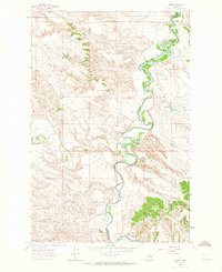
 1956 Jordan1956 Print · USGSCentral Montana ranching country and the massive Missouri River impoundment are captured here in the mid-fifties. Researchers can trace remote homesteading landmarks like Robertson Brothers Ranch and small rural hubs including Jordan, Brusett, and Cohagen.
 - 1957 Map of Forsyth
 1957 Forsyth1957 Print · USGSSouth-central Montana in the late fifties is captured here through its dual-river geography and emergent energy economy. Researchers can trace the path of the Northern Pacific through Forsyth, locate the Ragged Point Oil Field, and find early sidings like Ahles Siding.
 - 1958 Map of Jordan
 1958 Jordan1958 Print · USGSGarfield County and the Missouri River country are shown here in the late fifties as the regional geography adjusted to the massive new reservoir. Genealogists and local historians can trace isolated homesteads and numerous rural schoolhouses like Iler School, Brusett, and the Robertson Brothers Ranch.
 - 1958 Map of Roundup
 1958 Roundup1958 Print · USGSCentral Montana ranching and rail infrastructure are captured here in the late fifties as the Musselshell River valley thrived. Researchers can trace the Great Northern line through Harlowton or locate the Judith Cemetery and Gage Community.2 unique versions available
 - 1958 Map of Forsyth
 1958 Forsyth1958 Print · USGSMid-century Montana comes alive along the Yellowstone River and the competing transcontinental rail lines. Local historians can trace the legacy of the Northern Pacific through Forsyth or explore early oil developments at the Ragged Point Oil Field.
 - 1959 Map of Lewistown
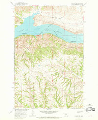
 1959 Lewistown1959 Print · USGSCentral Montana in the mid-1950s shows a landscape defined by the winding Missouri River and the rise of the South Moccasin Mtns. Researchers can trace the rail lines of the Great Northern through towns like Winifred and locate the Cat Creek Oil Field.3 unique versions available
 - 1962 Map of Mosby, 1965 Print
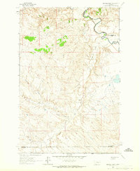
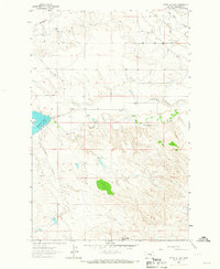
 1962 Mosby1965 Print · USGSThe Musselshell River breaks and surrounding plains of Petroleum and Garfield counties are captured here in the early 1960s. Genealogists and historians can trace the remote settlement of Mosby and water features like Shaie Reservoir or Flatwillow Creek.2 unique versions available
 - 1962 Map of Maxwell Ranch, 1965 Print
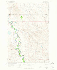
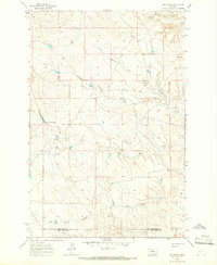
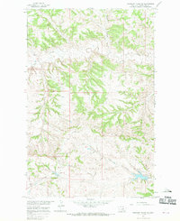
 1962 Maxwell Ranch1965 Print · USGSThe high plains of Petroleum County are documented in the early sixties as cattle ranching and resource exploration defined the land. Researchers can trace the layout of the Maxwell Ranch, find early industrial marks like a Drill Hole, and follow the Musselshell River.2 unique versions available
 - 1962 Map of Mosby SE, 1965 Print
 1962 Mosby SE1965 Print · USGSThe Musselshell River country of central Montana is captured here in the early sixties, showing the river's dramatic meanders along the Rosebud County border. Genealogists and historians can trace the intricate drainages of Nineteen Coulee and Rattlesnake Creek near a prominent cross-country Pipeline.2 unique versions available
 - 1963 Map of Kelley, 1966 Print
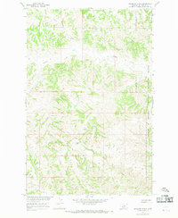
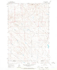 1963 Kelley1966 Print · USGSCentral Montana ranching and oil country are captured here in the early 1960s along the Petroleum and Musselshell county line. Researchers can locate the Kelley (Site), trace the drainages of Mud Creek, and find early industrial markers like Oil Wells near Rattlesnake Butte.
 - 1963 Map of Petrolia Lake, 1966 Print
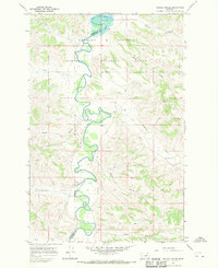
 1963 Petrolia Lake1966 Print · USGSCentral Montana ranching lands are captured in the early sixties, showing the vital water infrastructure surrounding Petrolia Lake. Genealogists and historians can trace old property lines and rural landmarks like the Box Elder Sch and Rattlesnake Butte.
 - 1963 Map of Breed Spring, 1966 Print
 1963 Breed Spring1966 Print · USGSPetroleum County's ranching landscape is captured here in the early sixties, showing the vital water networks of central Montana. Researchers can trace the winding path of Flatwillow Creek and locate family-named landmarks like Anderson Coulee and Breed Spring.
 - 1963 Map of Mud Spring, 1966 Print
 1963 Mud Spring1966 Print · USGSPetroleum and Musselshell counties are captured here in the early sixties, showing a landscape shaped by intermittent waterways and cattle ranching. Researchers can trace the drainage of Maginnis Creek and locate historic water sources like Mud Spring and Circle Bar Spring.
 - 1964 Map of Jordan
 1964 Jordan1964 Print · USGSGarfield County and the surrounding Montana prairie are captured in the mid-1950s as the Fort Peck Reservoir reshapes the northern landscape. Local historians can trace the locations of rural schoolhouses like South First Creek School and remote ranching outposts such as Brusett and Van Norman.
 - 1965 Map of Dry Coulee, 1968 Print
 1965 Dry Coulee1968 Print · USGSThe Missouri River breaks of central Montana are captured here in the mid-sixties, centered on the Fort Peck Reservoir. Researchers can trace old family holdings like the Novak Homestead and McArthur Ranch tucked among the drainages of Dry Coulee.2 unique versions available
 - 1965 Map of Germaine Coulee West, 1969 Print
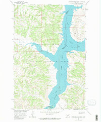 1965 Germaine Coulee West1969 Print · USGSThe Missouri and Musselshell rivers meet in the mid-1960s as the rising waters of the Fort Peck Reservoir reshape the Montana plains. Researchers can trace the flooded valleys of Germaine Coulee and Crooked Creek within the Charles M Russell National Wildlife Range.3 unique versions available
 - 1965 Map of Chain Buttes, 1969 Print
 1965 Chain Buttes1969 Print · USGSCentral Montana's riverbreaks and high country are captured here in the mid-1960s, showing the intersection of the Fort Peck Reservoir and the Charles M. Russell National Wildlife Range. Researchers can trace old family locales like Beauchamp, Hawley, and Weingart among the ridges of the Chain Buttes.2 unique versions available
 - 1965 Map of Locke Ranch, 1969 Print
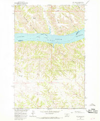
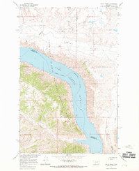 1965 Locke Ranch1969 Print · USGSPhillips and Petroleum counties meet at the Missouri River in the mid-1960s, showing the early years of the massive reservoir. Trace family ranching roots at Locke Ranch or locate isolated landmarks like Legg Well and the remote Landing Strips.2 unique versions available
 - 1965 Map of Weingart Place, 1969 Print
 1965 Weingart Place1969 Print · USGSPetroleum County in the mid-1960s is captured here through a landscape of remote ranch lands and federal wildlife territory. Genealogists and local historians can trace the geography around Weingart Place and the winding course of Crooked Creek or Alkali Creek.
 - 1965 Map of Weingart Place NW, 1969 Print
 1965 Weingart Place NW1969 Print · USGSThe central Montana landscape of Petroleum County is captured here in the mid-1960s, showing the complex drainage systems of the Missouri River Basin. Researchers can trace the meandering paths of Crooked Creek and Drag Creek or locate the site of a rural Spillway.
 - 1967 Map of Nelson Coulee, 1970 Print
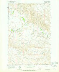
 1967 Nelson Coulee1970 Print · USGSGarfield and Petroleum counties are captured here in the late sixties as the winding Musselshell River meets the Fort Peck Reservoir. Researchers can trace old ranching landmarks like the Matovich Ranch, find the Coop Cem, and locate isolated water sources including Davis Well.
Showing maps 1-25 of 294
Top cities of Petroleum County
Frequently asked questions
- What are the different types of historical maps available for Petroleum County?
- What is the oldest map of Petroleum County?
- Where can I purchase historical maps of Petroleum County for my home or office?
- Where can I download high-res historical maps of Petroleum County?
- Are there historical topographic maps available for Petroleum County?
- Is there historical aerial imagery available for Petroleum County?
- Where are historical maps of Petroleum County sourced from?