1960s Maps of Phillips County, Montana
Explore 47 historic maps of Phillips County from the 1960s. These maps offer a rare glimpse into what life looked like during the 1960s — showing old roads, neighborhoods, homes, and landmarks that have changed or disappeared over time.
Whether you're researching your family's past, planning a metal detecting trip, or studying how Phillips County's landscape evolved across the 1960s, these high-resolution maps are a powerful tool for exploring the history of this region.
- Focus on a specific era: All maps on this page are from the 1960s, giving you a focused view of this time period.
- See what’s changed: Compare century-old streets, trails, and buildings to today's modern landscape using overlays and satellite layers.
- Research with precision: Use these maps for genealogy, historical research, land use analysis, or educational projects.
- View, download, or print: Maps are fully viewable online in high resolution, and can be downloaded or printed for your own records.
Start exploring Phillips County's history through authentic maps from the 1960s. This is your window into the past.
Phillips County, MT maps
(47)- 1964 Map of Jordan
 1964 Jordan1964 Print · USGSGarfield County and the surrounding Montana prairie are captured in the mid-1950s as the Fort Peck Reservoir reshapes the northern landscape. Local historians can trace the locations of rural schoolhouses like South First Creek School and remote ranching outposts such as Brusett and Van Norman.
 - 1964 Map of Coburg, 1967 Print
 1964 Coburg1967 Print · USGSThe rural plains of northern Montana are captured here in the 1960s, centered on the railroad siding of Coburg. Genealogists and historians can trace the Great Northern rail line and locate the Horn Cem near the banks of the Milk River.
 - 1964 Map of Dodson NE, 1967 Print
 1964 Dodson NE1967 Print · USGSThe northern plains of Phillips County are captured in the mid-1960s as the Missouri River Basin project shaped the landscape. Researchers can trace the path of the North Dodson Canal and locate landmarks like Three Buttes and Exeter Creek.
 - 1964 Map of Coburg SE, 1967 Print
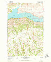
 1964 Coburg SE1967 Print · USGSPhillips County ranch land and reservation territory are captured here in the mid-1960s. Researchers can trace land use and water features along Peoples Creek, the Fort Belknap Indian Reservation Boundary, and East Belknap.
 - 1964 Map of Weigand Reservoir, 1967 Print
 1964 Weigand Reservoir1967 Print · USGSThe northern Montana prairie comes into focus during the 1960s, showing the intersection of the Fort Belknap Indian Reservation and the county line. Trace the local hydrology through landmarks like Weigand Reservoir, Old Woman Lake, and a rural Mine.
 - 1964 Map of Dodson, 1967 Print
 1964 Dodson1967 Print · USGSThe town of Dodson and the Phillips County ranchlands are captured here in the mid-1960s as a vital rail and river corridor. Genealogists and historians can trace the Great Northern railroad, the Milk River irrigation canals, and landmarks like the Hillside Cem.
 - 1964 Map of Cow Creek, 1967 Print
 1964 Cow Creek1967 Print · USGSPhillips County ranchlands and river bottom are documented in the mid-1960s as the Missouri River Basin development era shaped the landscape. Researchers can trace irrigation infrastructure like the Dodson South Canal and landmarks like Rocky Point.
 - 1964 Map of Dodson Dam, 1968 Print
 1964 Dodson Dam1968 Print · USGSPhillips County in the mid-1960s was a hub for Milk River irrigation and Great Northern rail traffic. Researchers can trace the Fort Belknap Indian Reservation Boundary, locate the Cem at Graveyard Hill, and follow the Dodson North Canal.
 - 1965 Map of Karsten Coulee, 1968 Print
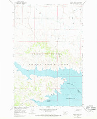
 1965 Karsten Coulee1968 Print · USGSPhillips County conservation efforts and high plains drainage patterns are captured here in the mid-sixties. Researchers can trace the rugged breaks of the Charles M Russell National Wildlife Range and the expanse of Cruikshank Flat.
 - 1965 Map of Germaine Coulee East, 1968 Print
 1965 Germaine Coulee East1968 Print · USGSGarfield and Phillips counties were defined by the vast reach of the Missouri River breaks during the mid-sixties. Researchers can trace the rugged drainage of Germaine Coulee and Sandburn Coulee as they meet the Fort Peck Reservoir.
 - 1965 Map of Dry Coulee, 1968 Print
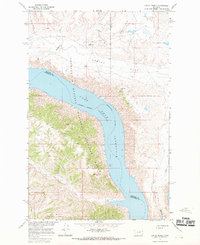
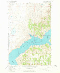
 1965 Dry Coulee1968 Print · USGSThe Missouri River breaks of central Montana are captured here in the mid-sixties, centered on the Fort Peck Reservoir. Researchers can trace old family holdings like the Novak Homestead and McArthur Ranch tucked among the drainages of Dry Coulee.2 unique versions available
 - 1965 Map of Germaine Coulee West, 1969 Print
 1965 Germaine Coulee West1969 Print · USGSThe Missouri and Musselshell rivers meet in the mid-1960s as the rising waters of the Fort Peck Reservoir reshape the Montana plains. Researchers can trace the flooded valleys of Germaine Coulee and Crooked Creek within the Charles M Russell National Wildlife Range.3 unique versions available
 - 1965 Map of Wagner, 1969 Print
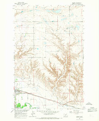
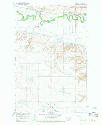 1965 Wagner1969 Print · USGSMid-century Phillips County centers on the Milk River valley, where irrigation and rail infrastructure supported the settlement of Wagner. Genealogists and researchers can trace the South Wagner Sch and the path of the historic Lewis and Clark Trail.
 - 1965 Map of Chain Buttes, 1969 Print
 1965 Chain Buttes1969 Print · USGSCentral Montana's riverbreaks and high country are captured here in the mid-1960s, showing the intersection of the Fort Peck Reservoir and the Charles M. Russell National Wildlife Range. Researchers can trace old family locales like Beauchamp, Hawley, and Weingart among the ridges of the Chain Buttes.2 unique versions available
 - 1965 Map of Coal Mine Hill, 1969 Print
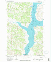
 1965 Coal Mine Hill1969 Print · USGSThe Larb Hills of Phillips County are captured here in the mid-1960s, showing a remote ranching landscape shaped by the Missouri River Basin. Researchers can locate family landmarks like the Spencer Ranch or trace the drainages of North Shotgun Coulee and Telegraph Creek.2 unique versions available
 - 1965 Map of Lost Creek, 1969 Print
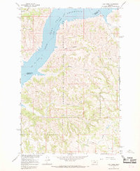 1965 Lost Creek1969 Print · USGSGarfield County's river breaks and the vast Missouri River reservoir are captured here during the mid-1960s. Researchers can trace the rugged topography of the Charles M. Russell National Wildlife Range and find remote landmarks like Brandon Butte and Devils Creek.2 unique versions available
 - 1965 Map of West Alkali Reservoir, 1969 Print
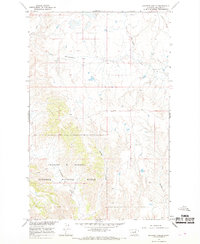
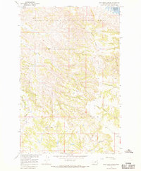
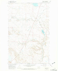
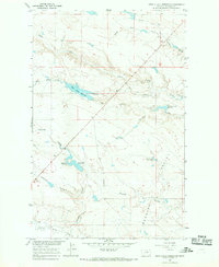 1965 West Alkali Reservoir1969 Print · USGSPhillips County's rangelands are captured here in the mid-1960s during a period of Missouri River Basin development. Researchers can trace the vital network of local water management through features like West Alkali Reservoir, Reservoir No 161, and Partnership Reservoir.
 - 1965 Map of Veseth Reservoir, 1969 Print
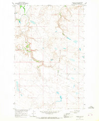
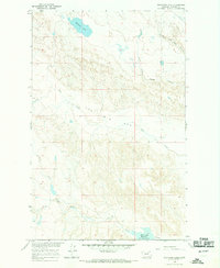
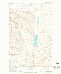 1965 Veseth Reservoir1969 Print · USGSPhillips County ranching and water management are the focus of this mid-century survey of the northern plains. Genealogists and historians can locate family landmarks such as the Veseth Ranch, the Midale Sch, and the winding course of Beaver Creek.
 - 1965 Map of Sun Prairie, 1969 Print
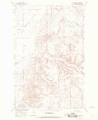 1965 Sun Prairie1969 Print · USGSPhillips County in the mid-sixties reveals a sparsely settled ranching landscape defined by the expansive Sun Prairie Flats. Genealogists and local researchers can locate the original Sun Prairie settlement site, the Sun Prairie Sch, and the winding paths of Telegraph Creek.3 unique versions available
 - 1965 Map of Herman Point, 1969 Print
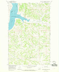
 1965 Herman Point1969 Print · USGSThe northern reaches of the Missouri River Basin are captured in the mid-1960s, showing the intersection of Phillips and Garfield counties. Researchers can trace the sprawling shoreline of Fort Peck Reservoir and remote landmarks like Herman Point or Reynolds Hill.
 - 1965 Map of Locke Ranch, 1969 Print
 1965 Locke Ranch1969 Print · USGSPhillips and Petroleum counties meet at the Missouri River in the mid-1960s, showing the early years of the massive reservoir. Trace family ranching roots at Locke Ranch or locate isolated landmarks like Legg Well and the remote Landing Strips.2 unique versions available
 - 1965 Map of Pine Grove School, 1969 Print
 1965 Pine Grove School1969 Print · USGSGarfield County ranchlands and the Missouri River breaks are captured here in the mid-1960s. Researchers can locate remote outposts like Dogtown, the rural Pine Grove Sch, and family sites near South Sawmill Creek and Leedy.2 unique versions available
 - 1965 Map of Whitcomb Lake, 1969 Print
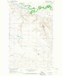
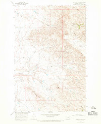
 1965 Whitcomb Lake1969 Print · USGSThe Montana high plains of Phillips County are captured here in the mid-1960s, showing a landscape defined by ranching and water management. Researchers can trace land use at the Cotter Ranch and explore the distinct topography of The Big Sag and Whitcomb Lake.
 - 1965 Map of Mickey Butte, 1969 Print
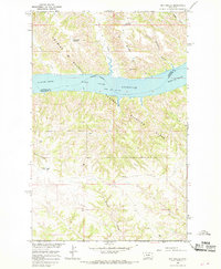
 1965 Mickey Butte1969 Print · USGSIn the mid-1960s, the Missouri River breaks of Montana were defined by the expansion of the Fort Peck Reservoir. Researchers can trace the rugged shoreline and upland landmarks like Mickey Butte, Mickus Bottom, and the Charles M. Russell National Wildlife Range.2 unique versions available
 - 1965 Map of Phillips, 1969 Print
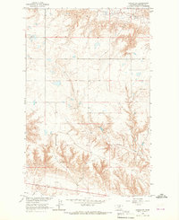
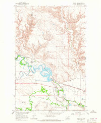
 1965 Phillips1969 Print · USGSPhillips County ranching life is documented here during the mid-sixties as the Missouri River Basin development programs were underway. Researchers can locate family landmarks like the KRM Ranch, the settlement at Phillips, and the rural locality of Veseth.
Showing maps 1-25 of 47
Top cities of Phillips County
Frequently asked questions
- What are the different types of historical maps available for Phillips County?
- What is the oldest map of Phillips County?
- Where can I purchase historical maps of Phillips County for my home or office?
- Where can I download high-res historical maps of Phillips County?
- Are there historical topographic maps available for Phillips County?
- Is there historical aerial imagery available for Phillips County?
- Where are historical maps of Phillips County sourced from?