Old Maps of Phillips County, Montana for Metal Detecting
Plan your next treasure hunt with 817 historic maps of Phillips County. Find old homesites, ghost towns, trails, and gathering spots that may be lost to time — perfect for identifying promising metal detecting locations.
- Locate forgotten sites: Uncover places like long-lost settlements, abandoned rail lines, or gathering spots.
- Plan better hunts: Use map overlays combined with LiDAR or satellite views to narrow in on historically rich areas.
- Made for detectorists: Thousands of hobbyists use these maps to discover relics, coins, and hidden history.
Use these historic maps to boost your research and find new opportunities beneath the surface of Phillips County.
Phillips County, MT maps
(817)- 1905 Map of Bowdoin
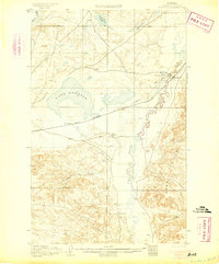 1905 Bowdoin1905 Print · USGSValley County at the start of the century shows a landscape being transformed by the railroad and irrigation. Genealogists and historians can locate early settlements like Ashfield and Bradys Ranch along the Great Northern line.2 unique versions available
 - 1905 Map of Saco Special
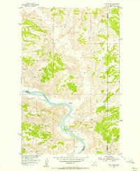
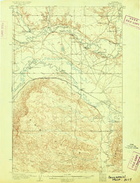 1905 Saco Special1905 Print · USGSNorthern Montana at the start of the twentieth century shows a ranching landscape centered on the Great Northern R. R. and the winding Milk River. Genealogists can trace early homesteads like Taylor's Ranch and Whitfords Ranch or locate the rural River School.2 unique versions available
 - 1906 Map of Hinsdale Special Map
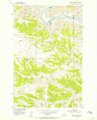
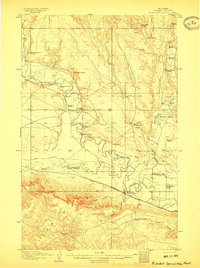 1906 Hinsdale Special Map1906 Print · USGSValley County ranching life is frozen in time here at the turn of the century as the railroad pushed through the Milk River valley. Genealogists and local historians can locate early homesteads like Nelson's Ranch and Drabbs Ranch or trace the Rock Creek Schoolhouse.2 unique versions available
 - 1920 Map of Avery
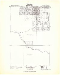
 1920 Avery1920 Print · USGSPhillips and Blaine counties appear here just after the Great War, showing the rural network of the Montana high plains along the Canadian border. Genealogists can locate early community hubs like Caldwell P.O., Turner, and rural schools such as Hubert S.H..
 - 1920 Map of Cowan
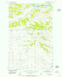
 1920 Cowan1920 Print · USGSNorthern Phillips County sits along the Canadian border in the early twentieth century, showing a landscape defined by the Milk River irrigation project. Genealogists can locate isolated rural schoolhouses like Broderson School and Berg School or trace the early post offices at Freewater P.O. and Lovejoy P.O.
 - 1943 Map of Landusky
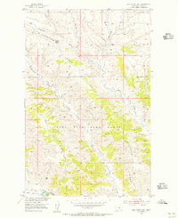
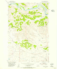
 1943 Landusky1943 Print · USGSPhillips County during the early 1940s is shown here as a landscape of isolated mountain settlements and the wild Missouri Breaks. Researchers can trace the layout of Landusky, the mountain peaks of the Jefferson National Forest, and river landmarks such as Cow Island.
 - 1953 Map of Havre, 1967 Print
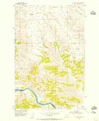
 1953 Havre1967 Print · USGSNorthern Montana’s Hi-Line comes into focus in the mid-fifties, centered on the Milk River and the critical Great Northern rail link. Genealogists can trace small sidings and settlements like Assinniboine, Laredo, and Box Elder alongside the Fort Belknap Agency.3 unique versions available
 - 1954 Map of Bell Ridge East, 1956 Print
 1954 Bell Ridge East1956 Print · USGSPhillips County was a center for river basin development in the mid-fifties, featuring the Missouri River at the edge of the game range. Researchers can trace land contours across Bell Ridge and locate riparian features like Jones Island and Bell Bottoms.2 unique versions available
 - 1954 Map of Cow Island, 1956 Print
 1954 Cow Island1956 Print · USGSThe Missouri River breaks of Montana are captured here during the mid-fifties, showing the isolated river valley at the borders of Blaine, Fergus, and Phillips counties. Researchers can locate the Kip Homestead, trace the path of the Jeep Trail, and see the prominent Cow Island in the river's bend.3 unique versions available
 - 1954 Map of Hessler Ridge, 1956 Print
 1954 Hessler Ridge1956 Print · USGSThe Missouri River corridor of north-central Montana was undergoing focused basin development in the mid-fifties. Researchers can trace the varied terrain of the Fort Peck Game Range and early-named landmarks like King Island, Hessler Ridge, and Gardipee Bottoms.3 unique versions available
 - 1954 Map of Baker Monument, 1956 Print
 1954 Baker Monument1956 Print · USGSThe Missouri River breaks of central Montana are captured here during the 1950s era of river basin development. Researchers can trace historic river crossings and infrastructure like the Ferry, the Heller Sch, and early Powerplant (Ruins).2 unique versions available
 - 1954 Map of Carter Coulee, 1956 Print
 1954 Carter Coulee1956 Print · USGSThe Missouri River breaks and the high plains of central Montana are captured here during the mid-fifties ranching era. Genealogists and historians can trace the foundations of local settlement through the Little Crooked Creek School, the Mathison Ranch, and the winding path of an Old Trail.2 unique versions available
 - 1954 Map of Bell Ridge West, 1956 Print
 1954 Bell Ridge West1956 Print · USGSCentral Montana ranching lands along the Missouri River are captured here in the mid-fifties. Researchers can trace riverside land use through Kendall Bottoms and Gardipee Bottoms or locate the Kendall Cow Camp within the Fort Peck Game Range.3 unique versions available
 - 1954 Map of Grand Island, 1956 Print
 1954 Grand Island1956 Print · USGSThe Missouri River breaks of Central Montana are captured here during the mid-fifties, showing the intersection of Fergus and Phillips Counties. Researchers can trace the wild river corridor through Grand Island and Kendall Bottoms, or locate isolated landmarks like the Landing Strip and VABM Crystal 3097.3 unique versions available
 - 1954 Map of Jordan, 1965 Print
 1954 Jordan1965 Print · USGSGarfield County in the mid-fifties is a land of expansive ranches and isolated prairie schoolhouses. Researchers can trace rural genealogy and land use through landmarks like Regina School, Robertson Brothers Ranch, and the Charles M Russell National Wildlife Range.2 unique versions available
 - 1954 Map of Glasgow, 1967 Print
 1954 Glasgow1967 Print · USGSNortheastern Montana is shown during the mid-fifties as the rail-and-river economy shaped the plains. Trace family roots and vanished landmarks from the Wendell Post Office to the Great Northern sidings at Ashfield and Hinsdale.2 unique versions available
 - 1954 Map of Lewistown, 1967 Print
 1954 Lewistown1967 Print · USGSCentral Montana at the height of the mid-century rail era reveals a landscape shaped by the Judith River and high mountain ranges. Trace the old lines of the Great Northern through Lewistown and Denton, or locate sites like Giltedge and Landusky.3 unique versions available
 - 1956 Map of Jordan
 1956 Jordan1956 Print · USGSCentral Montana ranching country and the massive Missouri River impoundment are captured here in the mid-fifties. Researchers can trace remote homesteading landmarks like Robertson Brothers Ranch and small rural hubs including Jordan, Brusett, and Cohagen.
 - 1957 Map of Glasgow
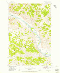
 1957 Glasgow1957 Print · USGSNortheastern Montana during the late 1950s shows a landscape shaped by the Milk River and the expanding influence of the Fort Peck Lake reservoir. Genealogists and historians can trace the Great Northern rail stops from Malta to Glasgow, including old sidings like Kintyre Siding and rural centers like Opheim.
 - 1957 Map of Havre
 1957 Havre1957 Print · USGSNorth-central Montana at the mid-century is defined by the vital Great Northern rail corridor and the winding Milk River. Researchers can trace old settlements like Laredo and Savoy, or locate historic sites such as the Hays (old) Sub Agency and the Chinook No 1 mine.
 - 1958 Map of Glasgow
 1958 Glasgow1958 Print · USGSNortheastern Montana comes to life in this mid-century survey of the Milk River valley and the Great Northern rail corridor. Researchers can trace the rise and fall of work camps like New Deal and Wheeler alongside remote landmarks like the Wendell Post Office.2 unique versions available
 - 1958 Map of Jordan
 1958 Jordan1958 Print · USGSGarfield County and the Missouri River country are shown here in the late fifties as the regional geography adjusted to the massive new reservoir. Genealogists and local historians can trace isolated homesteads and numerous rural schoolhouses like Iler School, Brusett, and the Robertson Brothers Ranch.
 - 1958 Map of Havre
 1958 Havre1958 Print · USGSUpper Montana in the late fifties was a landscape of remote rail towns and vast high-plain ranges. Genealogists and historians can trace the Great Northern railroad through Havre, Chinook, and the Fort Belknap Indian Reservation.
 - 1959 Map of Lewistown
 1959 Lewistown1959 Print · USGSCentral Montana in the mid-1950s shows a landscape defined by the winding Missouri River and the rise of the South Moccasin Mtns. Researchers can trace the rail lines of the Great Northern through towns like Winifred and locate the Cat Creek Oil Field.3 unique versions available
 - 1964 Map of Jordan
 1964 Jordan1964 Print · USGSGarfield County and the surrounding Montana prairie are captured in the mid-1950s as the Fort Peck Reservoir reshapes the northern landscape. Local historians can trace the locations of rural schoolhouses like South First Creek School and remote ranching outposts such as Brusett and Van Norman.
Showing maps 1-25 of 817
Top cities of Phillips County
Frequently asked questions
- What are the different types of historical maps available for Phillips County?
- What is the oldest map of Phillips County?
- Where can I purchase historical maps of Phillips County for my home or office?
- Where can I download high-res historical maps of Phillips County?
- Are there historical topographic maps available for Phillips County?
- Is there historical aerial imagery available for Phillips County?
- Where are historical maps of Phillips County sourced from?