Old Maps of Peaks and Pines Park, Montana for Academic Research
Study the evolution of Peaks and Pines Park with 9 high-resolution historic maps. Whether you're teaching, researching, or modeling changes in land use, these maps provide essential visual documentation of urban, environmental, and geographic change.
- Analyze long-term change: Track patterns in development, transportation, and natural features.
- Ideal for environmental or urban studies: Support academic projects with primary historical map data.
- Use in the classroom or lab: Educators and researchers rely on these maps to bring historical context to life.
These maps are a powerful tool for teaching, research, and visualizing how Peaks and Pines Park has changed over the decades.
Peaks and Pines Park, MT maps
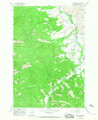
(9)- 1956 Map of Elk City, 1963 Print
 1956 Elk City1963 Print · USGSThe Idaho backcountry in the mid-fifties remains a landscape of isolated mining camps and remote forest outposts. Researchers can trace historical mining operations at Stibnite Mine and Blackbird Mine or locate riverside landmarks like Mackay Bar and Campbell's Ferry.3 unique versions available
 - 1960 Map of Elk City
 1960 Elk City1960 Print · USGSThe Central Idaho wilderness and Bitterroot Range are captured here during the peak of mid-century industrial mining. Researchers can trace remote backcountry settlements like Burgdorf and Warren, alongside major mineral sites including the Blackbird Mine and Ima Mine.2 unique versions available
 - 1964 Map of Burnt Ridge, 1968 Print
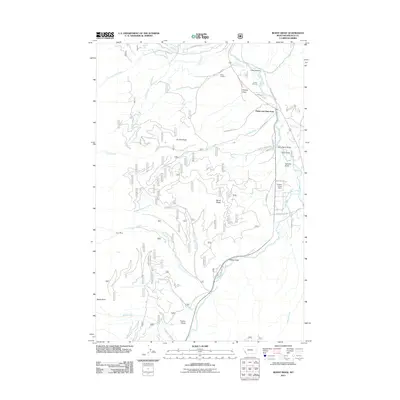
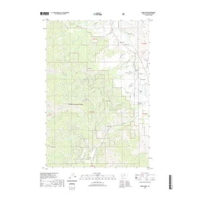
 1964 Burnt Ridge1968 Print · USGSThe confluence of the Bitterroot River forks near Conner is captured in this mid-1960s survey. Genealogists and historians can trace the valley's development near John Bench or locate the Trapper Creek Rural Conservation Center.4 unique versions available
 - 1998 Map of Burnt Ridge, 2002 Print
 1998 Burnt Ridge2002 Print · USGSRavalli County’s river valleys and forest lands are captured in the late twentieth century, showing the meeting of the East and West Forks. Genealogists and historians can locate the Conner settlement and Trapper Creek Job Corps Center, or trace the banks of the Bitterroot River.
 - 2011 Map of Burnt Ridge, 2011 Print
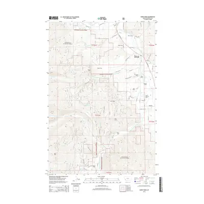
 2011 Burnt Ridge2011 Print · USGSCovers Peaks and Pines Park, including Ravalli County, United States, and other nearby areas
 - 2014 Map of Burnt Ridge, 2014 Print
 2014 Burnt Ridge2014 Print · USGSCovers Peaks and Pines Park, including Ravalli County, United States, and other nearby areas
 - 2017 Map of Burnt Ridge, 2017 Print
 2017 Burnt Ridge2017 Print · USGSCovers Peaks and Pines Park, including Ravalli County, United States, and other nearby areas
 - 2020 Map of Burnt Ridge, 2020 Print
 2020 Burnt Ridge2020 Print · USGSCovers Peaks and Pines Park, including Ravalli County, United States, and other nearby areas
 - 2024 Map of Burnt Ridge, 2024 Print
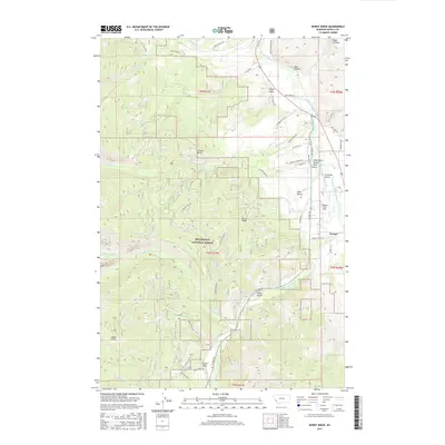
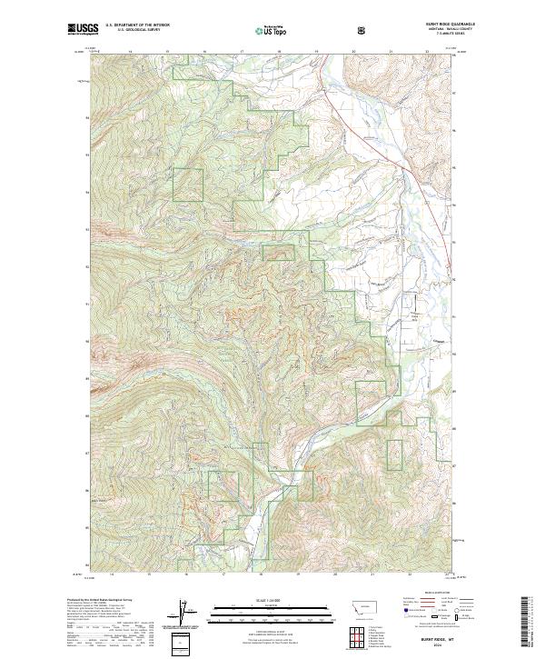 2024 Burnt Ridge2024 Print · USGSThe Bitterroot Valley in the 2020s remains a landscape of river confluences and mountain access. Genealogists and historians can trace the geography around Conner and the drainage networks of Chaffin Creek and Trapper Creek.
End of results
Showing maps 1-9 of 9
Top cities near Peaks and Pines Park
Frequently asked questions
- What are the different types of historical maps available for Peaks and Pines Park?
- What is the oldest map of Peaks and Pines Park?
- Where can I purchase historical maps of Peaks and Pines Park for my home or office?
- Where can I download high-res historical maps of Peaks and Pines Park?
- Are there historical topographic maps available for Peaks and Pines Park?
- Is there historical aerial imagery available for Peaks and Pines Park?
- Where are historical maps of Peaks and Pines Park sourced from?