1990s Maps of Wibaux County, Montana
Explore 3 historic maps of Wibaux County from the 1990s. These maps offer a rare glimpse into what life looked like during the 1990s — showing old roads, neighborhoods, homes, and landmarks that have changed or disappeared over time.
Whether you're researching your family's past, planning a metal detecting trip, or studying how Wibaux County's landscape evolved across the 1990s, these high-resolution maps are a powerful tool for exploring the history of this region.
- Focus on a specific era: All maps on this page are from the 1990s, giving you a focused view of this time period.
- See what’s changed: Compare century-old streets, trails, and buildings to today's modern landscape using overlays and satellite layers.
- Research with precision: Use these maps for genealogy, historical research, land use analysis, or educational projects.
- View, download, or print: Maps are fully viewable online in high resolution, and can be downloaded or printed for your own records.
Start exploring Wibaux County's history through authentic maps from the 1990s. This is your window into the past.
Wibaux County, MT maps
(3)- 1997 Map of Skaar, 2001 Print
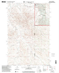 1997 Skaar2001 Print · USGSThe North Dakota-Montana borderlands are captured here in the late nineties, showing the rugged intersection of the Little Missouri River and the Little Missouri National Grassland. Researchers can trace remote ranching roots at Metcalf Ranch or follow old 4WD tracks past Skaar.
 - 1997 Map of Carlyle, 2001 Print
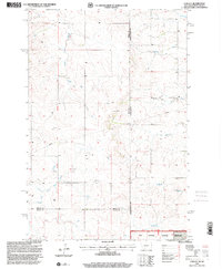 1997 Carlyle2001 Print · USGSThe high plains along the Montana-North Dakota border come into focus in the late 1990s as ranching and energy infrastructure intersect. Genealogists can locate the town of Carlyle and its nearby Cem, while tracing watercourses like Bullion Creek and Lame Steer Creek.
 - 1997 Map of Skaar NE, 2001 Print
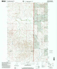 1997 Skaar NE2001 Print · USGSRichland County at the Montana and North Dakota border comes into focus in the late nineties, showing a region defined by ranching and vast grasslands. Researchers can locate remote community hubs like Shadwell Sch, Grace Ch, and the Folkvord Ranch.
End of results
Showing maps 1-3 of 3
Top cities of Wibaux County
Frequently asked questions
- What are the different types of historical maps available for Wibaux County?
- What is the oldest map of Wibaux County?
- Where can I purchase historical maps of Wibaux County for my home or office?
- Where can I download high-res historical maps of Wibaux County?
- Are there historical topographic maps available for Wibaux County?
- Is there historical aerial imagery available for Wibaux County?
- Where are historical maps of Wibaux County sourced from?