Old Maps of Wibaux County, Montana for Academic Research
Study the evolution of Wibaux County with 168 high-resolution historic maps. Whether you're teaching, researching, or modeling changes in land use, these maps provide essential visual documentation of urban, environmental, and geographic change.
- Analyze long-term change: Track patterns in development, transportation, and natural features.
- Ideal for environmental or urban studies: Support academic projects with primary historical map data.
- Use in the classroom or lab: Educators and researchers rely on these maps to bring historical context to life.
These maps are a powerful tool for teaching, research, and visualizing how Wibaux County has changed over the decades.
Wibaux County, MT maps
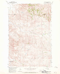
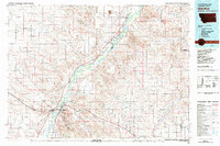
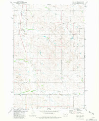
(168)- 1909 Map of Glendive
 1909 Glendive1909 Print · USGSThe confluence of the Missouri and Yellowstone rivers in the first decade of the twentieth century shows a region of scattered ranches and emerging river towns. Genealogists can trace family landmarks like Cavanaughs Ranch or Nortons Ranch and find early resource sites like the Coal Mine.
 - 1953 Map of Miles City, 1966 Print
 1953 Miles City1966 Print · USGSEastern Montana and the North Dakota borderlands come alive in this mid-century survey of the Yellowstone River valley. Genealogists and historians can trace the rural network of the era through sites like Fertile Prairie School, St Johns Church, and the rail lines serving Ismay and Plevna.4 unique versions available
 - 1954 Map of Glendive, 1967 Print
 1954 Glendive1967 Print · USGSEastern Montana at mid-century shows a landscape of river-valley commerce and remote prairie ranching. Researchers can trace the legacy of rural education and transport through sites like Prairie Elk School, the Great Northern rail lines, and Circle.2 unique versions available
 - 1957 Map of Miles City
 1957 Miles City1957 Print · USGSEastern Montana and the North Dakota borderlands come alive in the mid-fifties as the rail and ranching economy peaks along the Yellowstone River. Genealogists and historians can trace numerous rural landmarks like St Phillips Church, Fertile Prairie School, and the Ostendorf Ranch.
 - 1957 Map of Glendive
 1957 Glendive1957 Print · USGSEastern Montana in the mid-1950s is defined by its deep river valleys and a sprawling network of rural school districts. You can trace the path of the Great Northern railroad and locate vanished local landmarks like Breezy Flat School and Newton Junction.
 - 1958 Map of Miles City
 1958 Miles City1958 Print · USGSEastern Montana ranching and rail life are documented here during the late fifties, centered on the confluence of the Yellowstone River and Powder River. Researchers can trace rural school locations like St Phillips Church and Chimney Creek School alongside dozens of named family ranches.
 - 1958 Map of Glendive
 1958 Glendive1958 Print · USGSEastern Montana and the North Dakota borderlands come alive in the late fifties, showing the agricultural heart of the Yellowstone valley. Trace the legacy of rural education through Kimmel School and Ridgelawn School or locate rail hubs in Glendive and Sidney.
 - 1966 Map of Savage SE, 1970 Print
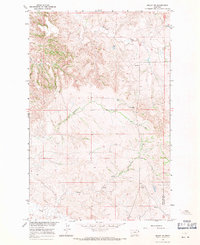
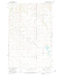
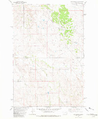
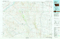
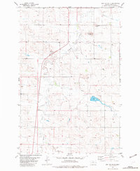
 1966 Savage SE1970 Print · USGSEastern Montana's high plains and deep coulees are captured in this mid-century survey of Wibaux County. Researchers can trace the rugged drainage patterns of Dry Creek and Devils Canyon or locate local landmarks like Valentine Flat.
 - 1966 Map of Savage SW, 1970 Print
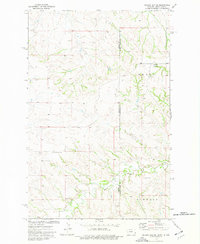
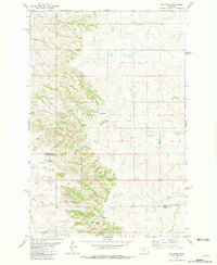
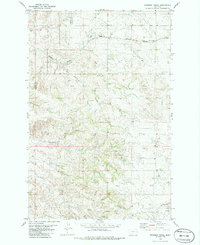
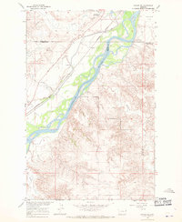 1966 Savage SW1970 Print · USGSThe Yellowstone River corridor in eastern Montana is captured here in the mid-1960s, showing the intersection of Dawson and Richland counties. Trace the historic Lewis and Clark Trail, the Northern Pacific railroad, and the Main Pacific Canal.
 - 1966 Map of Skaar NW, 1971 Print
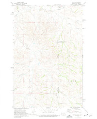
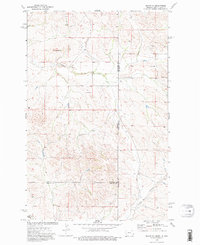
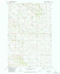
 1966 Skaar NW1971 Print · USGSEastern Montana ranching country is captured here just before the 1970s, right along the NORTH DAKOTA STATE LINE. Genealogists and historians can locate the Clark Sch and trace local water sources like Shadwell Creek and Elm Coulee.
 - 1974 Map of Skaar, 1977 Print
 1974 Skaar1977 Print · USGSThe Montana and North Dakota borderlands come into focus in the mid-1970s, showing a landscape shaped by creek drainage and scoria mining. Researchers can trace the rural settlement of Skaar and local extraction sites like the Scoria Pits near Henry Creek.
 - 1974 Map of Odland Dam, 1977 Print
 1974 Odland Dam1977 Print · USGSThe North Dakota-Montana borderlands come into focus in the mid-seventies, showing a landscape defined by the Little Beaver Creek drainage. Researchers can locate the Odland Dam, the Elmwood community Townhall, and local industrial Scoria Pits.
 - 1974 Map of Odland Dam NE, 1977 Print
 1974 Odland Dam NE1977 Print · USGSThe high plains along the Montana-North Dakota border come alive in this mid-seventies survey. Genealogists and local historians can locate rural landmarks like Arvid Sch and Blue Mountain Cem among the drainages of Dry Beaver Creek.
 - 1974 Map of Skaar NE, 1977 Print
 1974 Skaar NE1977 Print · USGSThe high plains of the Montana-North Dakota border come into focus in the mid-1970s, showing a sparsely populated ranching landscape. Researchers can trace rural landmarks like Shadwell Sch, Grace Ch, and the local Scoria Pit near Bull Butte.2 unique versions available
 - 1981 Map of Glendive
 1981 Glendive1981 Print · USGSEastern Montana and the North Dakota border come into focus in the early 1980s, centered on the Yellowstone River corridor. Researchers can trace rural schoolhouses like Green School, early aviation sites at Savage Airport, and the industrial footprint of the Burlington Northern rail line.
 - 1981 Map of Ayer Spring NE
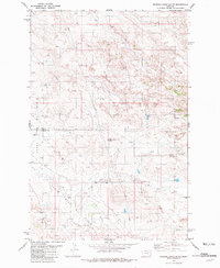
 1981 Ayer Spring NE1981 Print · USGSEastern Montana in the early eighties shows an industrial landscape shaped by energy production at the Wibaux and Fallon county lines. Trace oil history through the South Pine Oil Field and the central Pine Unit or Gas Plant.
 - 1981 Map of Cap Rock
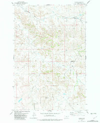
 1981 Cap Rock1981 Print · USGSThe high plains of eastern Montana are captured here during the late 1970s, showing a landscape of remote ranchlands and critical water sources. Trace the rugged terrain around Cap Rock and locate historical landmarks like Spring Cap Rock and Rattlesnake Creek.
 - 1981 Map of Rocking Chair Butte
 1981 Rocking Chair Butte1981 Print · USGSThe high plains of Wibaux and Fallon counties are captured here in the early 1980s during a peak era of petroleum development. Researchers can trace the industrial layout of the South Pine Oil Field and find landmarks like Rocking Chair Butte and Cabin Creek.
 - 1981 Map of Carlyle
 1981 Carlyle1981 Print · USGSThe Montana-North Dakota borderlands are captured here in the early 1980s, centered on the railroad crossing at Carlyle. Genealogists and historians can trace local development through the Burlington Northern line and the settlement at Williams.
 - 1981 Map of Carlyle NW
 1981 Carlyle NW1981 Print · USGSThe borderlands of Wibaux and Fallon counties are captured here in the early 1980s as a landscape of remote ranching and emerging infrastructure. Trace the paths of Beaver Creek and Lone Tree Creek, alongside early industrial markers like a Pipeline.
 - 1981 Map of Wibaux, 1982 Print
 1981 Wibaux1982 Print · USGSThe Montana and North Dakota borderlands come into focus in the early 1980s, showcasing a landscape shaped by the BURLINGTON NORTHERN railroad and the Yellowstone River. Researchers can trace the rail corridor through Wibaux and Yates or locate isolated landmarks like Graveyard Hill and Johnstone Dam.
 - 1982 Map of Hodges SE
 1982 Hodges SE1982 Print · USGSWibaux County's cattle country and prairie drainages are mapped here during the early eighties, showing the essential water sources of the high plains. Researchers can trace land use through landmarks like Wolf Creek, Horse Creek, and the strategically located Flowing Well.
 - 1982 Map of Hodges
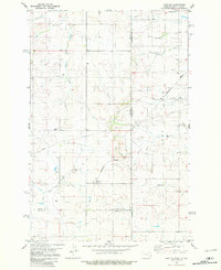
 1982 Hodges1982 Print · USGSDawson and Wibaux counties come together on the Montana plains in the early eighties, centered on the railroad siding at Hodges. Researchers can trace the rural infrastructure of the era through the Burlington Northern rail line and local Well sites.
 - 1982 Map of Red Top Butte
 1982 Red Top Butte1982 Print · USGSThe ranching country of Wibaux County comes into focus in the early 1980s, documenting a landscape of high buttes and prairie creeks. Researchers can locate community landmarks like St Philip Ch, South Center Sch, and the geographic marker at Horse Point.
 - 1982 Map of Freeman Creek
 1982 Freeman Creek1982 Print · USGSIn the early 1980s, the borderlands of Dawson and Wibaux counties remained a sparsely settled landscape of grazing land and rail. Researchers can trace the path of the Burlington Northern railroad as it passes Beaver Hill and the many water sources along Freeman Creek.
Showing maps 1-25 of 168
Top cities of Wibaux County
Frequently asked questions
- What are the different types of historical maps available for Wibaux County?
- What is the oldest map of Wibaux County?
- Where can I purchase historical maps of Wibaux County for my home or office?
- Where can I download high-res historical maps of Wibaux County?
- Are there historical topographic maps available for Wibaux County?
- Is there historical aerial imagery available for Wibaux County?
- Where are historical maps of Wibaux County sourced from?