Old Maps of Cavalier County, North Dakota
Explore 281 old maps of Cavalier County, spanning from 1918 to today. These high-resolution historic maps reveal how streets, neighborhoods, landmarks, and natural features evolved over time — perfect for genealogy, metal detecting, research, and local history exploration.
What you can do with these maps:
- See how Cavalier County changed over time: Compare historical maps to modern-day views to trace roads, homesites, rail lines & more.
- View detailed metadata: Each map includes creators, publishers, year, scale, and archive source.
- Overlay maps with satellite & LiDAR: Visualize the past alongside modern tools to explore terrain & human change.
- Trusted historical sources: Maps sourced from the USGS, Library of Congress, and other archives.
- Access maps your way: View online, download high-res files, or order prints for personal or research use.
Start exploring old maps of Cavalier County to uncover forgotten places, hidden landmarks, and the deep history beneath your feet.
Cavalier County, ND maps
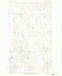
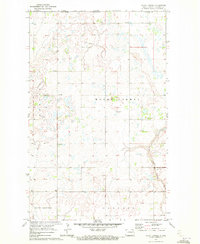
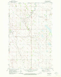
(281)- 1918 Map of Walhalla
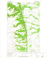
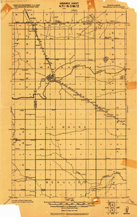 1918 Walhalla1918 Print · USGSThe North Dakota borderlands come into focus at the end of the Great War, showing a landscape of pioneer townships and river valleys. Genealogists can trace family footprints near Walhalla and Beaulieu, or locate long-standing rural Schools and the Great Northern R.R. line.
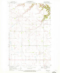
 - 1943 Map of Walhalla
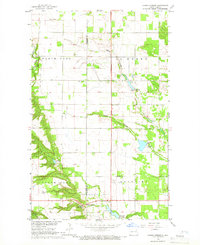
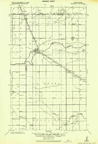 1943 Walhalla1943 Print · USGSSettlement along the international border is captured here during the 1940s, centered on the railroad corridor. Genealogists can locate family sites near Walhalla, the rural schoolhouses of Beaulieu, or the Bay Center Church.
 - 1952 Map of Thief River Falls, 1967 Print
 1952 Thief River Falls1967 Print · USGSThe Red River Valley's agricultural and conservation landscape is captured in the mid-1950s, detailing a web of rail lines and international border crossings. Researchers can trace family roots in towns like Thief River Falls, locate the State School for Blind, and survey landmarks like the Agassiz National Wildlife Refuge.2 unique versions available
 - 1953 Map of Devils Lake, 1968 Print
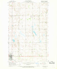
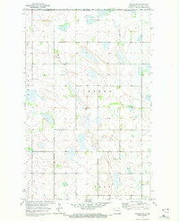
 1953 Devils Lake1968 Print · USGSNorth Dakota's northern plains are captured here in the mid-fifties, showing a landscape of rail-fed grain elevators and prairie wetlands. Genealogists can locate family landmarks like Rose Hill School, Hurricane Lake Church, and the Turtle Mountain Indian Reservation.3 unique versions available
 - 1956 Map of Thief River Falls
 1956 Thief River Falls1956 Print · USGSThe Red River Valley in the mid-1950s is captured here as a sprawling network of rail corridors and wildlife refuges along the Canadian border. Trace the vanished transport routes of the Dismantled railroad and Abandoned railroad or locate local landmarks like the Herrick Elevator and State School for Blind.
 - 1956 Map of Devils Lake
 1956 Devils Lake1956 Print · USGSNorthern North Dakota is shown at a mid-century peak of rail-driven agriculture, where the Soo Line and Great Northern railroads cross the prairie. Trace the borders of the Turtle Mountain Indian Reservation and locate local landmarks like Rose Hill School or Camp Grafton.
 - 1957 Map of Thief River Falls
 1957 Thief River Falls1957 Print · USGSThe Red River Valley in the mid-fifties is captured here as a thriving network of rail towns and conservation lands. Genealogists and historians can trace family roots through settlements like Grafton, Pembina, and Hallock, or locate landmarks such as the State School for Blind and the Great Northern RR corridor.
 - 1962 Map of Egeland, 1964 Print
 1962 Egeland1964 Print · USGSTowner County's rail-dependent agricultural landscape comes into focus in the early sixties at the junction of two major lines. Genealogists and historians can trace the early footprints of Egeland, the sidings at Olmstead, and the rural township divisions of Crocus and Victor.
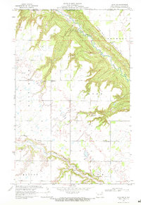
 - 1964 Map of Walhalla, 1965 Print
 1964 Walhalla1965 Print · USGSWalhalla and the Pembina River valley are captured in the mid-sixties, showing the town's transition from the wooded escarpment to the open plains. Researchers can locate the Walhalla Cem, trace the Great Northern railroad, or identify the Port of Entry US Customs at the international border.3 unique versions available
 - 1964 Map of Concrete, 1965 Print
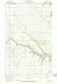
 1964 Concrete1965 Print · USGSThe border of Cavalier and Pembina counties comes into focus in the 1960s, showing the rural townships of the Red River Valley hinterlands. Researchers can locate the settlement of Concrete, family-relevant sites like St Ellens Cem, and the winding path of the Tongue River.
 - 1964 Map of Hanks Corner, 1966 Print
 1964 Hanks Corner1966 Print · USGSNortheast North Dakota during the mid-sixties shows a landscape of carefully managed prairie water and rural townships. Genealogists and local historians can trace the family lands surrounding Hanks Corner, Beaulieu Cemetery, and Oak Lawn Cemetery.
 - 1967 Map of Thief River Falls
 1967 Thief River Falls1967 Print · USGSThe Red River Valley and the international border come alive in the 1960s, showing a landscape shaped by major rail lines and river commerce. Genealogists and historians can trace the paths of the Great Northern and Soo Line through towns like Thief River Falls, Grafton, and Hallock.
 - 1967 Map of Langdon East, 1969 Print
 1967 Langdon East1969 Print · USGSCavalier County life in the late sixties is centered on the railroad hub of Langdon and its surrounding townships. Genealogists and historians can trace local landmarks like Lebanon Cem, the Harvey Center Ch, and the Fairground.2 unique versions available
 - 1967 Map of Maida, 1969 Print
 1967 Maida1969 Print · USGSCavalier County sits on the international line in the late sixties, where the small community of Maida serves as a northern gateway. Researchers can trace rural landmarks from the Port of Entry U S Customs down to Stilwell Ch and Elkwood Cem.
 - 1969 Map of Rock Lake NE, 1972 Print
 1969 Rock Lake NE1972 Print · USGSThe international border between North Dakota and Manitoba takes center stage in this late 1960s survey of the high plains. Researchers can trace the layout of Sarles on the county line or locate local landmarks like Dash Cem and the township of Loansing.
 - 1969 Map of Olga SW, 1972 Print
 1969 Olga SW1972 Print · USGSCavalier County agricultural life in the late sixties is defined by its township borders and the deep valley of the South Pembina River. Genealogists and local historians can locate community cornerstones like the Town Hall, South Pembina Cem, and Zion Cem.
 - 1969 Map of Olga NW, 1972 Print
 1969 Olga NW1972 Print · USGSNear the Canadian border in the late sixties, this survey of Cavalier County captures a landscape shaped by the Pembina escarpment. Researchers can locate community anchors like Nora Numedahl Ch, Big Pembina Cem, and the local Townhall.
 - 1970 Map of Alsen, 1972 Print
 1970 Alsen1972 Print · USGSCavalier County agricultural life in the early seventies centers on the rail-fed hub of Alsen and the surrounding prairie townships. Researchers can trace family roots through the Soo Line rail corridor and sites like Rosehill Cem and Storlie.
 - 1970 Map of Mount Carmel, 1972 Print
 1970 Mount Carmel1972 Print · USGSCavalier County agricultural lands met the international border in the early seventies, centered on the rural community of Mount Carmel. Researchers can trace local landmarks like the Townhall or industrial sites including a Shale Pit and the Little South Pembina River.
 - 1970 Map of Sarles NE, 1972 Print
 1970 Sarles NE1972 Print · USGSThe North Dakota borderlands meet the Canadian line in this early 1970s survey of rural Cavalier County. Genealogists and local historians can locate the Byron Cem and trace the agricultural development of Glenila and Byron townships.
 - 1970 Map of Calvin, 1972 Print
 1970 Calvin1972 Print · USGSCavalier County agricultural life in the early seventies is anchored by the rail connection and small-town centers of the North Dakota prairie. Genealogists and local historians can trace the exact locations of Corinthian Cem, the town of Calvin, and the Burlington Northern line.
 - 1970 Map of Sarles SE, 1972 Print
 1970 Sarles SE1972 Print · USGSCavalier County prairie lands are captured here in the late sixties, showcasing a landscape of glacial wetlands and rural townships. Genealogists and local historians can locate the Evangelical Cem and trace early section roads through Huron and Grey.
 - 1970 Map of Sarles, 1972 Print
 1970 Sarles1972 Print · USGSNear the international boundary in the early 1970s, this area of North Dakota shows a remote agricultural landscape centered on the rail-line town of Sarles. Genealogists and researchers can trace local family landmarks like Woodbridge Cem, the US Customs station, and the Burlington Northern tracks.
 - 1970 Map of Hannah SW, 1972 Print
 1970 Hannah SW1972 Print · USGSCavalier County township life in the early seventies is defined by isolated farmsteads and the prairie pothole landscape. Genealogists and local historians can locate Our Saviors Ch, a rural Townhall, and the township boundaries of Moscow and Minto.
 - 1970 Map of Wales, 1972 Print
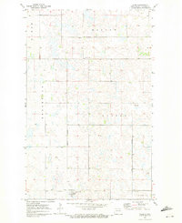
 1970 Wales1972 Print · USGSUpper Cavalier County near the Canadian border comes into focus in the early seventies, centered on the rail town of Wales. Genealogists and researchers can trace the Burlington Northern line and locate sites across Minto and Dresden townships.
Showing maps 1-25 of 281
Top cities of Cavalier County
- Langdon historical maps
- Munich historical maps
- Osnabrock historical maps
- Milton historical maps
- Mount Carmel historical maps
- Alsen historical maps
See more
Frequently asked questions
- What are the different types of historical maps available for Cavalier County?
- What is the oldest map of Cavalier County?
- Where can I purchase historical maps of Cavalier County for my home or office?
- Where can I download high-res historical maps of Cavalier County?
- Are there historical topographic maps available for Cavalier County?
- Is there historical aerial imagery available for Cavalier County?
- Where are historical maps of Cavalier County sourced from?