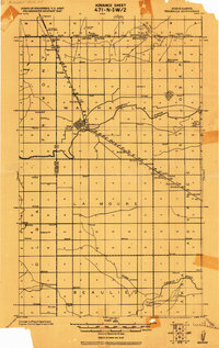
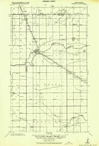
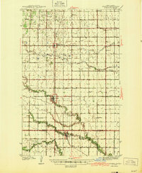
1918 Map of Walhalla
USGS Topo · Published 1918About this map
The United States Canada International Boundary forms the northern limit of this 1918 military survey, where the town of Walhalla serves as a central hub for the surrounding prairie. The Great Northern R.R. dictates the rhythm of the landscape, punctuated by numerous Farm Xings and Stations that supported the region’s agrarian economy during World War I. This era is characterized by a high density of rural infrastructure, visible in the frequent Schools and local parishes such as Bay Center Church and Beaulieu.
Find a feature on this map
25 named features on this map. Tap any name to fly to it.
Don’t see what you’re looking for? This feature index may not catch every label — zoom into the map to look around manually.
Map Details
Editions of this 1918 Walhalla Map
This is the sole edition of this map. No revisions or reprints were ever made.
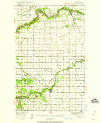
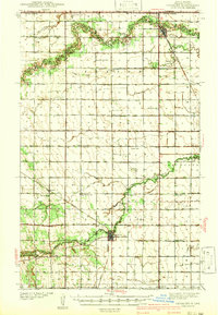
Other maps of this area
1939 · Cavalier
USGS Topo · 1:62,500
1941 · Cavalier
USGS Topo · 1:62,500
1943 · Walhalla
USGS Topo · 1:62,500
1944 · Crystal
USGS Topo · 1:62,500

1952 · Thief River Falls
USGS Topo · 1:250,000

1953 · Devils Lake
USGS Topo · 1:250,000

1956 · Thief River Falls
USGS Topo · 1:250,000

1956 · Devils Lake
USGS Topo · 1:250,000

1957 · Thief River Falls
USGS Topo · 1:250,000
1964 · Mountain
USGS Topo · 1:24,000