Old Maps of Brown County, Nebraska for Academic Research
Study the evolution of Brown County with 187 high-resolution historic maps. Whether you're teaching, researching, or modeling changes in land use, these maps provide essential visual documentation of urban, environmental, and geographic change.
- Analyze long-term change: Track patterns in development, transportation, and natural features.
- Ideal for environmental or urban studies: Support academic projects with primary historical map data.
- Use in the classroom or lab: Educators and researchers rely on these maps to bring historical context to life.
These maps are a powerful tool for teaching, research, and visualizing how Brown County has changed over the decades.
Brown County, NE maps
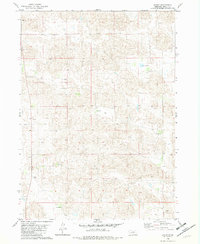
(187)- 1949 Map of Dutch Creek, 1976 Print
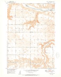
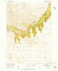
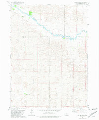
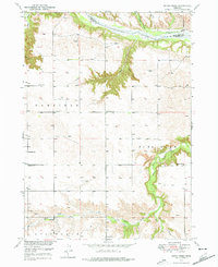 1949 Dutch Creek1976 Print · USGSBrown County's rugged Niobrara riverfront comes to life in this mid-century survey of the Garfield and Pine Glen precincts. Genealogists and historians can locate family landmarks like Lessig Cem and numerous rural schoolhouses including Jones Sch and Highland Sch.
 - 1949 Map of Koshopah, 1976 Print
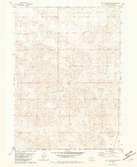
 1949 Koshopah1976 Print · USGSThe Nebraska Sandhills ranching country is captured here during the post-war era, showing the intersection of three counties. Genealogists can trace family holdings and local landmarks like White Ranch, Koshopah, and the many rural schools including Pixley Sch.
 - 1950 Map of Bassett NW
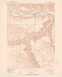 1950 Bassett NW1950 Print · USGSThe Niobrara River valley in the early post-war years shows a landscape of remote ranches and deep canyons at the junction of three Nebraska counties. Genealogists can locate several family burial sites like Leonard Cem and rural landmarks such as Cuba Ch and the Camp Meeting Ground.2 unique versions available
 - 1950 Map of Norden
 1950 Norden1950 Print · USGSThe Niobrara River valley in the early fifties shows a rugged landscape of family-run cattle operations and scattered rural school districts. Genealogists can locate family holdings like Worth Ranch or McMara Ranch and burial sites at Sparks Cem.2 unique versions available
 - 1950 Map of Meadville
 1950 Meadville1950 Print · USGSThe Niobrara River valley in Keya Paha County is shown here at mid-century, documenting a landscape of isolated farmsteads and rural townships. Genealogists can locate several historic schoolhouses including School No 87 and School No 42 near Meadville.2 unique versions available
 - 1950 Map of Huddle Table
 1950 Huddle Table1950 Print · USGSMid-century ranching life in northern Nebraska is preserved here as it appeared in 1950 along the river breaks. Genealogists and historians can locate several family landholdings like the Kirkpatrick Ranch and Chase Ranch, alongside rural landmarks such as Union Ch and School No 8.2 unique versions available
 - 1950 Map of Dutch Creek
 1950 Dutch Creek1950 Print · USGSNorthwestern Brown County was a landscape of remote farmsteads and scattered rural schoolhouses in the mid-century. Genealogists can locate family landmarks like Lessig Cem and Highland Ch or trace the drainage paths of Devils Gulch and Bone Creek.2 unique versions available
 - 1950 Map of Wood Lake, 1952 Print
 1950 Wood Lake1952 Print · USGSThe Cherry County ranchlands come into focus at mid-century, where the Chicago and North Western railroad connects isolated Nebraska prairie towns. Genealogists and local historians can trace family-named estates like Shepard Ranch and Anderson Ranch or locate rural landmarks such as Woodlawn Cem and School No 84 North.2 unique versions available
 - 1951 Map of Moon Lake
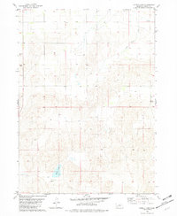
 1951 Moon Lake1951 Print · USGSThe Nebraska Sandhills in the early fifties were a land of expansive ranches and vital wetlands along the Calamus River. Genealogists and local historians can trace family-named properties like O'Hara Ranch and rural landmarks such as North Wrage Sch or the Long Lake Recreation Grounds.2 unique versions available
 - 1951 Map of Koshopah
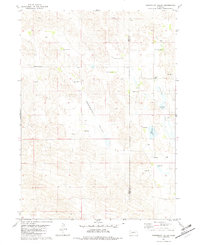
 1951 Koshopah1951 Print · USGSMid-century ranching life in Brown, Cherry, and Blaine Counties is documented here just after the war. Researchers can locate numerous family holdings and rural schoolhouses like Pixley Sch, Giles Cem, and O Teaford Ranch.
 - 1952 Map of Norden
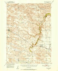
 1952 Norden1952 Print · USGSKeya Paha and Brown counties meet along the winding Niobrara River in the early fifties, capturing a period of transition for Nebraska's ranching country. Genealogists can trace family footprints at Norden, Sparks Cem, and numerous schoolhouses from Rockford Sch to School No 74.
 - 1954 Map of Ainsworth NW, 1955 Print
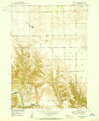
 1954 Ainsworth NW1955 Print · USGSBrown County's canyon country comes into focus in the mid-1950s, showing a ranching landscape shaped by the deep incisions of Plum Creek. Genealogists and local historians can trace legacy properties like the C. Keim Ranch and old rural sites such as School No 24.
 - 1954 Map of Ainsworth SW, 1955 Print
 1954 Ainsworth SW1955 Print · USGSBrown County's rural landscape is captured here in the mid-1950s, showing a network of rural schools and windmills across the Sandhills. Trace family history at Grand Prairie Cem or follow the Chicago and North Western line past Sandridge.
 - 1954 Map of Ainsworth, 1955 Print
 1954 Ainsworth1955 Print · USGSAinsworth was a bustling agricultural and rail hub in the mid-1950s, centered on the Chicago and North Western line. Researchers can locate civic landmarks like the Courthouse or trace rural school districts such as School No 55 and School No 20.
 - 1954 Map of Long Pine, 1956 Print
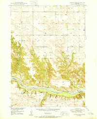
 1954 Long Pine1956 Print · USGSLong Pine and the surrounding Nebraska tablelands are captured here in the mid-fifties as the railroad and creek shaped local industry. Researchers can trace the Chicago and North Western line, find School No 7, and locate Camp Witness.
 - 1955 Map of O'Neill, 1974 Print
 1955 O'Neill1974 Print · USGSNorth-central Nebraska in the 1950s reveals a vast cattle-ranching landscape transitioning from the Missouri River breaks to the iconic Sand Hills. Researchers can trace the path of the Chicago and North Western rail line and locate rural landmarks like the Dustin Post Office and St Johns Lake Ch.2 unique versions available
 - 1957 Map of Valentine, 1960 Print
 1957 Valentine1960 Print · USGSNorthern Nebraska's ranching country and the vast Sand Hills are detailed here in the late fifties. Genealogists and historians can locate numerous family-named landmarks like the Dahlgren Ranch and trace the path of the Chicago and North Western railroad through Valentine.3 unique versions available
 - 1959 Map of Valentine
 1959 Valentine1959 Print · USGSThe northern Nebraska Sand Hills are captured here in the late fifties, showcasing a vast ranching landscape shaped by the Niobrara and Loup rivers. Genealogists and historians can trace rail-town development along the Chicago and North Western and locate remote outposts like Brownlee or Kennedy.
 - 1959 Map of O'Neill
 1959 O'Neill1959 Print · USGSNorth-central Nebraska in the late fifties is defined by the vast Sand Hills and the vital Chicago and North Western rail line. Genealogists and researchers can trace family roots through settlements like Atkinson, Bassett, and Stuart or follow the waters of the Niobrara River.2 unique versions available
 - 1969 Map of O'Neill
 1969 O'Neill1969 Print · USGSCentral Nebraska in the mid-fifties is defined here by the expansive Sand Hills and the winding Niobrara River. Trace the Chicago and North Western rail line through cattle towns like O'Neill and Ainsworth.
 - 1981 Map of Boiling Spring
 1981 Boiling Spring1981 Print · USGSFour Nebraska counties meet along the Calamus River in the early 1980s, revealing a landscape of remote cattle operations. Genealogists and historians can trace the footprints of family holdings like Easy Hour Ranch, Spencer Ranch, and the waters of Boiling Spring.
 - 1981 Map of Paramount Valley, 1982 Print
 1981 Paramount Valley1982 Print · USGSThe Nebraska Sandhills come into focus during the early 1980s, showcasing a landscape of isolated cattle ranches and expansive valley basins. Genealogists can locate family holdings like Barta Brothers Ranch or trace the rural history of Paramount Valley School.
 - 1982 Map of Lost Lake Ranch
 1982 Lost Lake Ranch1982 Print · USGSBrown County ranching country is documented here in the early 1980s, showcasing the isolated homesteads of the Nebraska sandhills. Genealogists and local historians can locate specific family lands like Allen Ranch, Steele Ranch, and the Paradise Valley Sch.
 - 1982 Map of Hofeld Lake
 1982 Hofeld Lake1982 Print · USGSBrown County ranchlands are documented here in the early eighties, showing a landscape defined by sandhills and scattered water sources. Researchers can locate Hofeld Lake, the winding Long Creek, and remote industrial markers like a Claypit.
 - 1982 Map of Raven
 1982 Raven1982 Print · USGSBrown County ranching life is well-documented in this early 1980s survey of the Nebraska Sandhills. Genealogists and local historians can locate specific homesteads like Forgey Ranch and Strand Ranch or trace landmarks such as Jones Lake.
Showing maps 1-25 of 187
Top cities of Brown County
Frequently asked questions
- What are the different types of historical maps available for Brown County?
- What is the oldest map of Brown County?
- Where can I purchase historical maps of Brown County for my home or office?
- Where can I download high-res historical maps of Brown County?
- Are there historical topographic maps available for Brown County?
- Is there historical aerial imagery available for Brown County?
- Where are historical maps of Brown County sourced from?