1960s Maps of Buffalo County, Nebraska
Explore 21 historic maps of Buffalo County from the 1960s. These maps offer a rare glimpse into what life looked like during the 1960s — showing old roads, neighborhoods, homes, and landmarks that have changed or disappeared over time.
Whether you're researching your family's past, planning a metal detecting trip, or studying how Buffalo County's landscape evolved across the 1960s, these high-resolution maps are a powerful tool for exploring the history of this region.
- Focus on a specific era: All maps on this page are from the 1960s, giving you a focused view of this time period.
- See what’s changed: Compare century-old streets, trails, and buildings to today's modern landscape using overlays and satellite layers.
- Research with precision: Use these maps for genealogy, historical research, land use analysis, or educational projects.
- View, download, or print: Maps are fully viewable online in high resolution, and can be downloaded or printed for your own records.
Start exploring Buffalo County's history through authentic maps from the 1960s. This is your window into the past.
Buffalo County, NE maps
(21)- 1961 Map of Elm Creek West, 1963 Print
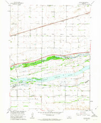
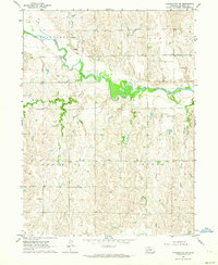
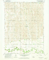
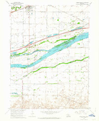
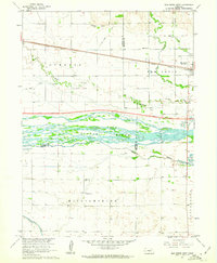 1961 Elm Creek West1963 Print · USGSCentral Nebraska's river valley and rail corridor are captured here in the early sixties, as the irrigation-fed landscape prepared for modern highway expansion. Genealogists can locate rural landmarks like Williamsburg Ch, East Twelfth Sch, and the small siding at Trued.
 - 1961 Map of Amherst, 1963 Print
 1961 Amherst1963 Print · USGSThe village of Amherst and the surrounding Buffalo County townships are captured here in the early sixties. Genealogists and local historians can trace the Union Pacific line, the meandering Wood River, and family landmarks like Stanley Cem.2 unique versions available
 - 1961 Map of Miller SW, 1963 Print
 1961 Miller SW1963 Print · USGSDawson and Buffalo counties are captured here in the early sixties, showing a rural Nebraska landscape shaped by the Missouri River Basin project. Genealogists can trace family footprints near Fairview Cem or the old grounds of School No 83 and School No 63.2 unique versions available
 - 1962 Map of Denman, 1963 Print
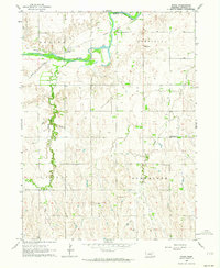
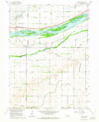 1962 Denman1963 Print · USGSThe braided Platte River channels define this Nebraska landscape in the early sixties as agricultural irrigation and modern highways transformed the valley. Genealogists and rail historians can trace the paths of the Union Pacific and Chicago Burlington and Quincy through Denman and Kenesaw.3 unique versions available
 - 1962 Map of Newark, 1963 Print
 1962 Newark1963 Print · USGSThe braided Platte River valley near the historic Kearney outpost is captured here in the early sixties. Genealogists and local historians can trace the intricate channels of Killgore Island, the grounds of Fort Kearney State Park, and the rail stops at Buda and Newark.3 unique versions available
 - 1962 Map of Riverdale, 1964 Print
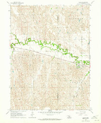
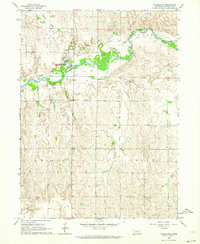
 1962 Riverdale1964 Print · USGSCentral Nebraska farmland comes into focus in the early sixties as the Union Pacific railroad cuts through the village of Riverdale. Researchers can trace old property lines and rural landmarks like School No 55 and the Lutheran Cem.
 - 1962 Map of Elm Creek East, 1964 Print
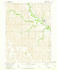
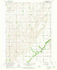
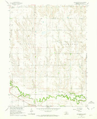
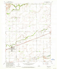
 1962 Elm Creek East1964 Print · USGSBuffalo County, Nebraska, is seen here during the transition to the interstate era in the early 1960s. Genealogists and local historians can trace the foundations of Elm Creek and Odessa or locate vanished landmarks like the Landing Field and early Gravel Pits.2 unique versions available
 - 1962 Map of Miller NE, 1964 Print
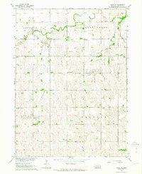
 1962 Miller NE1964 Print · USGSBuffalo County agriculture and rail transit are captured here in the early sixties as the Union Pacific line crosses the plains. Researchers can locate rural landmarks like Watertown Sch, Immanuel Lutheran Ch, and Cherry Valley.
 - 1962 Map of Pleasanton NW, 1964 Print
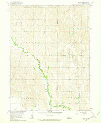
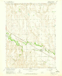
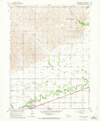
 1962 Pleasanton NW1964 Print · USGSBuffalo County's rural townships are captured here in the early sixties, showing the landscape before modern consolidation changed the face of Nebraska's farm country. Researchers can trace the winding South Loup River to find Sartoria, Peake Cem, and various rural landmarks like School No 73.
 - 1962 Map of Cameron, 1964 Print
 1962 Cameron1964 Print · USGSCentral Nebraska's rural landscape comes into focus during the early sixties, showing the agricultural settlement along the buffalo and hall county line. Genealogists can locate family landmarks like Mount Pleasant Cem, School No 48, and the Cameron Ch.
 - 1962 Map of Miller, 1964 Print
 1962 Miller1964 Print · USGSMiller and the surrounding Buffalo County townships are captured in the early sixties as the Union Pacific railroad continues to shape local life. Genealogists and historians can locate family landmarks like the Armada Cem and trace the paths of Wood River and Cherry Valley Creek.
 - 1962 Map of Poole NE, 1964 Print
 1962 Poole NE1964 Print · USGSBuffalo County’s rural sections are captured here in the early sixties, showing a landscape organized by township lines and traditional prairie agriculture. Genealogists can trace family roots through numerous landmark institutions, including St Wenceslaus Ch, Sodtown Cem, and local schoolhouses like Union Ridge Sch.
 - 1962 Map of Pleasanton SE, 1964 Print
 1962 Pleasanton SE1964 Print · USGSBuffalo County is shown in the early 1960s as a landscape of rural schoolhouses and rail-side settlements along the Wood River. Genealogists can locate family landmarks like Fairmont Cem, Havens Chapel, and the community at Prairie Center.2 unique versions available
 - 1962 Map of Poole, 1964 Print
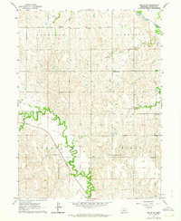
 1962 Poole1964 Print · USGSThe South Loup River valley and the village of Poole are captured here in the early sixties as the Union Pacific still defined the local corridor. Family historians can locate rural landmarks like School No 70, Majors Cem, and St Joseph Cem.2 unique versions available
 - 1962 Map of Kearney, 1964 Print
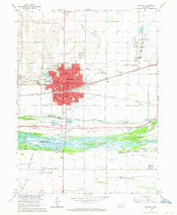 1962 Kearney1964 Print · USGSKearney and the braided Platte River are captured here in the early sixties during a period of infrastructure growth. Researchers can trace the legacy of Nebraska State Teachers College, locate the Old Fort Kearney Military Reservation, or find family ties near Glenwood Park and Buda.4 unique versions available
 - 1962 Map of Gibbon North, 1964 Print
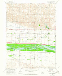
 1962 Gibbon North1964 Print · USGSBuffalo County plains and river valleys are captured here in the early sixties, showing the agricultural heartland of Nebraska. Genealogists can trace rural family sites near Riverside Cem or identify the locations of local landmarks like School No 17 and Davis Park.
 - 1962 Map of Buckeye Valley, 1964 Print
 1962 Buckeye Valley1964 Print · USGSBuffalo County prairie life in the early sixties centers on the fertile banks of the Wood River and the undulating hills of Buckeye Valley. Genealogists can trace rural roots through numbered landmarks like School No 97 and the United Brethren Ch.
 - 1962 Map of Shelton, 1964 Print
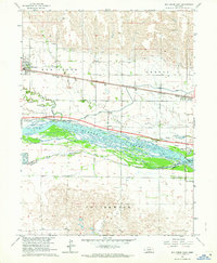
 1962 Shelton1964 Print · USGSThe town of Shelton and its surrounding Nebraska river bottoms are captured here in the early 1960s. Researchers can trace rural school districts like School No 33 and School No 5 or follow the Union Pacific tracks past Platte Valley Academy.2 unique versions available
 - 1962 Map of Pleasanton, 1964 Print
 1962 Pleasanton1964 Print · USGSPleasanton and the Buffalo County countryside are captured in the early sixties, showing the vital relationship between the valley and the surrounding prairie. Genealogists and historians can trace family locations near St Marys Cem, St Johns Cem, and Grace Ch.
 - 1962 Map of Alfalfa Center, 1964 Print
 1962 Alfalfa Center1964 Print · USGSBuffalo County is shown during the early 1960s as a landscape in transition, where new highway construction began to parallel the historic rail lines. Researchers can trace rural school districts like School No 114 and family landmarks near Dove Hill Cem and Alfalfa Center.2 unique versions available
 - 1962 Map of Gibbon South, 1964 Print
 1962 Gibbon South1964 Print · USGSThe braided Platte River valley in the early 1960s reveals a landscape defined by historic island farming and the path of major transcontinental railroads. Genealogists and local historians can trace the foundations of Gibbon and Lowell while locating rural landmarks like St Paul Cem and School No 42.3 unique versions available
End of results
Showing maps 1-21 of 21
Top cities of Buffalo County
- Kearney historical maps
- Gibbon historical maps
- Ravenna historical maps
- Shelton historical maps
- Elm Creek historical maps
- Odessa historical maps
See more
Frequently asked questions
- What are the different types of historical maps available for Buffalo County?
- What is the oldest map of Buffalo County?
- Where can I purchase historical maps of Buffalo County for my home or office?
- Where can I download high-res historical maps of Buffalo County?
- Are there historical topographic maps available for Buffalo County?
- Is there historical aerial imagery available for Buffalo County?
- Where are historical maps of Buffalo County sourced from?