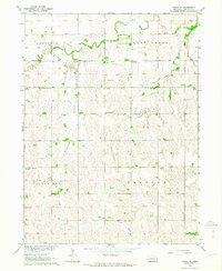
1962 Map of Poole NE
USGS Topo · Published 1964About this map
Antelope Valley and the surrounding Buffalo County tablelands are defined here by a network of rural schoolhouses and neighborhood churches established during the peak of the region's agricultural development. The landscape is segmented into civil townships including Garfield, Cherry Creek, Schneider, and Gardner. This 1962 survey reveals a deeply settled rural community, where landmark institutions like St Wenceslaus Ch and United Brethren Ch served as central gathering points for farm families. Local history is etched into the terrain through the preservation of the Sodtown Cem and Moss Cem, while the numbering of school sites such as School No 59 and School No 48 provides a spatial record of the early public education system across the prairie. Waterways like Sweet Creek and Prairie Creek meander through the sections, dictating the placement of farmsteads and rural routes.
Find a feature on this map
18 named features on this map. Tap any name to fly to it.
Don’t see what you’re looking for? This feature index may not catch every label — zoom into the map to look around manually.
Map Details
Editions of this 1962 Poole NE Map
This is the sole edition of this map. No revisions or reprints were ever made.
Other maps of this area

1895 · Wood River
USGS Topo · 1:62,500

1896 · Wood River
USGS Topo · 1:125,000

1899 · Loup
USGS Topo · 1:125,000

1953 · Rockville
USGS Topo · 1:24,000

1953 · Boelus
USGS Topo · 1:24,000

1953 · Ravenna
USGS Topo · 1:24,000

1955 · Broken Bow
USGS Topo · 1:250,000

1955 · Grand Island
USGS Topo · 1:250,000

1956 · Broken Bow
USGS Topo · 1:250,000

1957 · Grand Island
USGS Topo · 1:250,000