Old Maps of Shelton, Nebraska for Academic Research
Study the evolution of Shelton with 11 high-resolution historic maps. Whether you're teaching, researching, or modeling changes in land use, these maps provide essential visual documentation of urban, environmental, and geographic change.
- Analyze long-term change: Track patterns in development, transportation, and natural features.
- Ideal for environmental or urban studies: Support academic projects with primary historical map data.
- Use in the classroom or lab: Educators and researchers rely on these maps to bring historical context to life.
These maps are a powerful tool for teaching, research, and visualizing how Shelton has changed over the decades.
Shelton, NE maps
(11)- 1895 Map of Wood River
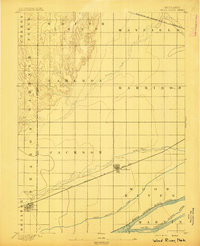 1895 Wood River1895 Print · USGSThe central Nebraska plains were undergoing a railroad-driven expansion in the 1890s as homesteads filled the townships. Researchers can trace early property lines and rail stops along the Union Pacific (Main Line) at Wood River and the braided channels of the North Channel Platte River.
 - 1896 Map of Wood River
 1896 Wood River1896 Print · USGSCentral Nebraska at the close of the nineteenth century is defined by its massive river islands and burgeoning rail towns. Local historians can trace early prairie commerce through the rail lines connecting Wood River, Shelton, and the distinctive Sugar Bowl terrain.4 unique versions available
 - 1955 Map of Grand Island, 1967 Print
 1955 Grand Island1967 Print · USGSCentral Nebraska is seen here during a period of industrial and agricultural growth, centered on the vital Platte River corridor. Researchers can trace the mid-century footprints of the U S Naval Ammunition Depot and the Cornhusker Ordnance Plant.3 unique versions available
 - 1957 Map of Grand Island
 1957 Grand Island1957 Print · USGSCentral Nebraska and Northern Kansas are shown here during a period of massive hydraulic and military expansion in the mid-fifties. Researchers can trace the development of the Harlan County Reservoir and the massive wartime legacy of the Cornhusker Ordnance Plant.
 - 1958 Map of Grand Island
 1958 Grand Island1958 Print · USGSSouth-central Nebraska thrived as a rail and industrial hub during the late fifties, shaped by the braided Platte River. Genealogists and historians can trace rail lines like the Union Pacific RR through towns such as Kearney or locate the sprawling Cornhusker Ordnance Plant.
 - 1962 Map of Shelton, 1964 Print
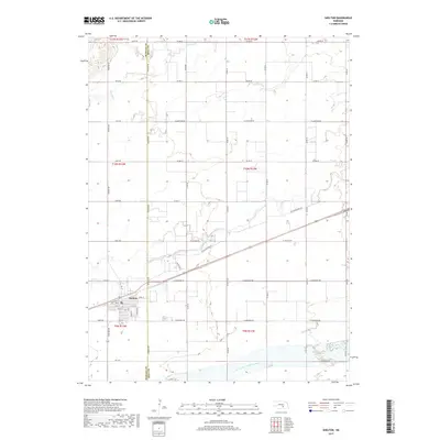
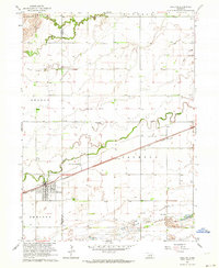 1962 Shelton1964 Print · USGSThe town of Shelton and its surrounding Nebraska river bottoms are captured here in the early 1960s. Researchers can trace rural school districts like School No 33 and School No 5 or follow the Union Pacific tracks past Platte Valley Academy.2 unique versions available
 - 1985 Map of Grand Island
 1985 Grand Island1985 Print · USGSThe Platte River valley in the mid-eighties shows a landscape of braided river channels and massive military-industrial sites. Trace the layout of the Cornhusker Ordnance Plant and find family landmarks like Parkview Cem or Good Samaritan Village.2 unique versions available
 - 2011 Map of Shelton, 2011 Print
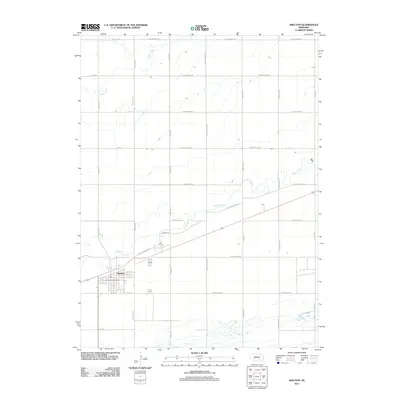 2011 Shelton2011 Print · USGSCovers Shelton, including Hall County, Buffalo County, and other nearby areas
 - 2014 Map of Shelton, 2014 Print
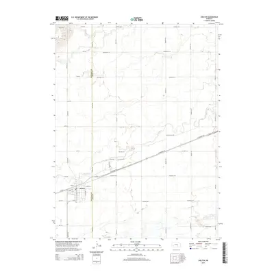 2014 Shelton2014 Print · USGSCovers Shelton, including Hall County, Buffalo County, and other nearby areas
 - 2017 Map of Shelton, 2017 Print
 2017 Shelton2017 Print · USGSCovers Shelton, including Hall County, Buffalo County, and other nearby areas
 - 2021 Map of Shelton, 2021 Print
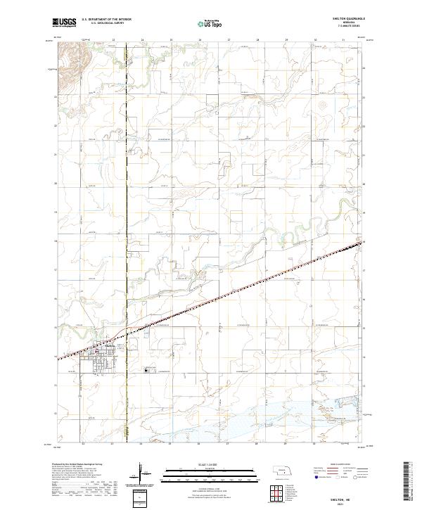 2021 Shelton2021 Print · USGSThe community of Shelton and the surrounding Platte Valley are shown in the early 2020s, highlighting the area's river-driven geography. Genealogists can locate family sites near Shelton Cem or trace the path of the historic W Old Military Rd.
End of results
Showing maps 1-11 of 11
Top cities near Shelton
- Gibbon historical maps
- Wood River historical maps
- Kenesaw historical maps
- Juniata historical maps
- Cairo historical maps
- Lowell historical maps
See more
Frequently asked questions
- What are the different types of historical maps available for Shelton?
- What is the oldest map of Shelton?
- Where can I purchase historical maps of Shelton for my home or office?
- Where can I download high-res historical maps of Shelton?
- Are there historical topographic maps available for Shelton?
- Is there historical aerial imagery available for Shelton?
- Where are historical maps of Shelton sourced from?