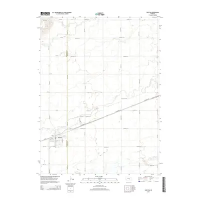
2014 Map of Shelton
USGS Topo · Published 2014About this map
Shelton sits at the heart of this agricultural landscape, straddling the county line between Buffalo Co and Hall Co. The town's grid is oriented alongside Railroad St, reflecting the historical importance of the rail corridor that parallels Us-30. This transportation artery cuts a diagonal path through the township, crossing the meandering path of the Wood River.
Find a feature on this map
38 named features on this map. Tap any name to fly to it.
Don’t see what you’re looking for? This feature index may not catch every label — zoom into the map to look around manually.
Map Details
Editions of this 2014 Shelton Map
This is the sole edition of this map. No revisions or reprints were ever made.
Other maps of this area

1894 · Kenesaw
USGS Topo · 1:62,500

1894 · Minden
USGS Topo · 1:62,500

1895 · Wood River
USGS Topo · 1:62,500

1896 · Wood River
USGS Topo · 1:125,000

1955 · Grand Island
USGS Topo · 1:250,000

1957 · Grand Island
USGS Topo · 1:250,000

1958 · Grand Island
USGS Topo · 1:250,000

1962 · Denman
USGS Topo · 1:24,000

1962 · Prosser
USGS Topo · 1:24,000
1962 · Shelton NE
USGS Topo · 1:24,000