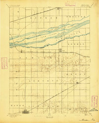
1894 Map of Minden
USGS Topo · Published 1894About this map
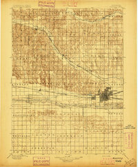
The Platte River dominates the northern landscape of this 1892 survey, where its braided channels create a complex network of named landmasses like Grand Island and Fort Farm Island. Three distinct railroad corridors define the local economy and settlement patterns during this era of agricultural expansion. The Union Pacific R.R. (Main Line) skirts the northern edge through Gibbon, while the Burlington and Missouri River R. R. (Kearney Branch) connects the river towns of Newark and Lowell. To the south, the Burlington and Missouri River R.R. (Main Line) provides a direct link to the county seat at Minden. The map reveals the intricate water system between the North Channel and South Channel, illustrating how early Nebraska settlers utilized the river's unique geography for farming and transportation.
Find a feature on this map
38 named features on this map. Tap any name to fly to it.
Don’t see what you’re looking for? This feature index may not catch every label — zoom into the map to look around manually.
Map Details
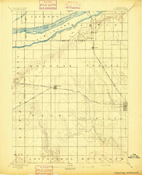
Editions of this 1894 Minden Map
2 editions found

Other maps of this area
1894 · Kenesaw
USGS Topo · 1:62,500
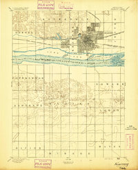
1894 · Kearney
USGS Topo · 1:62,500
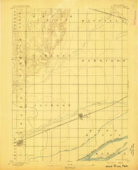
1895 · Wood River
USGS Topo · 1:62,500

1896 · Holdrege
USGS Topo · 1:125,000
1896 · Kearney
USGS Topo · 1:125,000

1896 · Wood River
USGS Topo · 1:125,000

1897 · Red Cloud
USGS Topo · 1:125,000

1955 · Grand Island
USGS Topo · 1:250,000

1957 · Grand Island
USGS Topo · 1:250,000

1958 · Grand Island
USGS Topo · 1:250,000