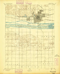
1894 Map of Kearney
USGS Topo · Published 1894About this map
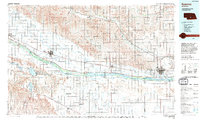
Kearney serves as a major hub of industry and transport on the plains, centered where the Union Pacific Railroad (Main Line) meets the Burlington and Missouri River R.R. (Kearney Branch). The landscape is defined by the heavy infrastructure of the Kearney Canal and the complex braids of the Platte River. This survey records a series of substantial river islands including Long Island, Black Island, and Evarts Island, which are separated by smaller waterways like Walker Channel and Ox Channel. Outside the grid of Kearney and the settlement at Odessa, the map illustrates a transition from the structured township boundaries of Riverdale and Center into the more undulating terrain of Blaine and Logan to the south. Small water bodies like Lake Kearney and Echo Lake provide a sharp contrast to the surrounding agricultural prairie.
Find a feature on this map
35 named features on this map. Tap any name to fly to it.
Don’t see what you’re looking for? This feature index may not catch every label — zoom into the map to look around manually.
Map Details
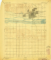
Editions of this 1894 Kearney Map
2 editions found
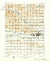
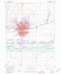
Historical Maps of Kearney Through Time
8 maps found
Featured Locations
- Sheens Trailer Court, NE
- Alfalfa Center, NE
- Cottonmill Mobile Home Court, NE
- Kearney, NE
- East Lawn Mobile Home Estates, Kearney