Old Maps of Cass County, Nebraska for Genealogy
Trace your family roots with 119 historic maps of Cass County. These high-res maps reveal old neighborhoods, homesites, landmarks, and streets — helping you uncover where your ancestors lived and how the area evolved over time.
- Explore historic neighborhoods: Identify where your relatives may have lived in the 1800s or 1900s.
- Compare maps over time: Trace the changes in streets, buildings, and landmarks for multi-generational research.
- Perfect for genealogy & ancestry research: Used by family historians and researchers to map out lineage and migration.
These maps are an incredible resource for exploring your personal connection to Cass County's past.
Cass County, NE maps
(119)- 1893 Map of Fremont, 1960 Print
 1893 Fremont1960 Print · USGSEastern Nebraska was a nexus of river navigation and rail expansion in the 1890s as the prairie gave way to organized township grids. Genealogists and historians can trace early settlements and transportation corridors through Fort Calhoun, the growth of Fremont, and the junctions of the Union Pacific R.R..
 - 1896 Map of Fremont
 1896 Fremont1896 Print · USGSThe rail-driven growth of eastern Nebraska is captured here in the late nineteenth century as steam power connected the prairie. Researchers can trace ancestral roots through dozens of established settlements like Fontanelle, Gretna, and Papillion, or follow the historic routes of the Union Pacific R.R. and the Elkhorn River.5 unique versions available
 - 1903 Map of Weeping Water
 1903 Weeping Water1903 Print · USGSSoutheast Nebraska at the start of the twentieth century was a thriving patchwork of rail-dependent prairie towns and river valleys. Genealogists and local historians can trace early property boundaries and township seats like Weeping Water, Syracuse, and the riverside town of Louisville.2 unique versions available
 - 1929 Map of Weeping Water
 1929 Weeping Water1929 Print · USGSEastern Nebraska's fertile prairie was a hub of railroad development and river-valley settlement at the start of the twentieth century. Researchers can trace the early layout of communities like Weeping Water, Syracuse, and Louisville along the Missouri Pacific R. R. and Platte River.
 - 1935 Map of Nehawka
 1935 Nehawka1935 Print · USGSThe Missouri River valley along the Nebraska-Iowa border appears here during the mid-1930s, showing a landscape defined by riverside bluffs and fertile bottomlands. Genealogists can trace family roots through numerous local landmarks, from Sargents Spur and Nehawka to rural schools like Ameck Sch and Eight Mile Grove Sch.2 unique versions available
 - 1940 Map of Nehawka
 1940 Nehawka1940 Print · USGSThe Missouri River valley comes to life in this pre-war survey of Cass County and the Iowa border. Genealogists can locate family names at Youngs Cem or trace dozens of rural school sites like Cottonwood Sch and Eightmile Grove Sch.3 unique versions available
 - 1954 Map of Omaha, 1967 Print
 1954 Omaha1967 Print · USGSMid-century development radiates from the river bluffs into the agricultural heartland during this period of post-war growth. Genealogists and historians can trace rail-connected towns like Atlantic and Red Oak or locate the sprawling grounds of Offutt Air Force Base and Manawa Lake.3 unique versions available
 - 1955 Map of Fremont, 1966 Print
 1955 Fremont1966 Print · USGSEastern Nebraska and the Missouri River border are captured during the mid-fifties, just as the interstate system began to emerge. Researchers can trace the development of Omaha, locate the sprawling Offutt Air Force Base, or study the river-bound ecology of the De Soto National Wildlife Refuge.3 unique versions available
 - 1955 Map of Nebraska City, 1967 Print
 1955 Nebraska City1967 Print · USGSThe four-state region surrounding the Missouri River valley appears here in the mid-1950s, a landscape of rail-dependent market towns and rural school districts. Genealogists can locate family landmarks like the Rock Bluff School, St Oswald Church, and the Clarinda State Hospital.3 unique versions available
 - 1955 Map of Lincoln, 1967 Print
 1955 Lincoln1967 Print · USGSSoutheast Nebraska in the mid-fifties presents a landscape of thriving railroad towns and the expanding footprint of the capital city. Researchers can trace the legacy of the pioneer era at the Homestead National Monument of America or locate mid-century military infrastructure like Lincoln Air Force Base.5 unique versions available
 - 1956 Map of Cedar Creek, 1957 Print
 1956 Cedar Creek1957 Print · USGSThe braided channels of the Platte River dominate this mid-century landscape on the Sarpy and Cass county line. Researchers can locate many small rural schoolhouses and rail stops, including Richfield, Cullom Sch, and the Glendale Cem near the riverbanks.5 unique versions available
 - 1956 Map of Springfield, 1957 Print
 1956 Springfield1957 Print · USGSThe banks of the Platte River and the bustling rail lines of Sarpy County are captured here in the mid-fifties. Researchers can trace numerous rural schoolhouses like Stringtown Sch and Sanborn Sch or explore the riverfront near Meadow.4 unique versions available
 - 1956 Map of Murray, 1957 Print
 1956 Murray1957 Print · USGSCass County, Nebraska, is seen here during the mid-fifties, capturing the rural transition between the rail-town of Plattsmouth and the village of Murray. Genealogists and historians can locate numerous rural landmarks, from School No 2 and Rock Creek Sch to the Clemmons Cem and Horning Cem.3 unique versions available
 - 1956 Map of Rock Bluff, 1957 Print
 1956 Rock Bluff1957 Print · USGSThe Missouri River valley in the mid-fifties shows a landscape of river islands and bluff-side quarries. Genealogists can trace family sites at Rock Bluff and the Rock Bluff Cem, or locate rural schoolhouses like Kenosha Sch.3 unique versions available
 - 1956 Map of Weeping Water NE, 1957 Print
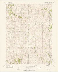 1956 Weeping Water NE1957 Print · USGSCass County agriculture and education are in focus during the mid-1950s across these rural townships. Researchers can trace numerous country schoolhouses like Sunnyside Sch, Pleasant Hill Sch, and Fairview Sch along the banks of Eightmile Creek.2 unique versions available
 - 1956 Map of Plattsmouth, 1958 Print
 1956 Plattsmouth1958 Print · USGSThe confluence of the Platte and Missouri rivers comes into sharp focus during the mid-fifties, showing the region's transition from river town to strategic military hub. Researchers can trace the development of Plattsmouth, find local landmarks like Oak Hill Cemetery, or locate rural schoolhouses such as Trumble Sch.5 unique versions available
 - 1956 Map of Pacific Junction, 1958 Print
 1956 Pacific Junction1958 Print · USGSPacific Junction and the Missouri River bluffs are documented here during the mid-1950s at the height of the railroad era. Researchers can trace rural school districts and family burial sites such as West Liberty Sch No 3, Bethlehem Sch, and Gowen Cem.4 unique versions available
 - 1957 Map of Fremont
 1957 Fremont1957 Print · USGSEastern Nebraska and western Iowa thrive along the Platte and Missouri rivers during the mid-fifties. Genealogists can locate small rural schools like Fairview School and tracing the paths of the Union Pacific through towns like Albion and Humphrey.
 - 1957 Map of Nebraska City
 1957 Nebraska City1957 Print · USGSThe four-state junction of Nebraska, Iowa, Missouri, and Kansas comes alive in this mid-fifties survey of the Missouri River valley. Genealogists and historians can trace the rail-and-road networks connecting Nebraska City, Maryville, and the Squaw Creek National Wildlife Refuge.
 - 1957 Map of Omaha
 1957 Omaha1957 Print · USGSWestern Iowa and the Missouri River valley are seen here in the mid-fifties during the height of the rail-and-road era. Researchers can trace the sprawling rail lines of the Chicago And North Western or locate Cold War landmarks like Offutt Air Force Base.
 - 1957 Map of Lincoln
 1957 Lincoln1957 Print · USGSSoutheastern Nebraska at mid-century shows a landscape of thriving rail towns and expanding infrastructure centered on Lincoln. Researchers can trace the path of the Chicago Burlington and Quincy railroad through communities like Weeping Water, Fairmont, and Seward.
 - 1958 Map of Omaha
 1958 Omaha1958 Print · USGSOmaha and Council Bluffs stand at the center of this mid-fifties landscape, where the Missouri River splits the urban plains of Nebraska from the rolling hills of western Iowa. Genealogists can trace the rail lines of the Wabash RR and Illinois Central RR to rural settlements like Missouri Valley and Red Oak.2 unique versions available
 - 1958 Map of Fremont
 1958 Fremont1958 Print · USGSEastern Nebraska in the late fifties is captured here as a thriving corridor of river-valley commerce and rail transport. Researchers can trace the development of Omaha and Fremont or locate local landmarks like Midland College and Offutt Air Force Base.
 - 1958 Map of Lincoln
 1958 Lincoln1958 Print · USGSSoutheast Nebraska at the end of the 1950s shows a region defined by agricultural trade and the expansion of the state capital. Genealogists can trace family footprints across the Blue Valley and locate landmarks like the Lincoln AFB or the U.S. Veterans Hospital.
 - 1958 Map of Nebraska City
 1958 Nebraska City1958 Print · USGSThe Missouri River Valley and its fertile four-state borderlands are captured here during the mid-century expansion of the regional highway and rail networks. Genealogists can trace family roots through numerous rural landmarks like Moulton School, Shady Grove Church, and the Clarinda State Hospital.
Showing maps 1-25 of 119
Top cities of Cass County
- Plattsmouth historical maps
- Eagle historical maps
- Weeping Water historical maps
- Louisville historical maps
- Elmwood historical maps
- Greenwood historical maps
See more
Frequently asked questions
- What are the different types of historical maps available for Cass County?
- What is the oldest map of Cass County?
- Where can I purchase historical maps of Cass County for my home or office?
- Where can I download high-res historical maps of Cass County?
- Are there historical topographic maps available for Cass County?
- Is there historical aerial imagery available for Cass County?
- Where are historical maps of Cass County sourced from?