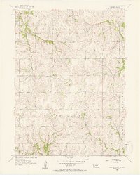
1956 Map of Weeping Water NE
USGS Topo · Published 1957About this map
Country schools define the mid-century landscape of Cass County in this detailed mid-1950s survey. The area is characterized by organized rural education, with schoolhouses such as Glendale Sch, Fairview Sch, and Sunnyside Sch serving the farming families of Eight Mile Grove and Mount Pleasant. This density of local schools highlights the decentralized nature of Nebraska's school districts during this era, before widespread consolidation transformed these rural communities.
Find a feature on this map
16 named features on this map. Tap any name to fly to it.
Don’t see what you’re looking for? This feature index may not catch every label — zoom into the map to look around manually.
Map Details
Editions of this 1956 Weeping Water NE Map
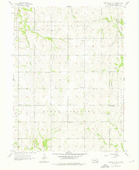
2 editions found
Other maps of this area

1893 · Fremont
USGS Topo · 1:125,000

1896 · Fremont
USGS Topo · 1:125,000

1903 · Weeping Water
USGS Topo · 1:125,000

1929 · Weeping Water
USGS Topo · 1:125,000

1935 · Nehawka
USGS Topo · 1:48,000

1940 · Nehawka
USGS Topo · 1:62,500

1954 · Omaha
USGS Topo · 1:250,000

1955 · Fremont
USGS Topo · 1:250,000

1955 · Nebraska City
USGS Topo · 1:250,000

1955 · Lincoln
USGS Topo · 1:250,000