Old Maps of Hartgraves Place, Nebraska for Metal Detecting
Plan your next treasure hunt with 10 historic maps of Hartgraves Place. Find old homesites, ghost towns, trails, and gathering spots that may be lost to time — perfect for identifying promising metal detecting locations.
- Locate forgotten sites: Uncover places like long-lost settlements, abandoned rail lines, or gathering spots.
- Plan better hunts: Use map overlays combined with LiDAR or satellite views to narrow in on historically rich areas.
- Made for detectorists: Thousands of hobbyists use these maps to discover relics, coins, and hidden history.
Use these historic maps to boost your research and find new opportunities beneath the surface of Hartgraves Place.
Hartgraves Place, NE maps
(10)- 1949 Map of Long Lake, 1978 Print
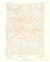
 1949 Long Lake1978 Print · USGSIn the Nebraska Sandhills during the late 1940s, ranching life followed the winding path of Goose Creek and the lake-filled basins of the north. Genealogists can trace family homesteads like Schleuter Ranch, Gudgel Ranch, and the Hartgraves Place.
 - 1951 Map of Long Lake
 1951 Long Lake1951 Print · USGSThe Nebraska sandhills of Cherry County come to life in this mid-century survey of the Valentine National Wildlife Refuge. Family researchers can locate historic holdings like the Schleuter Ranch and rural landmarks such as School No 149.2 unique versions available
 - 1957 Map of Valentine, 1960 Print
 1957 Valentine1960 Print · USGSNorthern Nebraska's ranching country and the vast Sand Hills are detailed here in the late fifties. Genealogists and historians can locate numerous family-named landmarks like the Dahlgren Ranch and trace the path of the Chicago and North Western railroad through Valentine.3 unique versions available
 - 1959 Map of Valentine
 1959 Valentine1959 Print · USGSThe northern Nebraska Sand Hills are captured here in the late fifties, showcasing a vast ranching landscape shaped by the Niobrara and Loup rivers. Genealogists and historians can trace rail-town development along the Chicago and North Western and locate remote outposts like Brownlee or Kennedy.
 - 1985 Map of Long Lake SE
 1985 Long Lake SE1985 Print · USGSThe Nebraska Sandhills of Cherry County are captured here in the mid-eighties, showing a landscape defined by isolated ranching outposts and winding waterways. Genealogists and local historians can trace legacy family sites like Piercy Place and Cline Ranch along the banks of Goose Creek.
 - 1985 Map of Goose Creek
 1985 Goose Creek1985 Print · USGSCentral Nebraska's Sandhills come into focus in the mid-eighties, showing a landscape of remote ranching outposts and wildlife preserves. Trace old rail routes and rural settlements like Brownlee, Seneca, and Purdum along the Goose Creek watershed.2 unique versions available
 - 2011 Map of Long Lake SE, 2011 Print
 2011 Long Lake SE2011 Print · USGSCovers Hartgraves Place, including Cherry County, United States, and other nearby areas
 - 2014 Map of Long Lake SE, 2014 Print
 2014 Long Lake SE2014 Print · USGSCovers Hartgraves Place, including Cherry County, United States, and other nearby areas
 - 2017 Map of Long Lake SE, 2017 Print
 2017 Long Lake SE2017 Print · USGSCovers Hartgraves Place, including Cherry County, United States, and other nearby areas
 - 2021 Map of Long Lake SE, 2021 Print
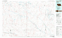
 2021 Long Lake SE2021 Print · USGSCherry County ranching country is mapped here in the modern era, showing the isolated water sources of the Nebraska Sandhills. Researchers can locate the Hartgrave Cemetery and trace the winding course of Goose Creek through the dunes.
End of results
Showing maps 1-10 of 10
Frequently asked questions
- What are the different types of historical maps available for Hartgraves Place?
- What is the oldest map of Hartgraves Place?
- Where can I purchase historical maps of Hartgraves Place for my home or office?
- Where can I download high-res historical maps of Hartgraves Place?
- Are there historical topographic maps available for Hartgraves Place?
- Is there historical aerial imagery available for Hartgraves Place?
- Where are historical maps of Hartgraves Place sourced from?