Old Maps of Irwin, Nebraska for Genealogy
Trace your family roots with 11 historic maps of Irwin. These high-res maps reveal old neighborhoods, homesites, landmarks, and streets — helping you uncover where your ancestors lived and how the area evolved over time.
- Explore historic neighborhoods: Identify where your relatives may have lived in the 1800s or 1900s.
- Compare maps over time: Trace the changes in streets, buildings, and landmarks for multi-generational research.
- Perfect for genealogy & ancestry research: Used by family historians and researchers to map out lineage and migration.
These maps are an incredible resource for exploring your personal connection to Irwin's past.
Irwin, NE maps
(11)- 1950 Map of Irwin, 1979 Print
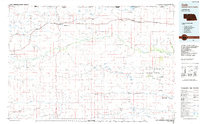
 1950 Irwin1979 Print · USGSThe Nebraska Sandhills and South Dakota borderlands are captured here at mid-century, showing a landscape of isolated ranches and scattered prairie lakes. You can trace the Chicago and North Western rail line and locate rural landmarks like School No 61 and Lions Bridge.
 - 1951 Map of Irwin
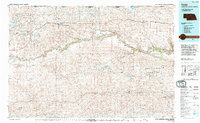
 1951 Irwin1951 Print · USGSThe ranching country of northern Nebraska is captured here in the early fifties, just as the Chicago and North Western rail line shaped local commerce. Researchers can locate remote school sites like School No 124 and trace the original Niobrara River crossings at Lions Bridge.
 - 1957 Map of Valentine, 1960 Print
 1957 Valentine1960 Print · USGSNorthern Nebraska's ranching country and the vast Sand Hills are detailed here in the late fifties. Genealogists and historians can locate numerous family-named landmarks like the Dahlgren Ranch and trace the path of the Chicago and North Western railroad through Valentine.3 unique versions available
 - 1959 Map of Valentine
 1959 Valentine1959 Print · USGSThe northern Nebraska Sand Hills are captured here in the late fifties, showcasing a vast ranching landscape shaped by the Niobrara and Loup rivers. Genealogists and historians can trace rail-town development along the Chicago and North Western and locate remote outposts like Brownlee or Kennedy.
 - 1985 Map of Cody
 1985 Cody1985 Print · USGSThe Nebraska Sandhills and the South Dakota borderlands are captured here in the mid-1980s, centered on the Chicago and North Western rail corridor. Genealogists and local historians can trace small-town development in Cody and Merriman or locate rural landmarks within the Samuel R McKelvie National Forest.
 - 1990 Map of Irwin
 1990 Irwin1990 Print · USGSCherry County ranching country and the Nebraska-South Dakota border are captured here in the 1990s. Genealogists and historians can trace family-named outposts like Wiley Ranch and Irwin alongside hydrological landmarks such as Log Cabin Lake and Scott Meadow.
 - 1994 Map of Cody
 1994 Cody1994 Print · USGSThe Nebraska Sandhills and South Dakota borderlands are captured here in the mid-nineties, showing the vast ranching country around the Niobrara River. Local historians can trace early settlements like Eli and Lavaca alongside the borders of the Samuel R Mc Kelvie National Forest.
 - 2011 Map of Irwin, 2011 Print
 2011 Irwin2011 Print · USGSCovers Irwin, including Martin, Cherry County, and other nearby areas
 - 2014 Map of Irwin, 2014 Print
 2014 Irwin2014 Print · USGSCovers Irwin, including Martin, Cherry County, and other nearby areas
 - 2017 Map of Irwin, 2017 Print
 2017 Irwin2017 Print · USGSCovers Irwin, including Martin, Cherry County, and other nearby areas
 - 2021 Map of Irwin, 2021 Print
 2021 Irwin2021 Print · USGSThe settlement of Irwin and the surrounding Nebraska Sandhills are shown in this recent survey of Cherry County. Researchers can trace the path of the Cowboy Trl and locate numerous water bodies like Goose Lake, North Twin Lake, and Cullison Lake.
End of results
Showing maps 1-11 of 11
Top cities near Irwin
Frequently asked questions
- What are the different types of historical maps available for Irwin?
- What is the oldest map of Irwin?
- Where can I purchase historical maps of Irwin for my home or office?
- Where can I download high-res historical maps of Irwin?
- Are there historical topographic maps available for Irwin?
- Is there historical aerial imagery available for Irwin?
- Where are historical maps of Irwin sourced from?