Old Maps of Colfax County, Nebraska for Hiking & Exploration
Hike through history with 69 historic maps of Colfax County. Explore old trails, ghost towns, and forgotten backroads — perfect for outdoor adventurers and local explorers.
- Rediscover forgotten places: Map out old mining camps, roads, and footpaths that no longer exist on modern maps.
- Layer with modern tools: Combine with LiDAR or satellite views to plan hikes through historical terrain.
- Made for exploration: Popular among hikers, overlanders, and local history lovers.
Use these maps to find adventure and explore the hidden past of Colfax County.
Colfax County, NE maps
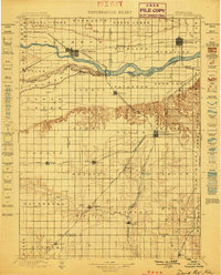
(69)- 1899 Map of Wahoo
 1899 Wahoo1899 Print · USGSSaunders County and its neighbors thrive as a booming rail hub in the 1890s, where the Platte River meets a dense web of iron tracks. Trace the early development of prairie towns like Wahoo, Valparaiso, and the Bohemian settlement at Prague.3 unique versions available
 - 1899 Map of David City
 1899 David City1899 Print · USGSButler County and its neighbors flourished during the late nineteenth-century railroad boom, centered on the junction at David City. Genealogists and historians can trace the early footprints of Surprise, Wayland, and Rising along the extensive steam rail networks.3 unique versions available
 - 1955 Map of Fremont, 1966 Print
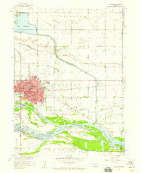
 1955 Fremont1966 Print · USGSEastern Nebraska and the Missouri River border are captured during the mid-fifties, just as the interstate system began to emerge. Researchers can trace the development of Omaha, locate the sprawling Offutt Air Force Base, or study the river-bound ecology of the De Soto National Wildlife Refuge.3 unique versions available
 - 1957 Map of Fremont
 1957 Fremont1957 Print · USGSEastern Nebraska and western Iowa thrive along the Platte and Missouri rivers during the mid-fifties. Genealogists can locate small rural schools like Fairview School and tracing the paths of the Union Pacific through towns like Albion and Humphrey.
 - 1958 Map of Fremont
 1958 Fremont1958 Print · USGSEastern Nebraska in the late fifties is captured here as a thriving corridor of river-valley commerce and rail transport. Researchers can trace the development of Omaha and Fremont or locate local landmarks like Midland College and Offutt Air Force Base.
 - 1958 Map of Columbus, 1959 Print
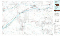
 1958 Columbus1959 Print · USGSColumbus thrived as a transportation hub in the late fifties at the junction of the Loup and Platte rivers. Researchers can trace the mid-century city layout through its numerous schools, the Union Pacific rail lines, and landmarks like the Drive-in Theater.2 unique versions available
 - 1966 Map of Clarkson SW, 1967 Print
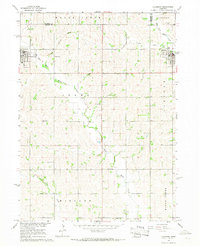
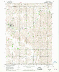
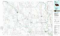
 1966 Clarkson SW1967 Print · USGSColfax County's rural landscape in the mid-sixties is a grid of section-line roads and family farmsteads centered on local township hubs. Genealogists and local historians can trace specific landmarks like Wilson Sch, Immanuel Ch, and School No 10.
 - 1966 Map of Humphrey SE, 1968 Print
 1966 Humphrey SE1968 Print · USGSThe rural townships of Platte County come into focus in the 1960s, showing the agricultural heart of the Nebraska plains. Genealogists can locate family landmarks like St Johns Ch, Calvary Cem, and several numbered country schools.
 - 1966 Map of Clarkson, 1968 Print
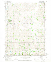
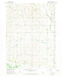
 1966 Clarkson1968 Print · USGSEastern Colfax County comes into focus in the mid-sixties, showing the settled prairie at a time of rural stability. Researchers can trace the Railroad Grade, locate old schoolhouses like School No 48, and find family sites near Heun.
 - 1966 Map of Creston, 1968 Print
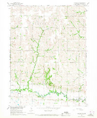
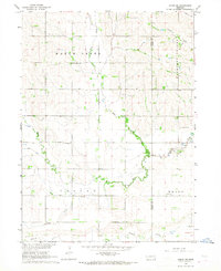
 1966 Creston1968 Print · USGSThe village of Creston and the surrounding farmlands are captured in the mid-1960s at the intersection of four Nebraska counties. Researchers can trace rural landmarks including the Old Railroad Grade, Creston Pioneer Cem, and Boheet Sch.
 - 1966 Map of Dodge SW, 1968 Print
 1966 Dodge SW1968 Print · USGSAgricultural life in eastern Nebraska comes into focus in the mid-1960s, showing a landscape defined by local schools and meandering creek forks. Researchers can trace rural community centers like Purple Cane Ch, St Patricks Cem, and School No 11 across the section lines.
 - 1966 Map of Dodge, 1968 Print
 1966 Dodge1968 Print · USGSNortheastern Nebraska farming country is documented here in the mid-sixties, centered on the communities of Dodge and Howells. Genealogists can locate family landmarks like SS Peter & Paul Cem, Tabor Cem, and Sacred Heart Ch.
 - 1966 Map of Leigh, 1968 Print
 1966 Leigh1968 Print · USGSThe rural countryside of Stanton and Colfax Counties is captured here in the mid-1960s, showing a landscape of family farms and small-town life. Researchers can trace the heritage of local settlements through several burial sites like Bohemian Cem and Leigh Cem or locate defunct schools such as Plain View Sch.
 - 1966 Map of Clarkson SE, 1968 Print
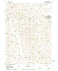
 1966 Clarkson SE1968 Print · USGSMid-century Colfax County is captured here as a landscape of rural schoolhouses and family cemeteries distributed across MIDLAND and GRANT townships. Researchers can trace the locations of Praha Sch, Tolman Cem, and Grandview Cem along the banks of Shell Creek.
 - 1968 Map of Richland, 1971 Print
 1968 Richland1971 Print · USGSRichland and the surrounding Colfax County farmland are captured in the late sixties as the Union Pacific railroad still drove local commerce. Researchers can locate Richland Cem, School No 1, and family landmarks near the banks of Lake McAllister.
 - 1968 Map of Schuyler, 1971 Print
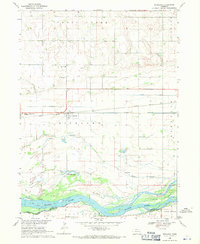
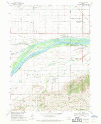
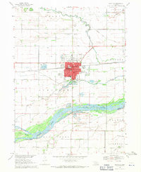 1968 Schuyler1971 Print · USGSThe Platte River valley in the late sixties shows a landscape of braided channels and Nebraska prairie. Genealogists and local historians can trace family roots at Schuyler Cemetery or locate the old Riverside Sch and Edholm settlement.
 - 1968 Map of Rogers, 1971 Print
 1968 Rogers1971 Print · USGSThe Platte River valley in the late sixties is shown here in meticulous detail, capturing the river's many islands and the surrounding rail-side towns. Genealogists and local historians can trace rural roots at Dawson Cem, St Marys Cem, and numerous school sites like School No 4.
 - 1982 Map of Fremont
 1982 Fremont1982 Print · USGSEastern Nebraska in the early eighties exhibits a landscape of industrious rail towns and river-fed agriculture. Genealogists and historians can trace the development of Fremont, locate the National Cem, and find landmarks like the Todd Valley.2 unique versions available
 - 1985 Map of David City
 1985 David City1985 Print · USGSCentral Nebraska in the mid-eighties centers on the convergence of the Platte River and Loup River. Trace the rail-and-river economy through towns like Columbus, David City, and Stromsburg, or locate family sites near Swedehome and Surprise.2 unique versions available
 - 1985 Map of Stanton
 1985 Stanton1985 Print · USGSNortheast Nebraska in the mid-eighties shows a landscape of river-valley agriculture and evolving rail networks. Genealogists can trace family footprints through Stanton and Madison, or locate historical markers like the Old Indian Treaty Boundary and Saint Bernard.2 unique versions available
 - 1986 Map of Blair
 1986 Blair1986 Print · USGSEastern Nebraska and the Iowa borderlands are captured here in the mid-eighties, showing the established river-and-rail network. Genealogists and historians can trace the foundations of Blair, West Point, and Tekamah, or locate smaller sites like Fontanelle and Scribner.2 unique versions available
 - 2011 Map of Humphrey SE, 2011 Print
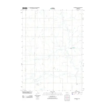 2011 Humphrey SE2011 Print · USGSCovers Colfax County, including Platte County, United States, and other nearby areas
 - 2011 Map of Creston, 2011 Print
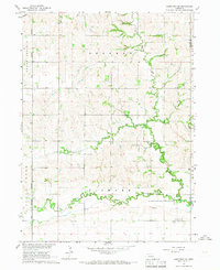
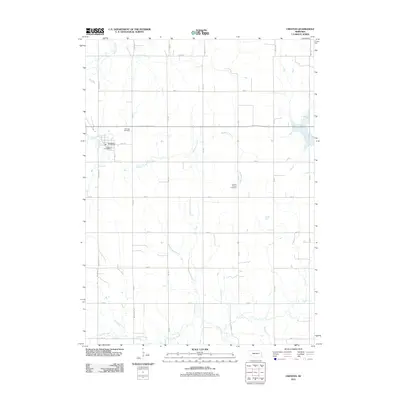 2011 Creston2011 Print · USGSCovers Colfax County, including Creston, Platte County, and other nearby areas
 - 2011 Map of Clarkson, 2011 Print
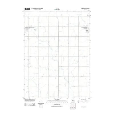 2011 Clarkson2011 Print · USGSCovers Colfax County, including Clarkson, Howells, and other nearby areas
 - 2011 Map of Clarkson SE, 2011 Print
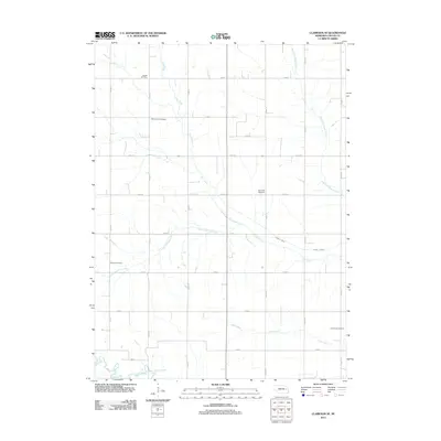 2011 Clarkson SE2011 Print · USGSCovers Colfax County, including United States, Nebraska, and other nearby areas
Showing maps 1-25 of 69
Top cities of Colfax County
- Schuyler historical maps
- Clarkson historical maps
- Howells historical maps
- Leigh historical maps
- Rogers historical maps
- Richland historical maps
Frequently asked questions
- What are the different types of historical maps available for Colfax County?
- What is the oldest map of Colfax County?
- Where can I purchase historical maps of Colfax County for my home or office?
- Where can I download high-res historical maps of Colfax County?
- Are there historical topographic maps available for Colfax County?
- Is there historical aerial imagery available for Colfax County?
- Where are historical maps of Colfax County sourced from?