Old Maps of Benson, Omaha for Academic Research
Study the evolution of Benson with 22 high-resolution historic maps. Whether you're teaching, researching, or modeling changes in land use, these maps provide essential visual documentation of urban, environmental, and geographic change.
- Analyze long-term change: Track patterns in development, transportation, and natural features.
- Ideal for environmental or urban studies: Support academic projects with primary historical map data.
- Use in the classroom or lab: Educators and researchers rely on these maps to bring historical context to life.
These maps are a powerful tool for teaching, research, and visualizing how Benson has changed over the decades.
Benson, Omaha maps
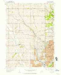
(22)- 1893 Map of Omaha
 1893 Omaha1893 Print · USGSThe Missouri River valley at the close of the 19th century shows a landscape defined by industrial expansion and volatile waterways. Genealogists and historians can trace early street layouts in Omaha and Council Bluffs or locate old crossings near Florence and Crescent.
 - 1893 Map of Fremont, 1960 Print
 1893 Fremont1960 Print · USGSEastern Nebraska was a nexus of river navigation and rail expansion in the 1890s as the prairie gave way to organized township grids. Genealogists and historians can trace early settlements and transportation corridors through Fort Calhoun, the growth of Fremont, and the junctions of the Union Pacific R.R..
 - 1896 Map of Fremont
 1896 Fremont1896 Print · USGSThe rail-driven growth of eastern Nebraska is captured here in the late nineteenth century as steam power connected the prairie. Researchers can trace ancestral roots through dozens of established settlements like Fontanelle, Gretna, and Papillion, or follow the historic routes of the Union Pacific R.R. and the Elkhorn River.5 unique versions available
 - 1954 Map of Omaha, 1967 Print
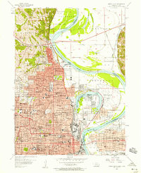
 1954 Omaha1967 Print · USGSMid-century development radiates from the river bluffs into the agricultural heartland during this period of post-war growth. Genealogists and historians can trace rail-connected towns like Atlantic and Red Oak or locate the sprawling grounds of Offutt Air Force Base and Manawa Lake.3 unique versions available
 - 1955 Map of Fremont, 1966 Print
 1955 Fremont1966 Print · USGSEastern Nebraska and the Missouri River border are captured during the mid-fifties, just as the interstate system began to emerge. Researchers can trace the development of Omaha, locate the sprawling Offutt Air Force Base, or study the river-bound ecology of the De Soto National Wildlife Refuge.3 unique versions available
 - 1956 Map of Irvington, 1957 Print
 1956 Irvington1957 Print · USGSNorthwest Omaha and Douglas County are captured in the mid-fifties as suburban growth begins to reach toward the countryside. Researchers can trace the grounds of Boys Town, the original University of Omaha, and several local aviation sites like Sky Ranch Landing Field.5 unique versions available
 - 1956 Map of Omaha North, 1958 Print
 1956 Omaha North1958 Print · USGSNorth Omaha and the Missouri River bottoms are shown in the mid-fifties as the city’s industrial and educational footprint expanded. Researchers can trace historic institutions like Fort Omaha, Creighton University, and the Omaha Municipal Airport.5 unique versions available
 - 1957 Map of Fremont
 1957 Fremont1957 Print · USGSEastern Nebraska and western Iowa thrive along the Platte and Missouri rivers during the mid-fifties. Genealogists can locate small rural schools like Fairview School and tracing the paths of the Union Pacific through towns like Albion and Humphrey.
 - 1957 Map of Omaha
 1957 Omaha1957 Print · USGSWestern Iowa and the Missouri River valley are seen here in the mid-fifties during the height of the rail-and-road era. Researchers can trace the sprawling rail lines of the Chicago And North Western or locate Cold War landmarks like Offutt Air Force Base.
 - 1958 Map of Omaha
 1958 Omaha1958 Print · USGSOmaha and Council Bluffs stand at the center of this mid-fifties landscape, where the Missouri River splits the urban plains of Nebraska from the rolling hills of western Iowa. Genealogists can trace the rail lines of the Wabash RR and Illinois Central RR to rural settlements like Missouri Valley and Red Oak.2 unique versions available
 - 1958 Map of Fremont
 1958 Fremont1958 Print · USGSEastern Nebraska in the late fifties is captured here as a thriving corridor of river-valley commerce and rail transport. Researchers can trace the development of Omaha and Fremont or locate local landmarks like Midland College and Offutt Air Force Base.
 - 1982 Map of Fremont
 1982 Fremont1982 Print · USGSEastern Nebraska in the early eighties exhibits a landscape of industrious rail towns and river-fed agriculture. Genealogists and historians can trace the development of Fremont, locate the National Cem, and find landmarks like the Todd Valley.2 unique versions available
 - 1985 Map of Omaha
 1985 Omaha1985 Print · USGSMid-century development and heavy rail infrastructure define the Missouri River corridor between Nebraska and Iowa. Genealogists and local historians can trace the footprints of Offutt Air Force Base, Forest Lawn Cemetery, and the Iowa School for the Deaf.2 unique versions available
 - 1994 Map of Omaha North, 1995 Print
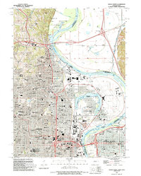 1994 Omaha North1995 Print · USGSThe northern reaches of Omaha and the Missouri River floodplains are captured here in the mid-1990s. Researchers can locate landmark institutions like Creighton University and St Cecilia Cathedral, or trace family roots in the large Forest Lawn Cemetery.
 - 2011 Map of Omaha North, 2011 Print
 2011 Omaha North2011 Print · USGSCovers Benson, including Omaha, Council Bluffs, and other nearby areas
 - 2011 Map of Irvington, 2011 Print
 2011 Irvington2011 Print · USGSCovers Benson, including Omaha, Briggs, and other nearby areas
 - 2014 Map of Omaha North, 2014 Print
 2014 Omaha North2014 Print · USGSCovers Benson, including Omaha, Council Bluffs, and other nearby areas
 - 2014 Map of Irvington, 2014 Print
 2014 Irvington2014 Print · USGSCovers Benson, including Omaha, Briggs, and other nearby areas
 - 2017 Map of Omaha North, 2017 Print
 2017 Omaha North2017 Print · USGSCovers Benson, including Omaha, Council Bluffs, and other nearby areas
 - 2017 Map of Irvington, 2017 Print
 2017 Irvington2017 Print · USGSCovers Benson, including Omaha, Briggs, and other nearby areas
 - 2021 Map of Omaha North, 2021 Print
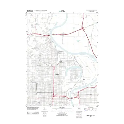
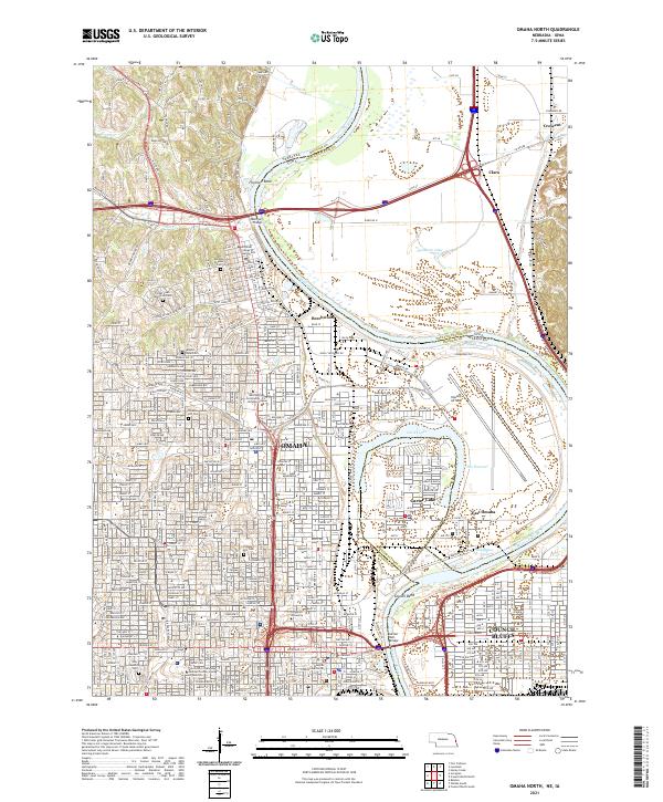 2021 Omaha North2021 Print · USGSOmaha and Council Bluffs stand on opposite banks of the Missouri River in this recent survey of these historic Missouri Valley hubs. Researchers can trace urban development and family history through numerous landmarks like Prospect Hill Cem, Creighton University, and Eppley Airfield.
 - 2021 Map of Irvington, 2021 Print
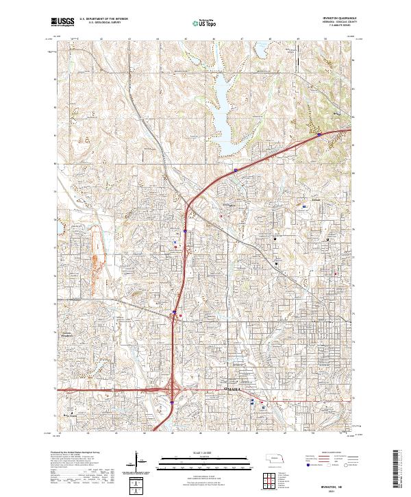 2021 Irvington2021 Print · USGSNorthwest Omaha and its suburban fringes are shown in detail during a period of significant residential and commercial maturity. Genealogists and local historians can trace the grounds of Boys Town, find historic burials at Springwell Danish Cem, and locate the former sites of Irvington and Briggs.
End of results
Showing maps 1-22 of 22
Frequently asked questions
- What are the different types of historical maps available for Benson?
- What is the oldest map of Benson?
- Where can I purchase historical maps of Benson for my home or office?
- Where can I download high-res historical maps of Benson?
- Are there historical topographic maps available for Benson?
- Is there historical aerial imagery available for Benson?
- Where are historical maps of Benson sourced from?